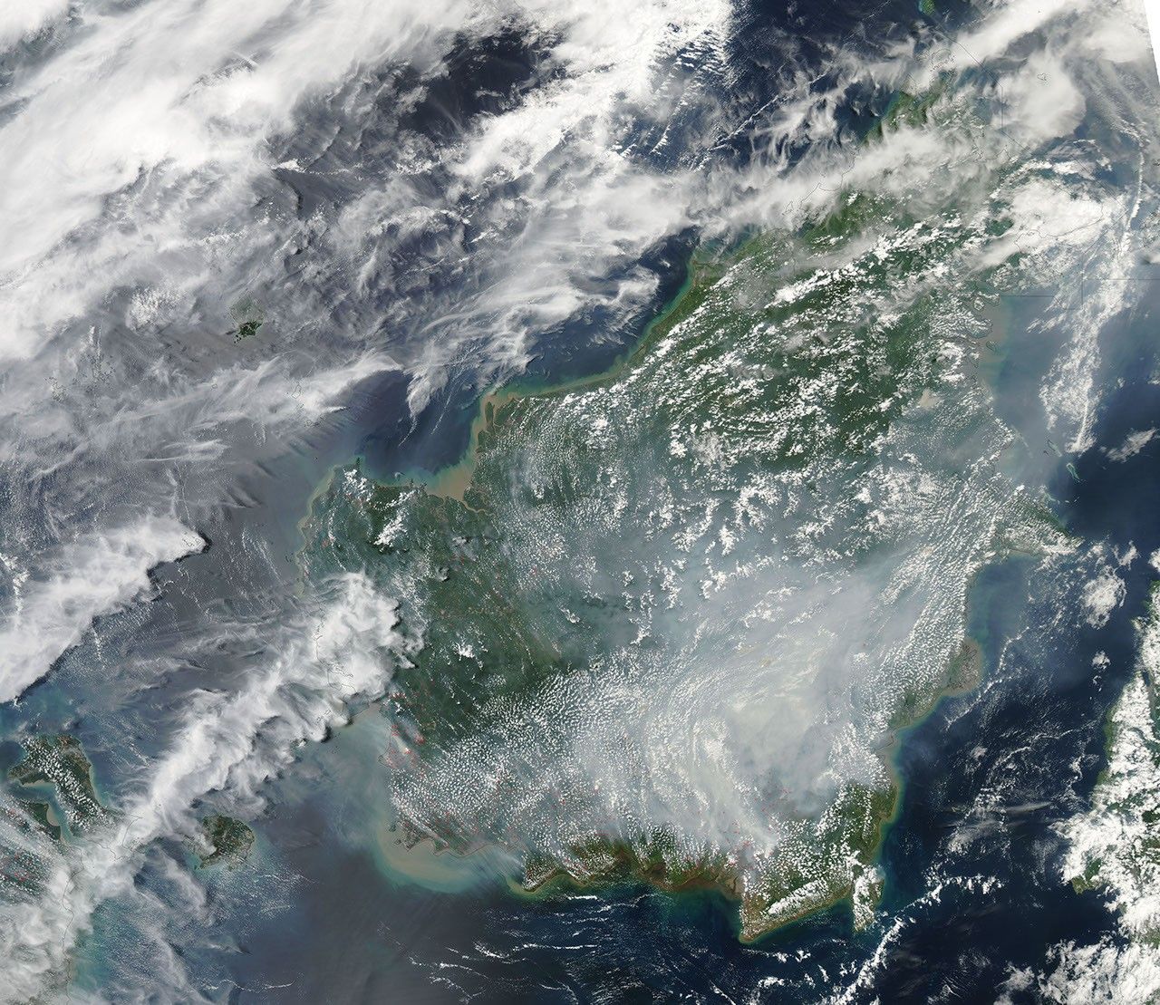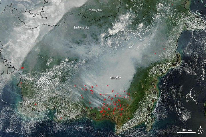
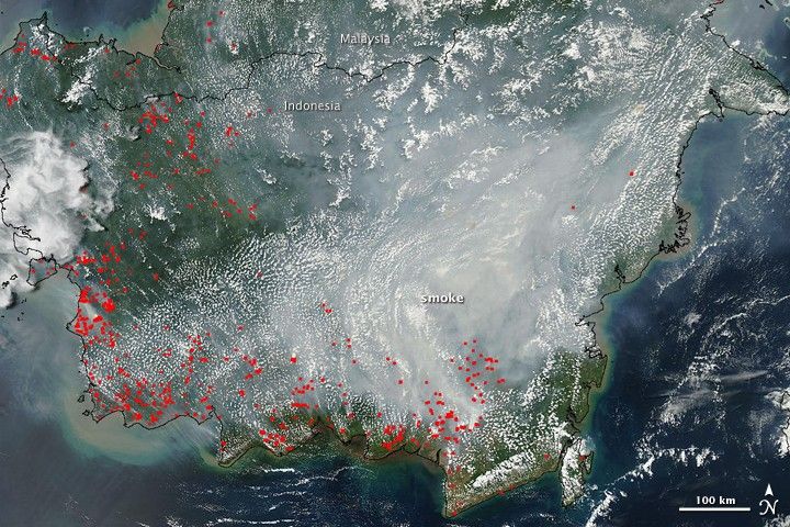
Thick smoke covered much of southern Borneo in September 2009. The smoke was so dense on September 6 (top) and September 7 (bottom) that it hid the ground from view in these photo-like images. The Moderate Resolution Imaging Spectroradiometer (MODIS) on NASA’s Terra satellite captured the top image, while the MODIS instrument on the Aqua satellite captured the lower image. The smoke is clearly coming from fires burning in Kalimantan, the Indonesian half of the island of Borneo. In this tropical region, the widespread fires were almost certainly deliberately set to clear land. The places where MODIS detected hot spots, probably fires, are marked in red.
The haze was dense enough to close schools and airports in Kalimantan on September 8, said the Jakarta Post. Fires and the resulting haze are common in Borneo during the dry season. To monitor the haze and fires in Borneo, see the twice-daily images produced by the MODIS Rapid Response System.
References & Resources
- Lindsey, R. (2007, March 30). Tropical Deforestation. NASA’s Earth Observatory. Accessed September 9, 2009.
- Sulalman, N. (2009, September 9). Haze causes four airports and schools to shut down. The Jakarta Post. Accessed September 9, 2009.
NASA images courtesy the MODIS Rapid Response Team at NASA GSFC. Caption by Holli Riebeek.