


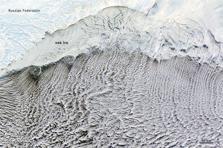
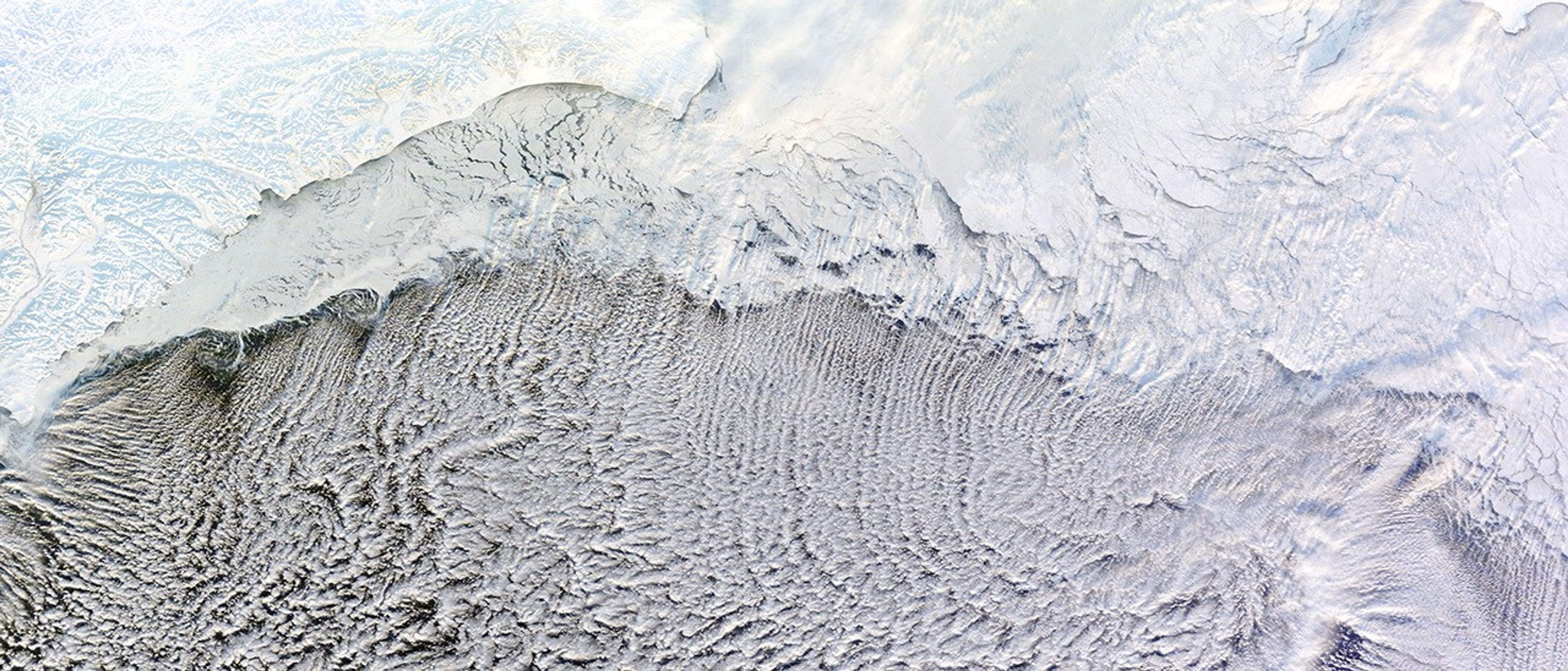
Most of us prefer our winter roads free of ice, but cloud streets depends on it. The Moderate Resolution Imaging Spectroradiometer (MODIS) on NASA’s Terra satellite captured this natural-color image on January 4, 2012.
These cloud formations developed over the Bering Sea in part because of the snow and ice blanketing the land and the sea ice clinging to the coast. Air blowing over ice and then warmer ocean water can lead to the development of parallel cylinders of spinning air. On the upper edge of these cylinders of rising air, small clouds form. Along the downward side (descending air), skies are clear. The resulting cloud formations resemble streets.
This image shows that some of the clouds begin over the sea ice, but most hover over the open ocean. These streets are not perfectly straight, curving to the east and west after passing over the sea ice. By lining up along the prevailing wind direction, the tiny clouds indicate the wind patterns around the time of formation.
References & Resources
NASA images courtesy LANCE/EOSDIS MODIS Rapid Response Team at NASA GSFC. Caption by Michon Scott.


