

December 27, 2012
The Human Dimension of Thetford Forest
Editor’s Note: Today’s caption is the answer to our Earth Day puzzler challenge.
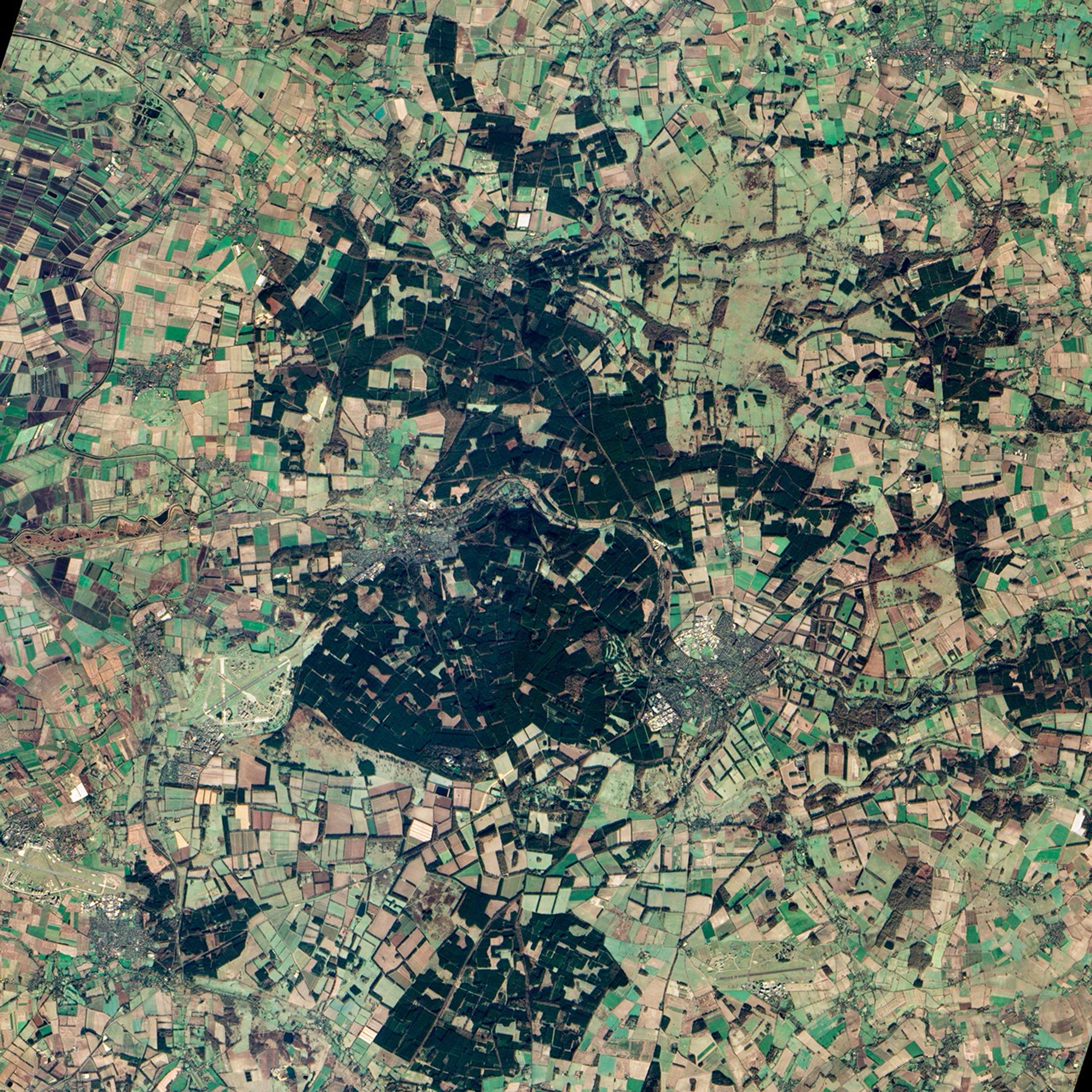
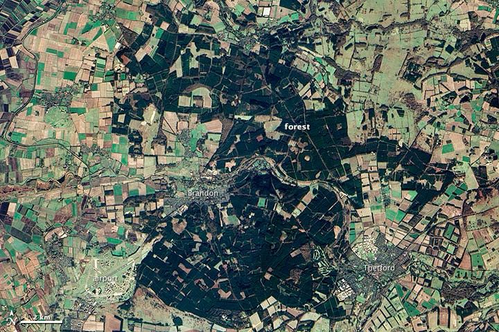
The human impact on the landscape cuts deep in southeastern Britain. And it’s not just the towns and villages—or farms, roads, and airport—scattered throughout the tract of land shown above. Even the forest in the center of the image is so deeply affected by humans that the term ”natural“ is a misnomer.
Thetford Forest, at least as it appears today, would not exist were it not for human intervention. The forest was created after World War I to prop up sagging timber supplies. Authorities planted stands of lowland pine in uniform rows in place of thorny evergreen shrubs (gorse) that grew naturally amid the sandy, heath-covered landscape. Today the forest is a popular recreational area, and the pine stands are periodically harvested for timber. Meanwhile, the ecosystem that Thetford Forest replaced—lowland heath—is now one of the rarest and most endangered ecosystems in Europe.
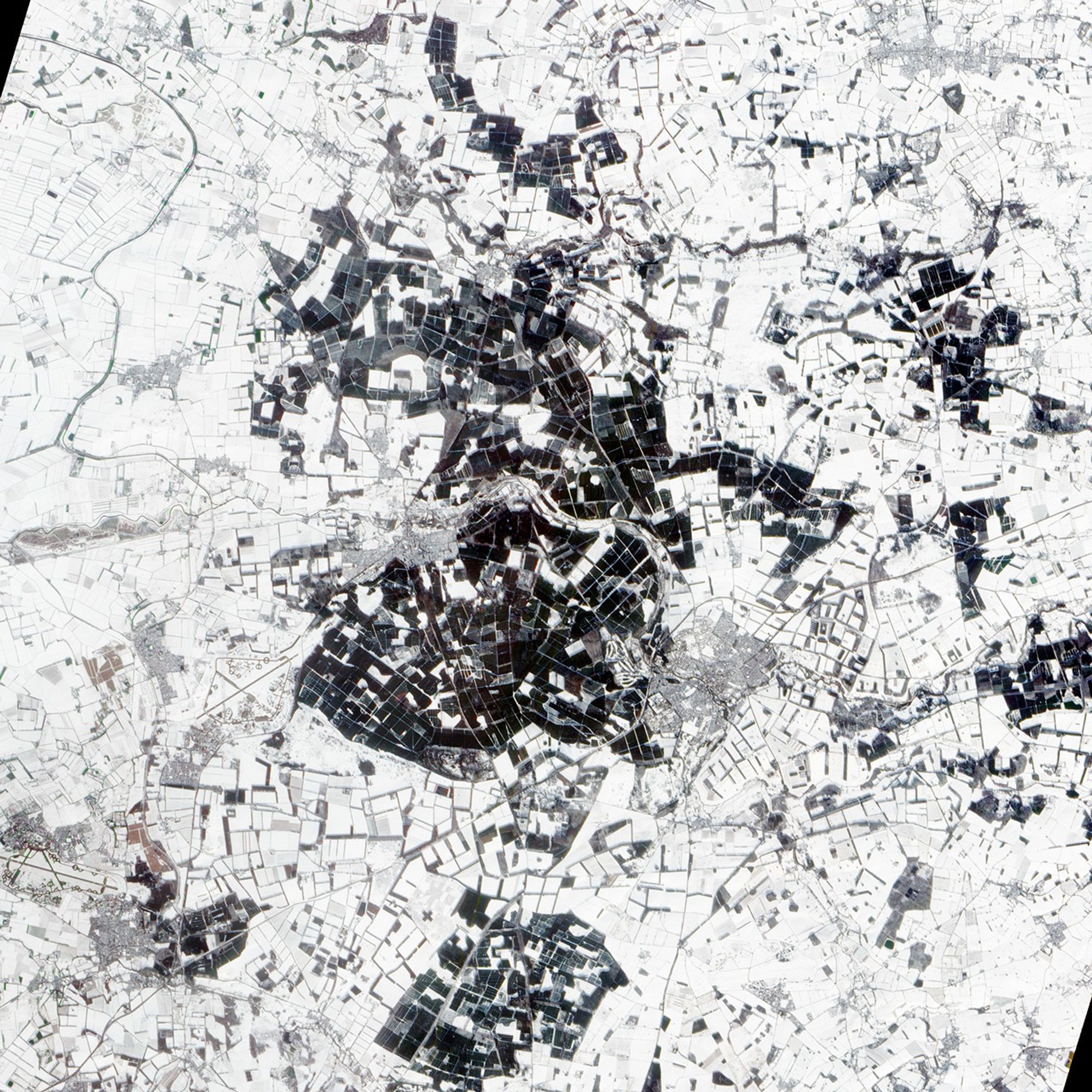
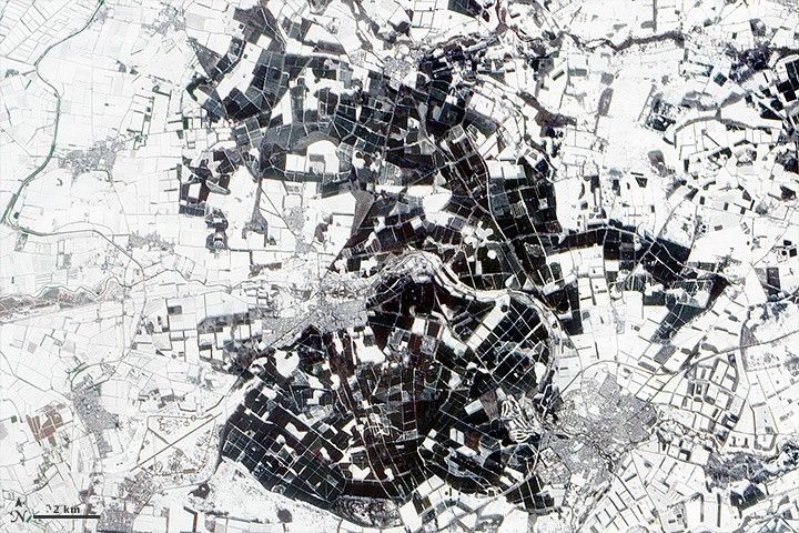
The two images above were acquired by the Advanced Land Imager on NASA’ Earth Observing-1 (EO-1) satellite. The top scene shows Thetford Forest on December 27, 2012; the bottom shows the same area on January 27, 2013, after a snowfall.
The other images in this week’s EO Puzzler series showed glimpses of landscapes on four other continents that have been touched far less by human activity. All of the scenes were captured by the Advanced Land Imager.
- The first puzzler showed undisturbed rainforest canopy in Brazil in part of Pará centered near 0° 58′ 37.1994″ S, 56° 42′ 39.5994″ W.
- The second showed two unnamed glacial lakes in Tibet’s Ngari Prefecture centered near 30° 20′ 31.63″ N, 84° 35′ 26.74″ E.
- The third showed a gorge formed by the Katherine River in Australia’s Northern Territory near the entrance of Nitmiluk National Park; it was centered near 4° 18′ 55.929″ S, 132° 25′ 31.1622″ E.
- The fourth showed salt pans in the floodplain of the Zambezi River centered near 15° 23′ 28.0638″ S, 23° 21′ 7.5528″ E in Zambia’s Western Province.
Further Reading
- Natural England Breckland ESA. Accessed April 26, 2013.
- Forest Commission Thetford Forest. Accessed April 26, 2013.
References & Resources
NASA Earth Observatory image by Jesse Allen and Robert Simmon, using EO-1 ALI data from the NASA EO-1 team. Caption by Robert Simmon. Caption by Adam Voiland. Congratulations to Christina Stiefel for solving Puzzler #5, Alan Wessman for solving Puzzler #3, and Angie Connelly for solving Puzzler #2. Honorable mention to Marcus Scherer for nearly solving Puzzler #1.