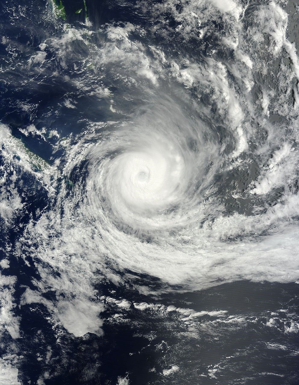




















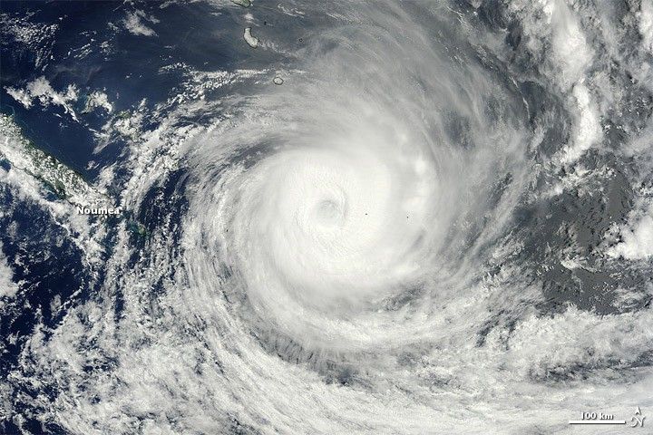
By February 8, 2012, Tropical Cyclone Jasmine had traveled eastward past the island of New Caledonia. The Moderate Resolution Imaging Spectroradiometer (MODIS) on NASA’s Terra satellite captured this natural-color image at 9:45 a.m. local time on February 9, 2012.
That day, the U.S. Navy’s Joint Typhoon Warning Center (JTWC) reported that Jasmine had maximum sustained winds of 105 knots (195 kilometers per hour) and gusts up to 130 knots (240 kilometers per hour). Located roughly 510 kilometers (275 nautical miles) east-southeast of Noumea, New Caledonia, the storm was expected to continue moving in an eastward direction and to weaken.
References & Resources
- Joint Typhoon Warning Center. (2012, February 9). Tropical Cyclone 10P (Jasmine) Warning. Accessed February 9, 2012.
NASA image courtesy Jeff Schmaltz, LANCE/EOSDIS MODIS Rapid Response Team at NASA GSFC. Caption by Michon Scott.