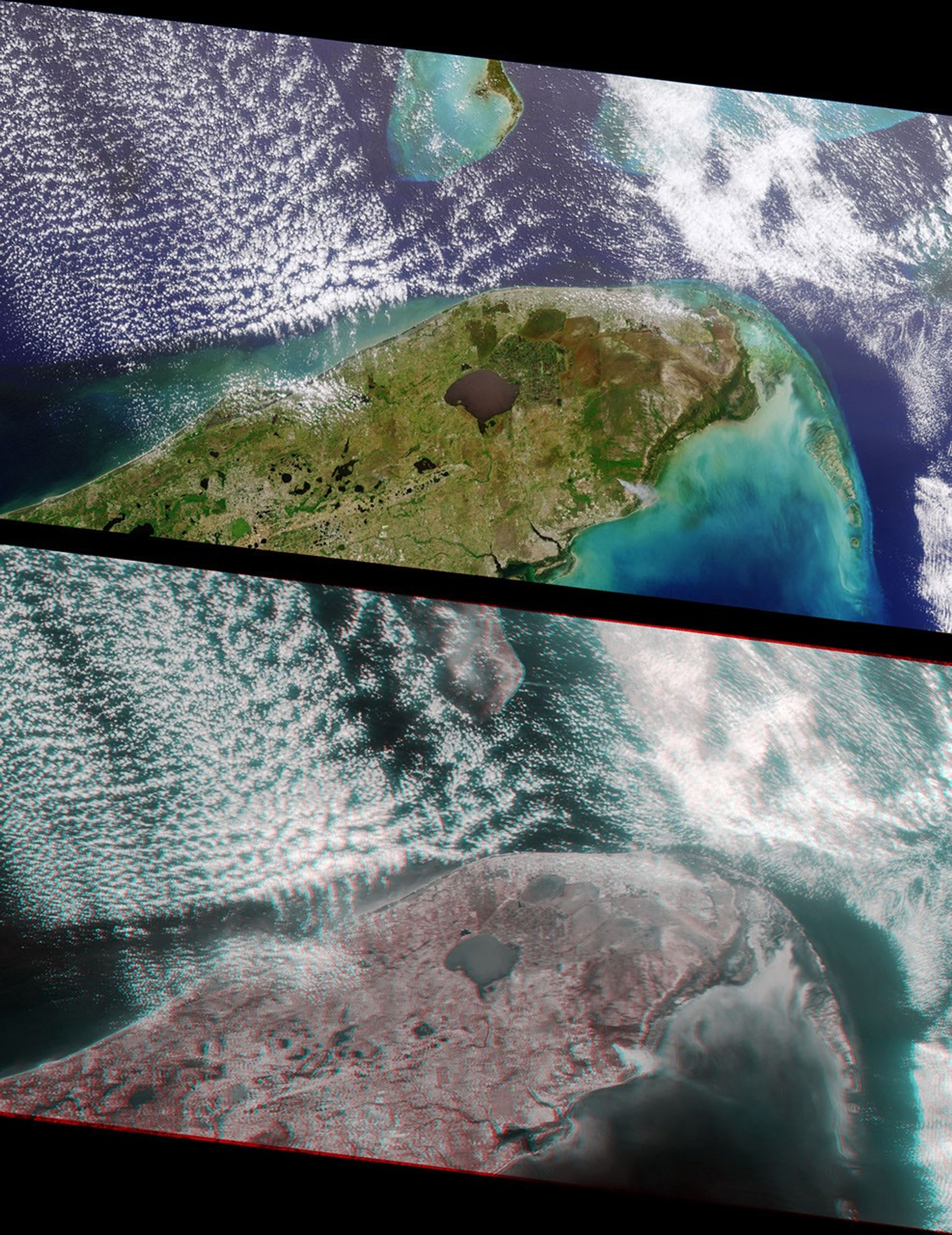

























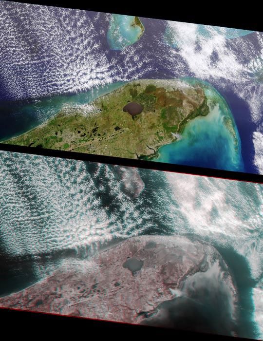
Multi-angle Imaging SpectroRadiometer (MISR) images of Florida acquiredon April 9, 2000 during Terra orbit 1650. The image at the top is acolor view acquired by the vertical (nadir) camera. It has beenreoriented so that the flight path is from left to right, to facilitatecomparison with the lower image, a stereo “anaglyph” generated using275-m resolution red band data from the cameras viewing 45.6 degrees and70.5 degrees aft of nadir. The anaglyph provides a three-dimensionaleffect when viewed using red/blue glasses with the red filter placedover the left eye. This stereoscopic “depth perception” and thevariation in brightness as a function of view angle enables scientiststo assess the climate impact of different types of cloud fields. Theplume from a large brush fire that burned about 15,000 acres is visibleat the western edge of the Big Cypress Swamp in southern Florida.
For more information, see the MISR web site.
References & Resources
Images by NASA/GSFC/JPL, MISR Science Team.