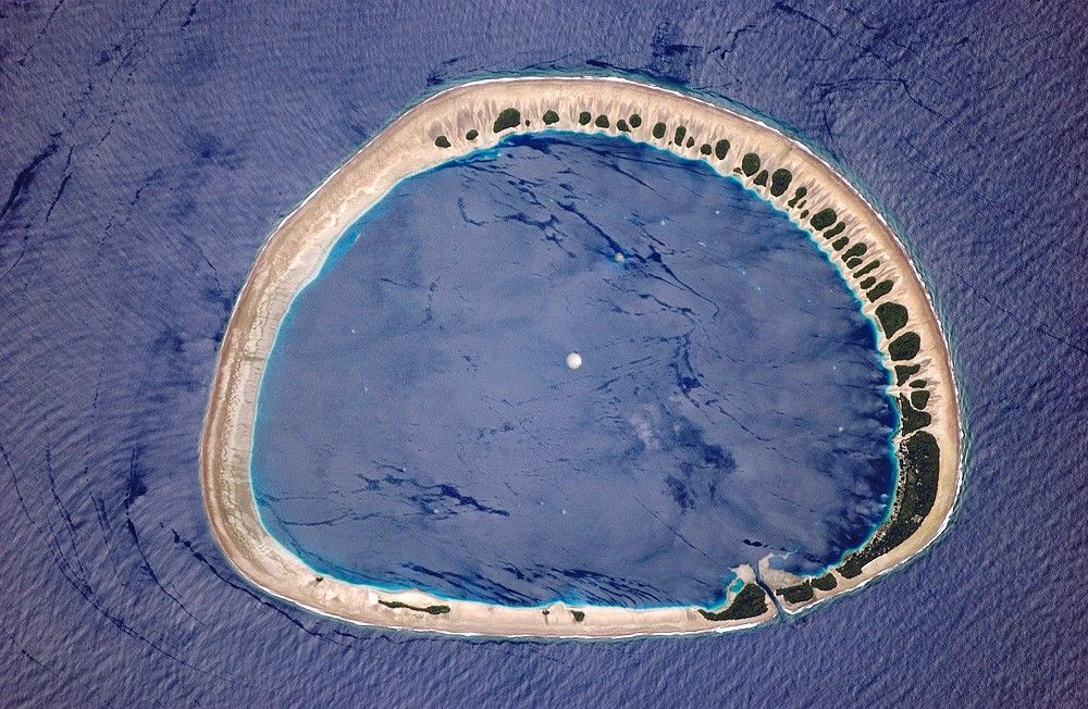
Located just north of the equator (3.85° North, 154.9° East), this classically shaped atoll is part of the Caroline Islands, which stretch northeast of Papua New Guinea in the western Pacific. (The islands are roughly north of Guadalcanal, and southeast of Guam and Truk Islands.) Nukuoro Atoll is one of 607 islands that make up the Federated States of Micronesia.
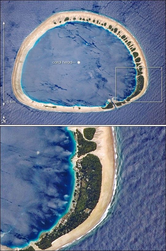
The image shows the sandy atoll with 42 distinct patches of vegetation. These patches are located on the northeast and east portions of the atoll that face the dominant easterly winds. The detailed image (white box indicates area shown) shows the larger fields and settlements, which are on the inland side of the largest forest patch, protected from the wind. The land surface is probably slightly higher above sea level here because dunes build up preferentially on wind-facing slopes where beach sand is mobilized by wind. Swells driven by these winds approach from the east-southeast (right) and wrap around the atoll to produce an interference pattern on the downwind side. Water in the lagoon is notably calm in comparison. Coral heads appear in the lagoon, including one in the center of the image.
About 900 people live on Nukuoro, whose lagoon is 6 kilometers (about 3.7 miles) in diameter. Fishing, animal husbandry, and agriculture (taro and copra) are the main occupations. Nukuoro is remote. It has no airstrip, and a passenger boat calls irregularly only once a month. The tiny population speaks its own unique language.
References & Resources
Astronaut photograph ISS013-E-28610 was acquired May 31, 2006, using a Kodak 760C digital camera with an 800 mm lens, and is provided by the ISS Crew Earth Observations experiment and the Image Science & Analysis Group, Johnson Space Center. The image in this article has been cropped and enhanced to improve contrast. The International Space Station Program supports the laboratory to help astronauts take pictures of Earth that will be of the greatest value to scientists and the public, and to make those images freely available on the Internet. Additional images taken by astronauts and cosmonauts can be viewed at the NASA/JSC Gateway to Astronaut Photography of Earth.