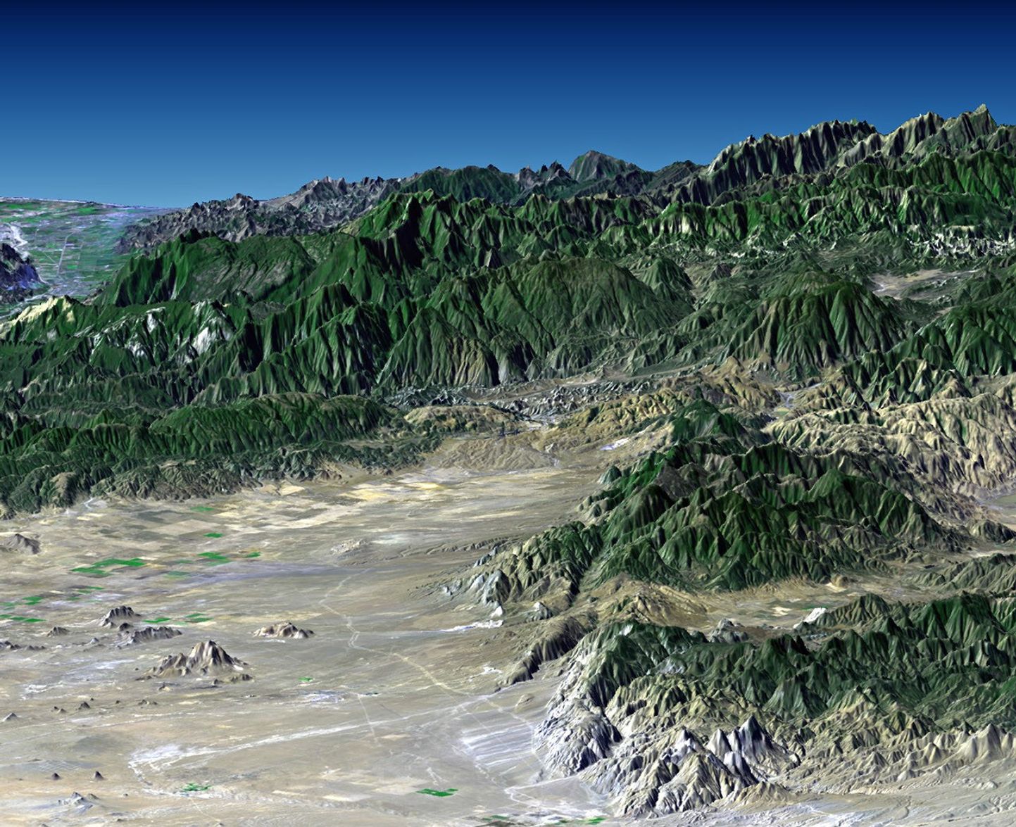


Southern California's dramatic topography plays a critical role inits climate, hydrology, ecology, agriculture, and habitability. Thisimage of Southern California, from the desert at Mojave to the ocean atVentura, shows a variety of landscapes and environments. Winds usuallybring moisture to this area from the west, moving from the ocean, acrossthe coastal plains, to the mountains, and then to the deserts. Mostrainfall occurs as the air masses rise over the mountains and cool withaltitude. Continuing east, and now drained of their moisture, the airmasses drop in altitude and warm as they spread across the desert. Themountain rainfall supports forest and chaparral vegetation, seen here,and also becomes ground water and stream flow that supports citrus,avocado, strawberry, other crops, and a large and growing population onthe coastal plains.
This perspective view was generated by draping a Landsat satelliteimage over a preliminary topographic map from the ShuttleRadar Topography Mission (SRTM). It shows the Tehachapi Mountains in the rightforeground, the city of Ventura on the coast at the distant left, andthe easternmost Santa Ynez Mountains forming the skyline at the distantright.
Landsat has been providing visible and infrared views of the Earthsince 1972. SRTM elevation data matches the 30 meter resolution of mostLandsat images and will substantially help in analyses of the large andgrowing Landsat image archive.
The elevation data used in this image was acquired by the ShuttleRadar Topography Mission (SRTM) aboard the Space Shuttle Endeavour,launched on February 11, 2000. SRTM used the same radar instrument thatcomprised the Spaceborne Imaging Radar-C/X-Band Synthetic Aperture Radar(SIR-C/X-SAR) that flew twice on the Space Shuttle Endeavour in 1994.SRTM was designed to collect three-dimensional measurements of theEarth's surface. To collect the 3-D data, engineers added a60-meter-long (200-foot) mast, installed additional C-band and X-bandantennas, and improved tracking and navigation devices.
Location: 34.8 deg. North lat., 118.8 deg. West lon.
Orientation: View toward the southwest, 3X vertical exaggeration
Image: Landsat bands 1, 2&4, 3 as blue, green, and red, respectively
Date Acquired: February 16, 2000 (SRTM), November 11, 1986 (Landsat)
References & Resources
Image courtesy NASA, the National Imagery and Mapping Agency (NIMA) of the U.S. Department of Defense (DoD), the German and Italian space agencies, and the Jet Propulsion Laboratory.