![Request for Information – Potential [Placeholder for Prize]](https://assets.science.nasa.gov/dynamicimage/assets/science/missions/a-step/FFR_Earth_Background_20251120%20.png?w=1024)


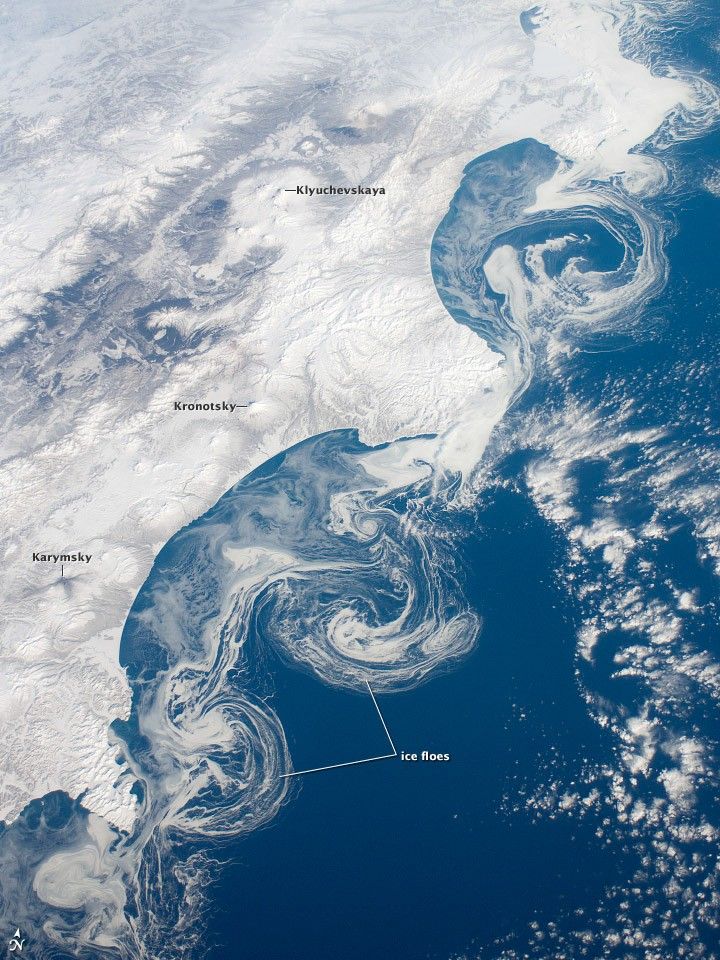
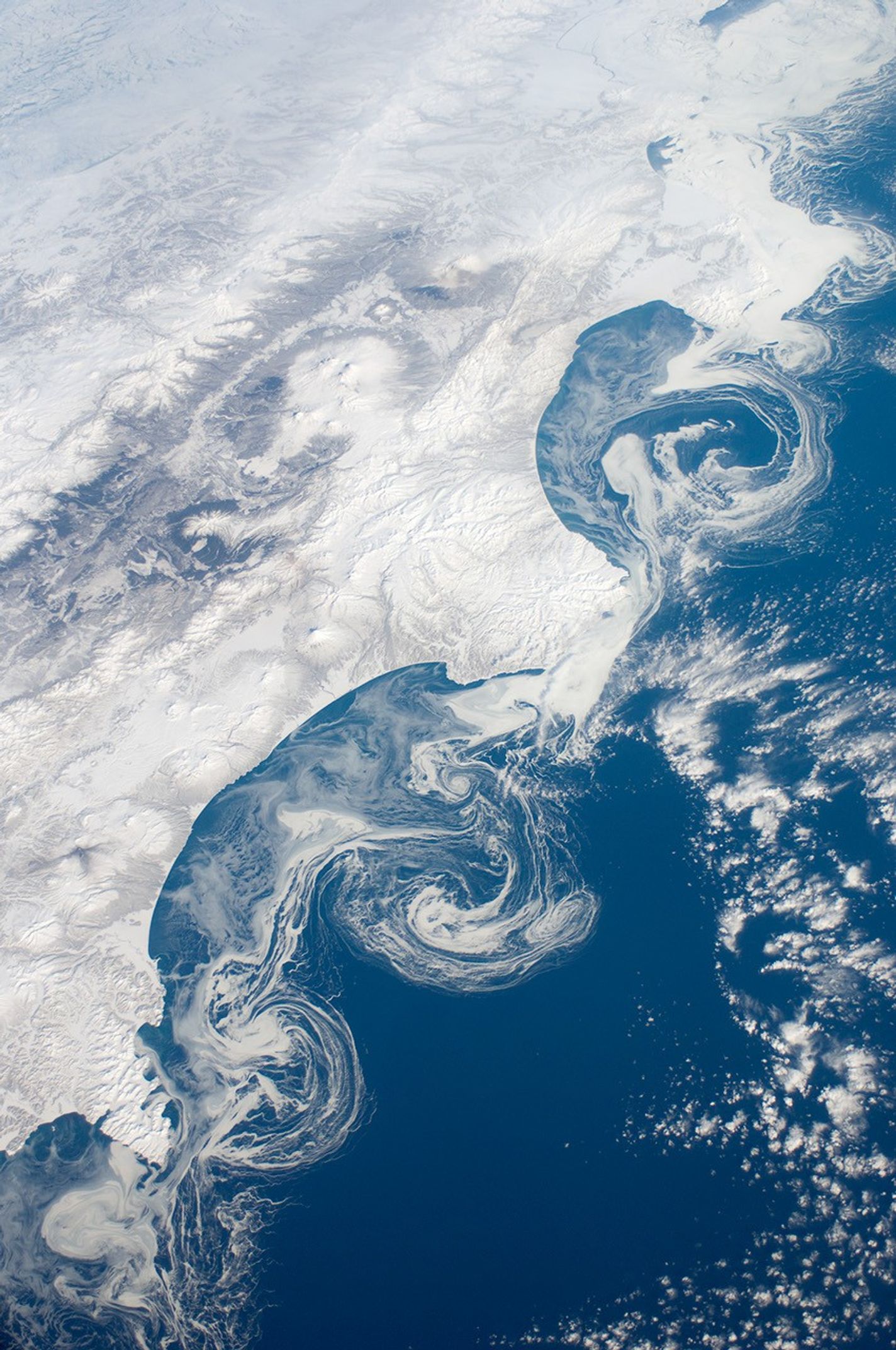
The vantage point from orbit on the International Space Station (ISS) frequently affords astronauts with the opportunity to observe processes that are impossible to see on the ground. The winter season blankets the Kamchatka Peninsula of Russia in snow, but significant amounts of sea ice can also form and collect along the Pacific coastline. As ice floes grind against each other, they produce smaller floes that can be moved by wind and currents.
The irregular southeastern coastline of Kamchatka provokes large, circular eddy currents to spin off from the main southwestward-flowing Kamchatka current. Three such eddies are highlighted by surface ice floe patterns at image center. The patterns are very difficult (and dangerous) to navigate in an ocean vessel. While the floes may look thin and delicate from the ISS vantage point, even the smaller ice chunks are several meters across. White clouds (image top right) are distinguished from the sea ice and snow cover by their high brightness and discontinuous nature.
The Kamchatka Peninsula also hosts many currently and historically active stratovolcanoes. Kliuchevskoi Volcano, the highest in Kamchatka (summit elevation 4,835 meters) and one of the most active, had its most recent confirmed eruption in June 2011. Meanwhile, Karymsky Volcano (to the south) likely produced ash plumes just days before this image was taken; the snow cover on the south and east sides of the summit is darkened by a cover of fresh ash or melted away altogether (image bottom center). By contrast, Kronotsky Volcano—a “textbook” symmetrical cone-shaped stratovolcano—last erupted in 1923.
References & Resources
Astronaut photograph ISS030-E-162344 was acquired on March 15, 2012, with a Nikon D2Xs digital camera using a 28 mm lens, and is provided by the ISS Crew Earth Observations experiment and Image Science & Analysis Laboratory, Johnson Space Center. The image was taken by the Expedition 30 crew. The image has been cropped and enhanced to improve contrast, and lens artifacts have been removed. The International Space Station Program supports the laboratory as part of the ISS National Lab to help astronauts take pictures of Earth that will be of the greatest value to scientists and the public, and to make those images freely available on the Internet. Additional images taken by astronauts and cosmonauts can be viewed at the NASA/JSC Gateway to Astronaut Photography of Earth. Caption by William L. Stefanov, Jacobs/ESCG at NASA-JSC.