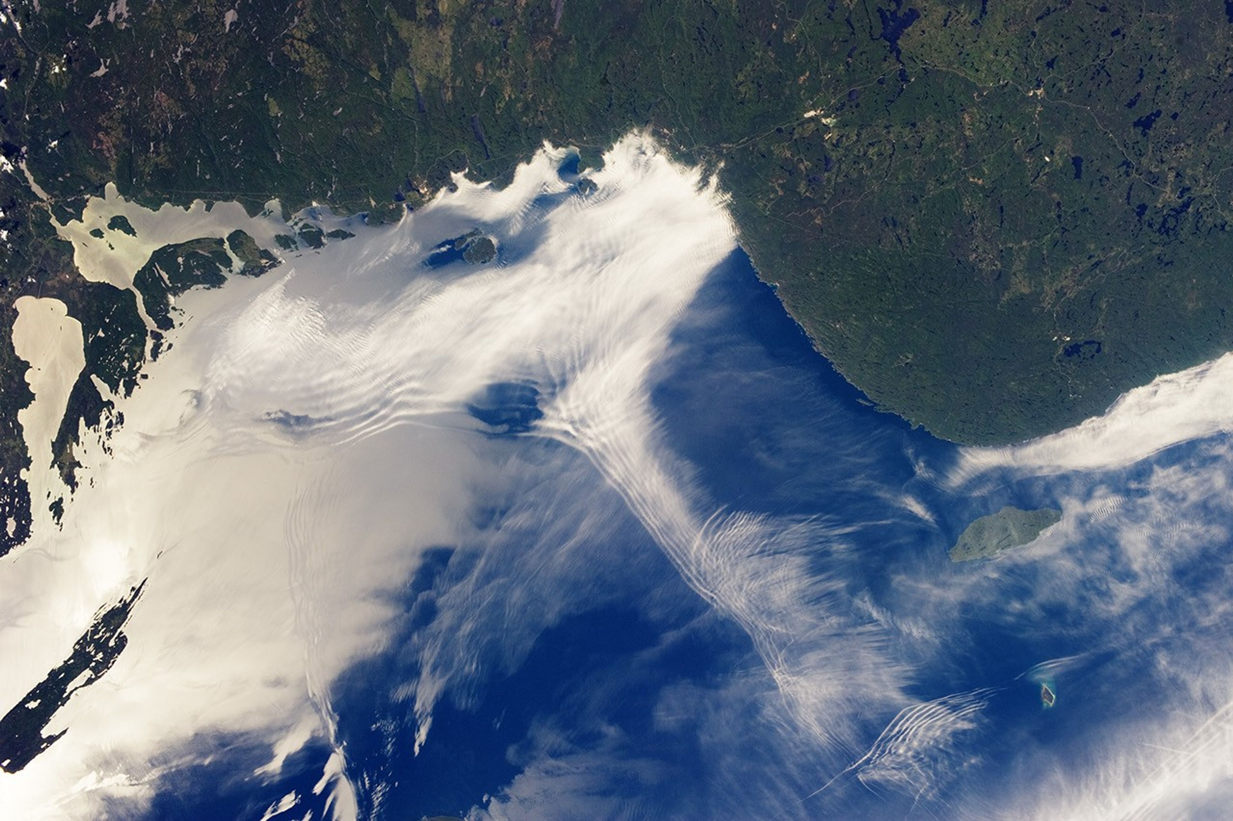
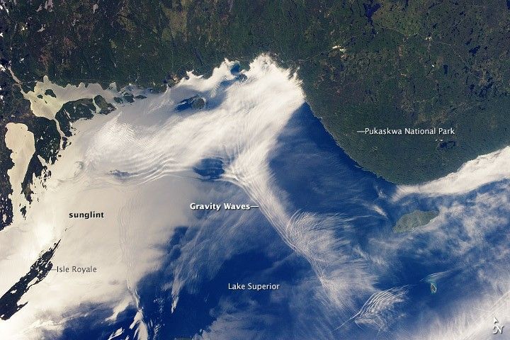
From the vantage point of the International Space Station, astronauts frequently observe atmospheric and surface phenomena in ways that are impossible to view from the ground. Two such phenomena—gravity waves and sunglint—are illustrated in this photograph of northeastern Lake Superior.
At the top of the image, the Canadian Shield of southern Ontario is covered by an extensive forest canopy typical of early summer. Offshore and to the west and southwest of Pukaskwa National Park, several distinct sets of parallel cloud bands are visible. Gravity waves are produced when moisture-laden air encounters imbalances in air density, such as might be expected when cool air flows over warmer air. This can cause the flowing air to oscillate up and down as it moves, causing clouds to condense as the air rises and cools and to evaporate away as the air sinks and warms. This produces parallel bands of clouds oriented perpendicular to the wind direction. The orientation of the cloud bands in this image, parallel to the coastlines, suggests that air flowing off of the land surfaces to the north is interacting with moist, stable air over the lake surface, creating gravity waves.
The second phenomenon—sunglint—affects the water surface around and to the northeast of Isle Royale. Sunglint is caused by light reflection off a water surface; some of the reflected light travels directly back towards the observer, resulting in a bright mirror-like appearance over large expanses of water. Water currents and changes in surface tension—typically caused by presence of oils or surfactants—alter the reflective properties of the water and can be highlighted by sunglint. For example, surface water currents are visible to the east of Isle Royale that are oriented similarly to the gravity waves, suggesting that they too are the product of winds moving off of the land surface.
References & Resources
Astronaut photograph ISS036-E-11843 was acquired on June 24, 2013, with a Nikon D3S digital camera using a 50 millimeter lens, and is provided by the ISS Crew Earth Observations experiment and Image Science & Analysis Laboratory, Johnson Space Center. The image was taken by the Expedition 36 crew. It has been cropped and enhanced to improve contrast, and lens artifacts have been removed. The International Space Station Program supports the laboratory as part of the ISS National Lab to help astronauts take pictures of Earth that will be of the greatest value to scientists and the public, and to make those images freely available on the Internet. Additional images taken by astronauts and cosmonauts can be viewed at the NASA/JSC Gateway to Astronaut Photography of Earth. Caption by William L. Stefanov, Jacobs/JETS and Michael H. Trenchard, Barrios/JETS, both at NASA-JSC.