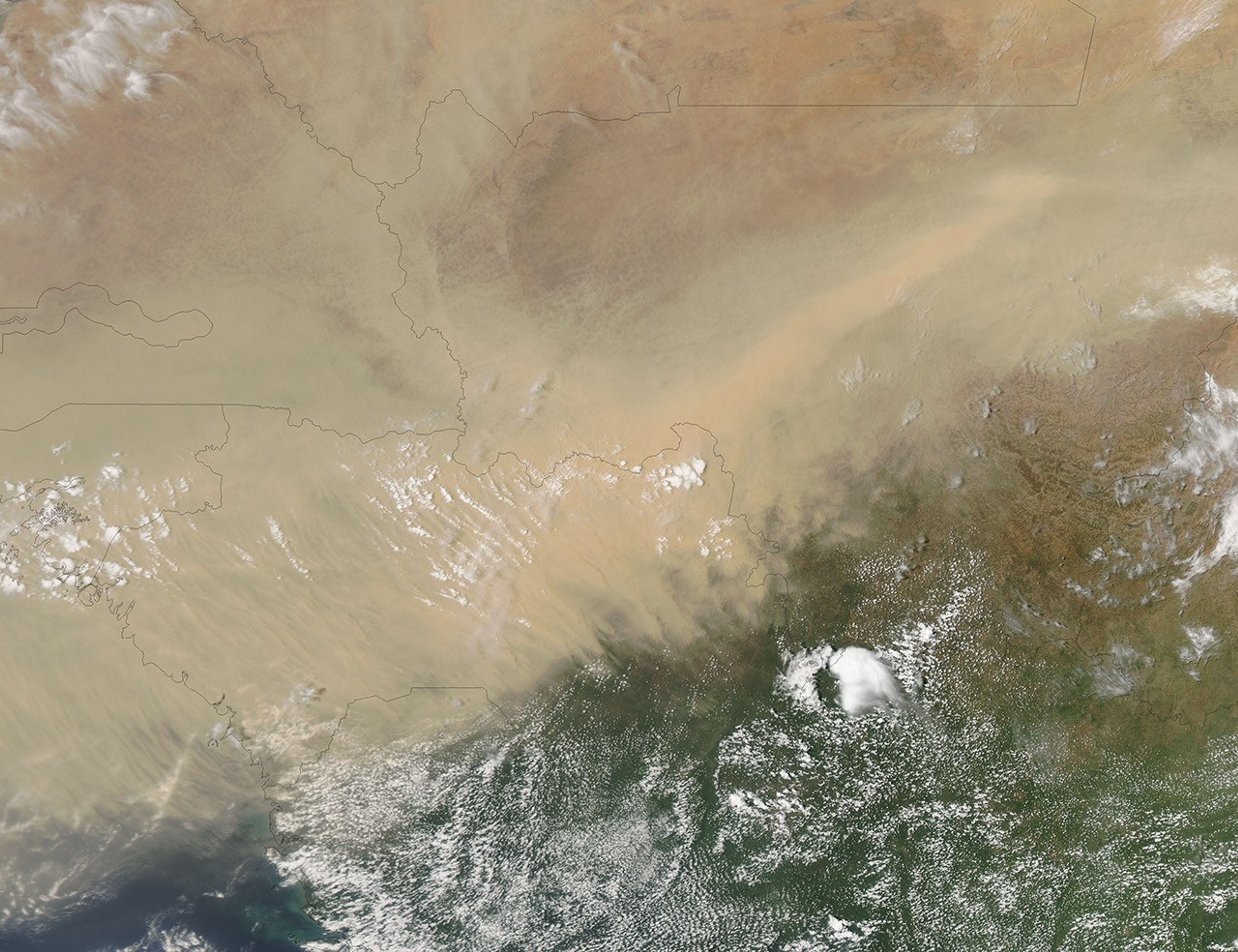


Dust continued blowing over western Africa on April 30, 2012. The Moderate Resolution Imaging Spectroradiometer (MODIS) on NASA’s Aqua satellite acquired this natural-color image the same day. An especially thick plume of dust blew over southwestern Mali and Guinea.
At least some of the dust appeared to originate in Mali. This large, landlocked nation receives little rainfall, but because northeastern Mali lies within the Sahara, and southwestern Mali lies within the Sahel, the country has a north-south rainfall gradient, with more precipitation falling in the south. By April 2012, however, southwestern Mali was coping with severe drought.
Mali’s rainy season lasts from June to August, but the rainy season of 2011 experienced just one month of rainfall. The unusual aridity in late 2011 and early 2012 may have increased the odds of dust storms by drying out marsh and river sediments in southwestern Mali. Meanwhile, the vast sand seas of northeastern Mali can regularly contribute to dust storms.
References & Resources
- International Rescue Committee. (2012, May 1) Mali: Latest update on the IRC’s emergency response. Accessed May 1, 2012.
- United Nations Environment Programme. (2008) Africa: Atlas of Our Changing Environment. Division of Early Warning and Assessment, United Nations Environment Programme, Nairobi, Kenya.
- United Nations Integrated Regional Information Networks. (2012, April 13) Mali: Beyond the drought – “Families will disappear.” AllAfrica.com. Accessed May 1, 2012.
NASA image by Jeff Schmaltz, LANCE MODIS Rapid Response. Caption by Michon Scott.