

January 9, 2014
Frozen Lake Erie
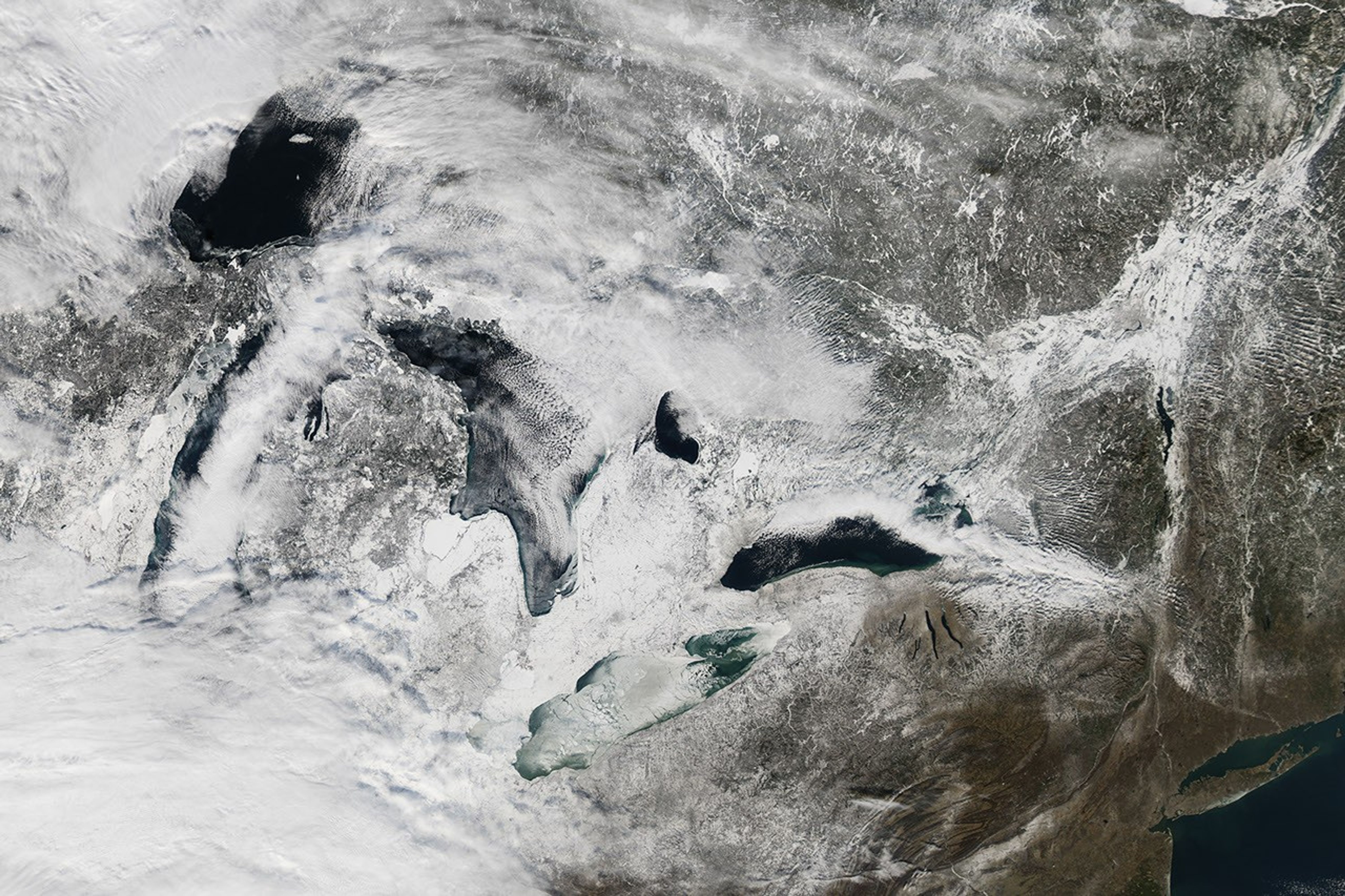
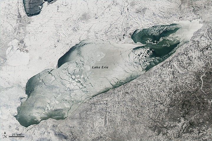
The intense cold snap that gripped much of central Canada and the United States in early January 2014 brought thick and widespread ice to the Great Lakes. Though parts of the lakes freeze every winter, several news media and meteorologist accounts suggested that January ice cover was thicker and more widespread than it has been in nearly two decades. The ice cover was hampering ship traffic in the region, according to news reports.
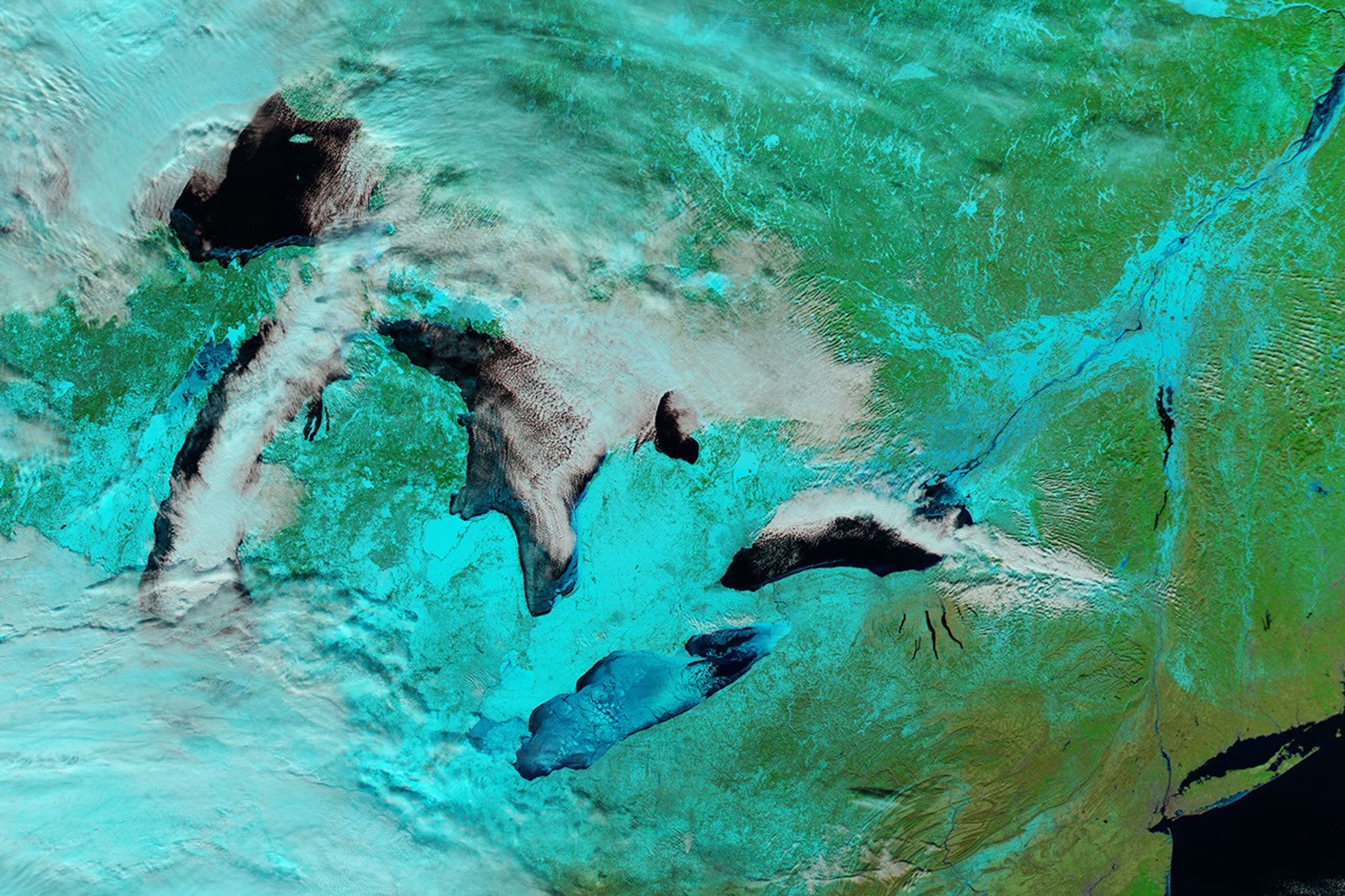
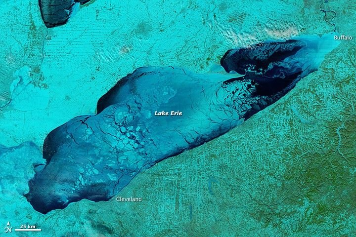
The Moderate Resolution Imaging Spectroradiometer (MODIS) on NASA’s Aqua satellite acquired these images in the early afternoon of January 9, 2014. The top view shows Lake Erie in natural color, while the second image shows a blend of shortwave infrared, near infrared, and red (MODIS bands 7-2-1) that helps distinguish ice from snow and water. Ice is pale blue (thicker ice is brighter), open water is navy, and snow is blue-green.
On January 9, Lake Erie was reported to be 90 percent ice covered, and nearly a quarter of the surface area of the five Great Lakes was covered. (Download the large images for a regional view.) Ironically, the ice cap on top of the lakes stifled the persistent “lake effect” snowstorms that had buried Buffalo, New York, and other towns during the deep freeze of early January. Cold arctic winds blowing across the frozen lake could no longer pick up moisture.
Since January 9, Lake Erie and much of the surrounding area has been blanketed by persistent, spotty cloud cover whenever Aqua passed over. However, it does appear that the ice has pulled back a bit as temperatures have returned to normal and even above normal in some areas. The NOAA Great Lakes Environmental Research Lab reported 88 percent ice cover around noon on January 12 and 62 percent at noon on January 14. Click here to view the observational models of Lake Erie ice.
References & Resources
- ImaGeo Blog, via Discover magazine (2014, January 11) A Great Lake Succumbs to the Deep Freeze. Accessed January 14, 2014.
- Dr. Jeff Masters WunderBlog, via Weather Underground (2013, January 9) Great Lakes Ice Cover at Highest Levels in 20 Years. Accessed January 14, 2014.
- The Star Tribune (2014, January 11) Worst buildup of ice in decades is causing problems for Lake Superior ships. Accessed January 14, 2014.
NASA Earth Observatory image by Jesse Allen, using data from the Level 1 and Atmospheres Active Distribution System (LAADS). Caption by Michael Carlowicz.