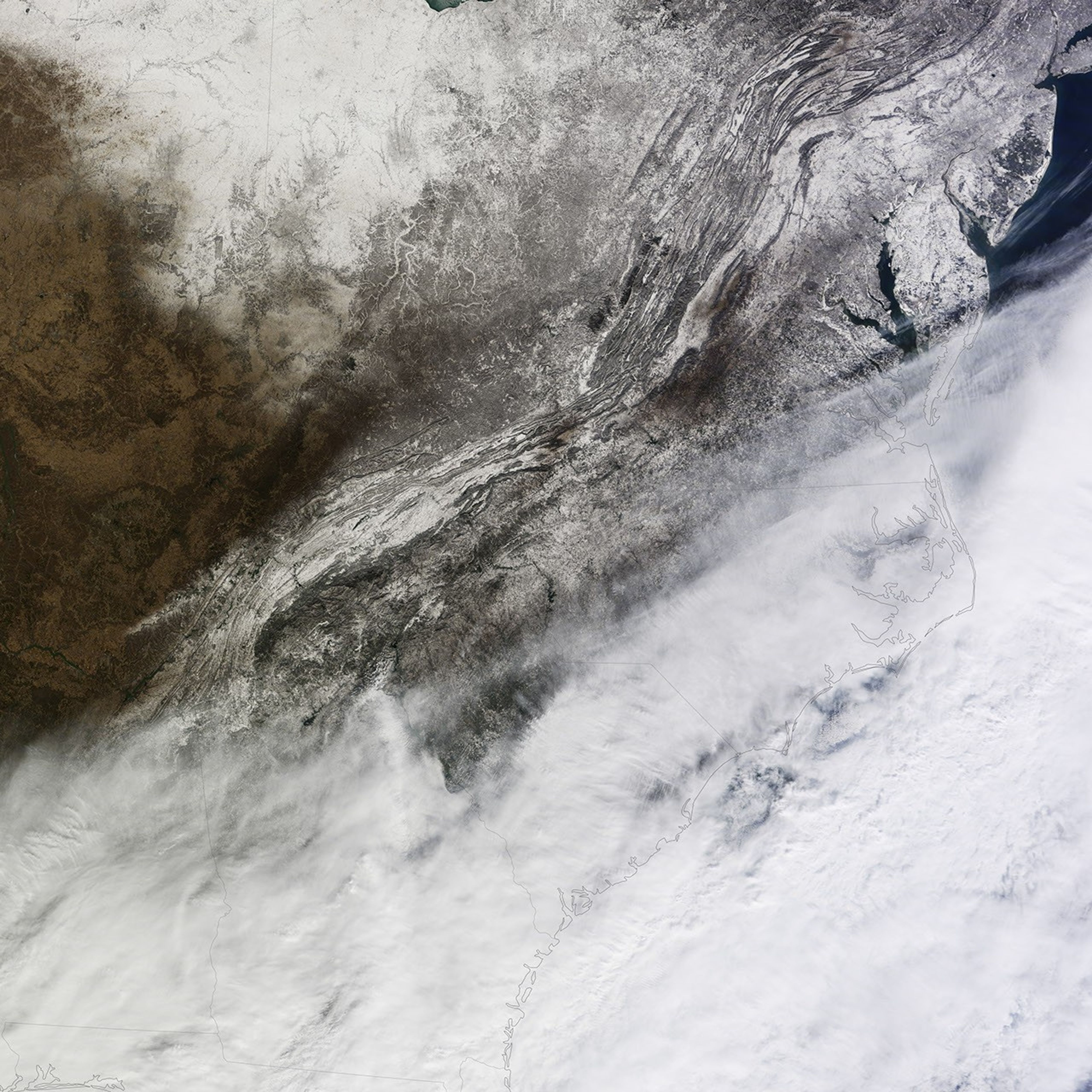

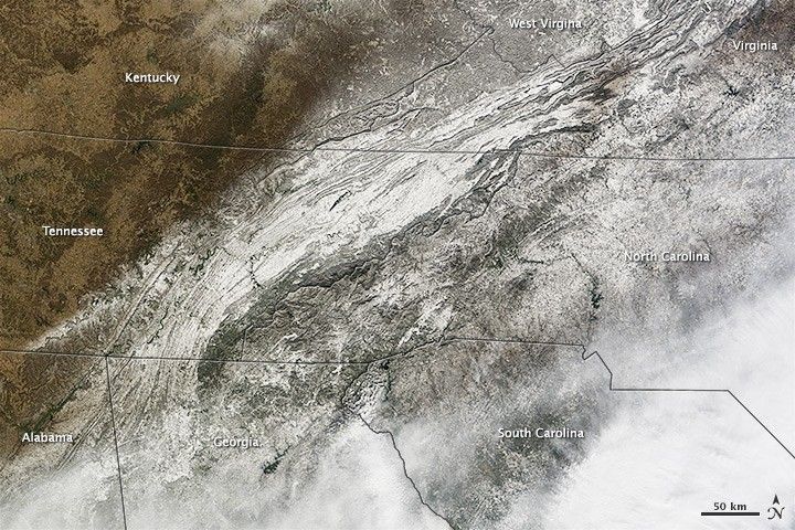
A large winter storm swept through the southeastern United States in January 2014, dropping snow and ice on an area unaccustomed to dealing with winter weather.
While clouds still covered most of the area affected by the storm when the Terra satellite passed over on January 29, 2014, the Moderate Resolution Imaging Spectroradiometer (MODIS) on board captured this view of snow on the ground in parts of northern Georgia, northern South Carolina, eastern Tennessee, and western North Carolina. According to the National Weather Service, the storm dropped up to 9 inches (23 centimeters) of snow in parts of North Carolina, 4 inches (10 centimeters) in parts of South Carolina and Georgia, and 2 inches (5 centimeters) in parts of Tennessee. Atlanta received 2.6 inches (6.6 centimeters) of snow. Many areas also received significant amounts of freezing rain and sleet.
The winter weather and the limited supply of snow-clearing equipment led to extreme travel woes throughout the region. In Atlanta, commuters faced gridlock on Tuesday afternoon as schools, businesses, and government offices all closed at approximately the same time. In many areas, roads that are normally packed with travelers ground to a complete standstill as accidents piled up. Frustrated by the gridlock, thousands of Atlantans abandoned their cars, which led to even more extreme congestion. Some children were forced to stay at school all night because the roads were impassable.
In the aftermath of the storm, there has been much discussion about whether meteorologists provided officials with an accurate forecast and enough warning. In a blog post published after the storm, Marshall Shepherd, president of the American Meteorological Society, argued they did. “The buses had a tough time getting kids home, but meteorologists should not be thrown under the bus,” he wrote, noting that the National Weather Service had started issuing snow warnings and watches as early 4:55 a.m. on Monday.
NASA Earth Observatory image by Jesse Allen and Robert Simmon, using data from the Land Atmosphere Near real-time Capability for EOS (LANCE). Caption by Adam Voiland.