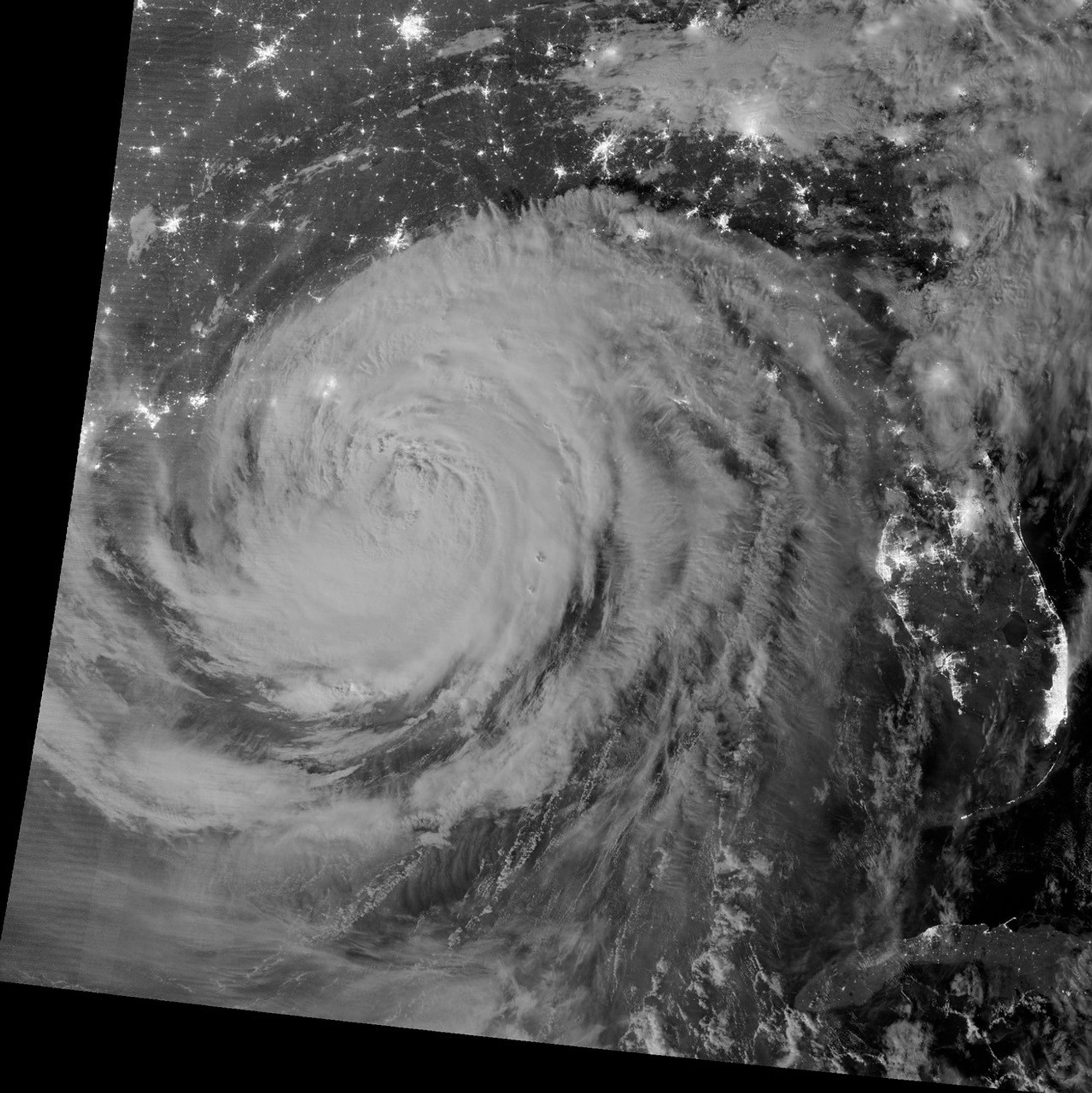

Early on August 29, 2012, the Visible Infrared Imaging Radiometer Suite (VIIRS) on the Suomi-NPP satellite captured this nighttime view of Hurricane Isaac and the cities near the Gulf Coast of the United States. The image was acquired at 1:57 a.m. local time (6:57 Universal Time) by the VIIRS “day-night band,” which detects light in a range of wavelengths from green to near-infrared and uses light intensification to enable the detection of dim signals. In this case, the clouds were lit by moonlight.
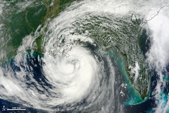
Isaac, a slow-moving storm, made landfall as a category 1 hurricane near the mouth of the Mississippi River in southwestern Louisiana at about 6:45 p.m. local time on August 28. It then moved westward and back out over water until making a second landfall near Port Fourchon around 4 a.m. on August 29. A weakening Isaac churned slowly northwest throughout the day at speeds of just 6 miles (9 kilometers) per hour, slow enough that forecasters expected the storm to drop 7 to 14 inches (18 to 36 centimeters) of rain across much of Louisiana, southern Mississippi, and southwestern Alabama.
Read a more detailed description of the storm from the satellite perspective at NASA’s Hurricane Resource Page. Also, the National Hurricane Center provides the official U.S. storm forecasts and regular updates on conditions on its home page.
Further Reading
- Science News. (2012, June 2) Storm Front: Hurricane Experts Push to Improve Intensity Forecasts. Accessed August 29, 2012.
References & Resources
- Associated Press. (2012, August 29) Hurricane Isaac Makes Landfall in La. Accessed August 29, 2012.
- National Hurricane Center. (2012, August 29) Issac. Accessed August 29, 2012.
- New York Times. (2012, August 29) As Isaac Crawls Into Louisiana, Rains Cloud Last for Days. Accessed August 29, 2012.
NASA Earth Observatory image by Jesse Allen and Robert Simmon, using VIIRS Day-Night Band data from the Suomi National Polar-orbiting Partnership (Suomi NPP). Suomi NPP is the result of a partnership between NASA, the National Oceanic and Atmospheric Administration, and the Department of Defense. Caption by Adam Voiland.