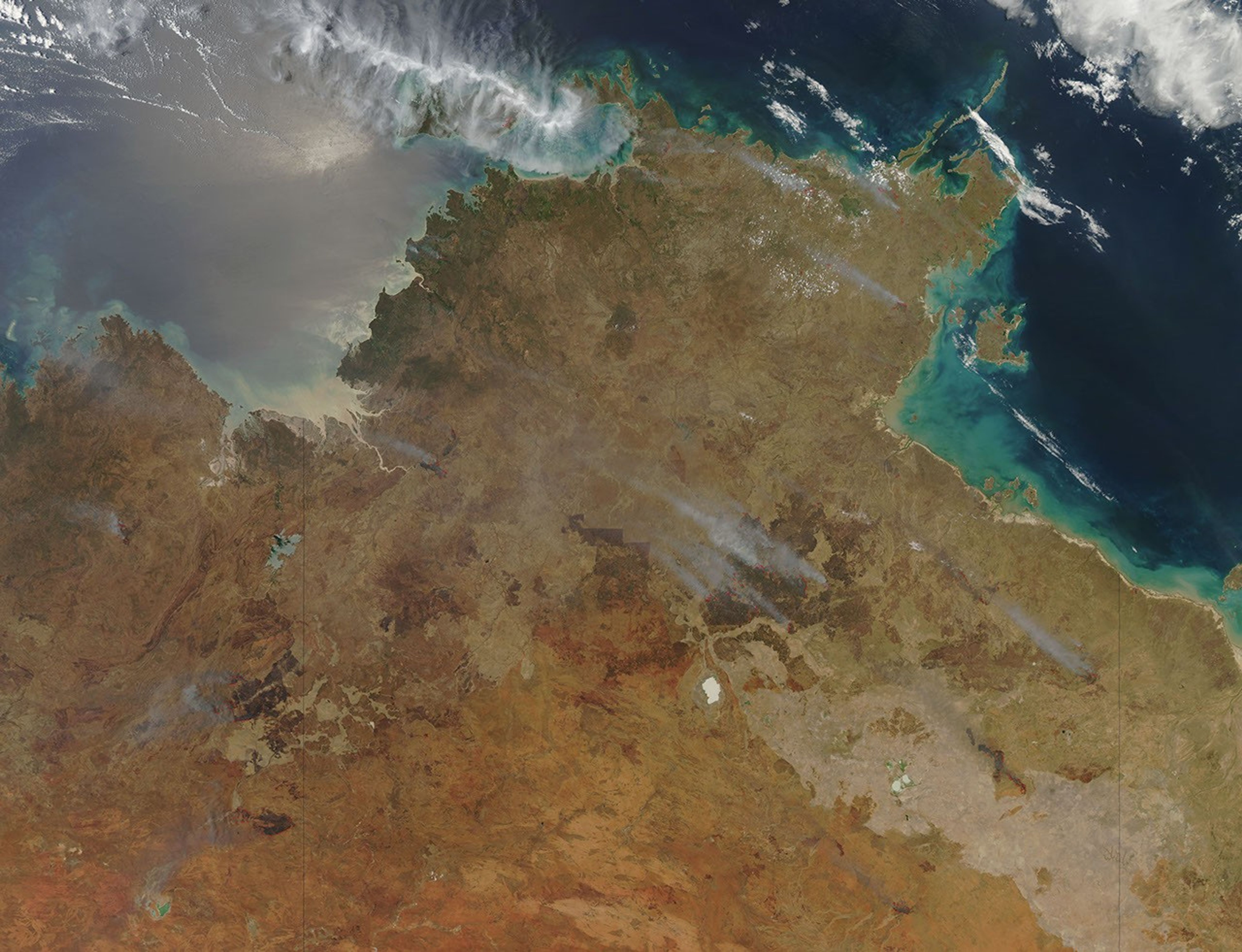
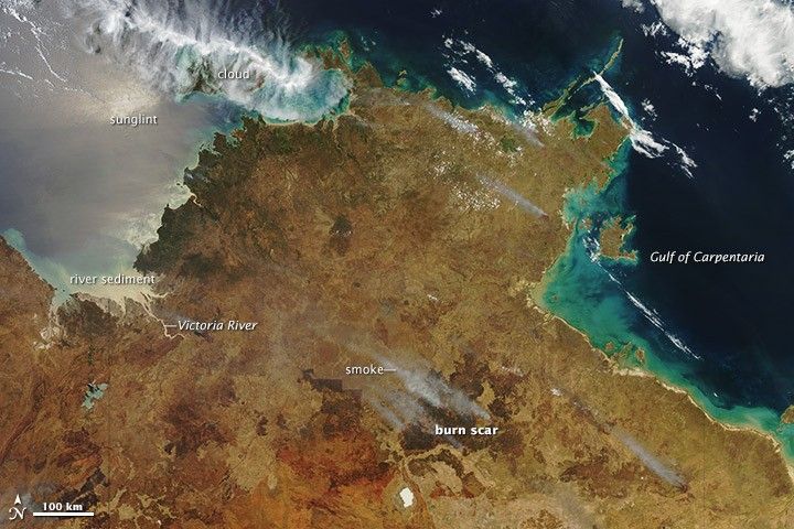
On October 13, 2012, the Moderate Resolution Imaging Spectroradiometer (MODIS) on NASA’s Terra satellite captured this natural-color image of fires burning in northern Australia. Smoke from the fires streams to the northwest due to trade winds blowing from the southeast. Red outlines indicate hot spots where MODIS detected unusually warm surface temperatures associated with fires.
Large fires in the tropical savannas of northern Australia are common in the spring. On average, about one-third of the land surface in these fire-prone ecosystems burn every year. Northwest of the fires, large amounts of sediment carried by the Victoria River flow into the Timor Sea. The water is likely turquoise near the continent’s coasts because of tides stirring up river sediment on the seabed and circulating it throughout shallow ocean waters.
Further Reading
- North Australia Fire Information. North Australian Fire Information. Accessed October 18, 2012.
References & Resources
NASA image courtesy Jeff Schmaltz, LANCE MODIS Rapid Response Team at NASA GSFC. Caption by Adam Voiland.