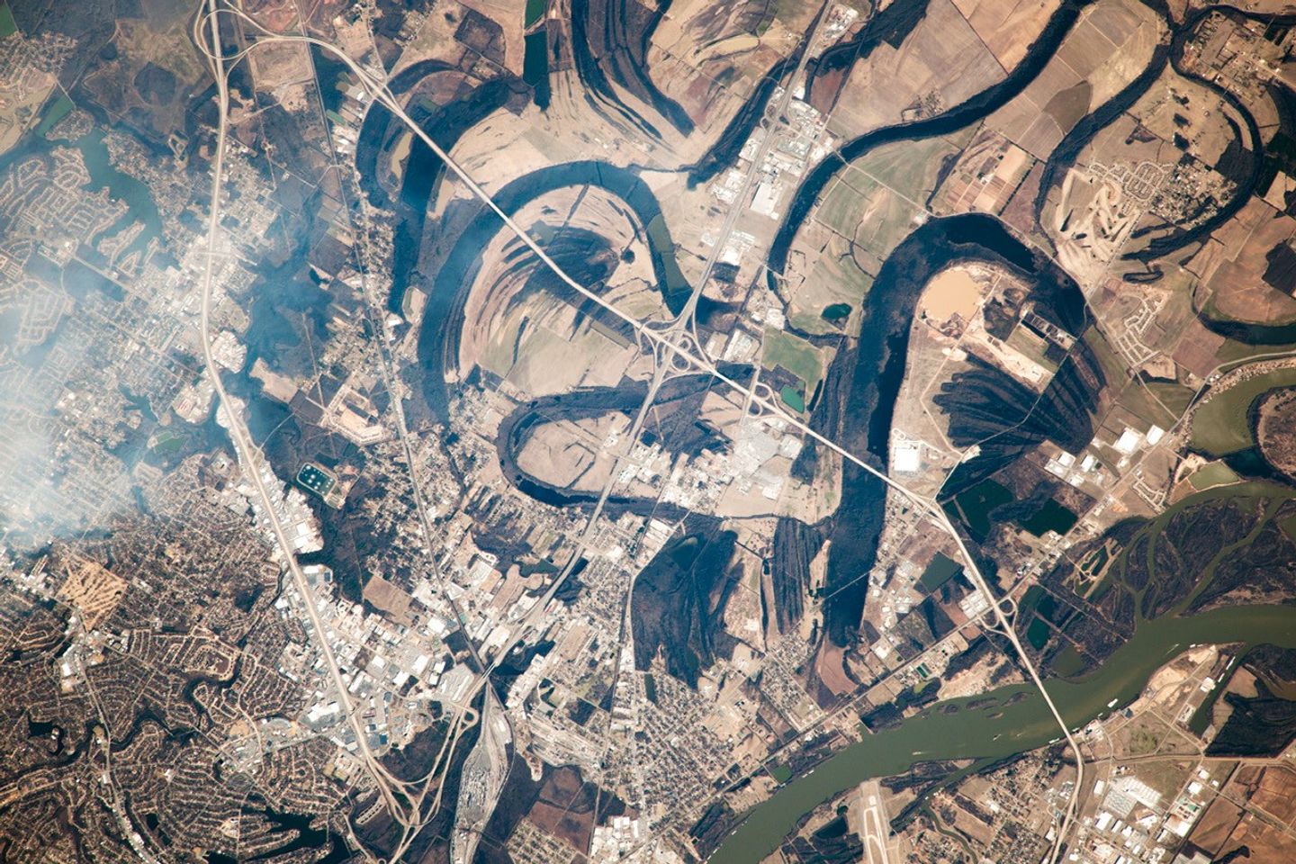


From a perch 400 kilometers (250 miles) above the surface of the Earth on the International Space Station, the arcs of dark meander lakes caught an astronaut’s eye. This photograph shows the point where the Arkansas River enters the wide flats of the Mississippi River floodplain. The river actually rises far to the west, in the Sawatch Range in the Rocky Mountains, and is the sixth longest in the United States.
Unconfined by natural valley walls, the Arkansas was once free to move across the floodplain, and most of the land surface shown in the image was part of the river at some time. The meander lakes show the positions of prior river courses at different times in the past. Meanders migrate constantly, a behavior also revealed by the successive positions of levees, which appear as fine lines and represent ancient river banks.
Today the river is controlled to prevent such movement, which can undercut bridge abutments (such as those of the highway on the lower right). Many locks along the river also allow barge traffic to operate as far inland as Tulsa, Oklahoma. (One such lock lies just off the lower right of the image.) The winding roads of North Little Rock, Arkansas, appear on the left of the image, while Highway 40 crosses the scene under a smudge of high cloud.
References & Resources
Astronaut photograph ISS038-E-57827 was acquired on February 21, 2014, with a Nikon D3X digital camera using a 1000 millimeter lens, and is provided by the ISS Crew Earth Observations Facility and the Earth Science and Remote Sensing Unit, Johnson Space Center. The image was taken by the Expedition 38 crew. It has been cropped and enhanced to improve contrast, and lens artifacts have been removed. The International Space Station Program supports the laboratory as part of the ISS National Lab to help astronauts take pictures of Earth that will be of the greatest value to scientists and the public, and to make those images freely available on the Internet. Additional images taken by astronauts and cosmonauts can be viewed at the NASA/JSC Gateway to Astronaut Photography of Earth. Caption by M. Justin Wilkinson, Jacobs at NASA-JSC.