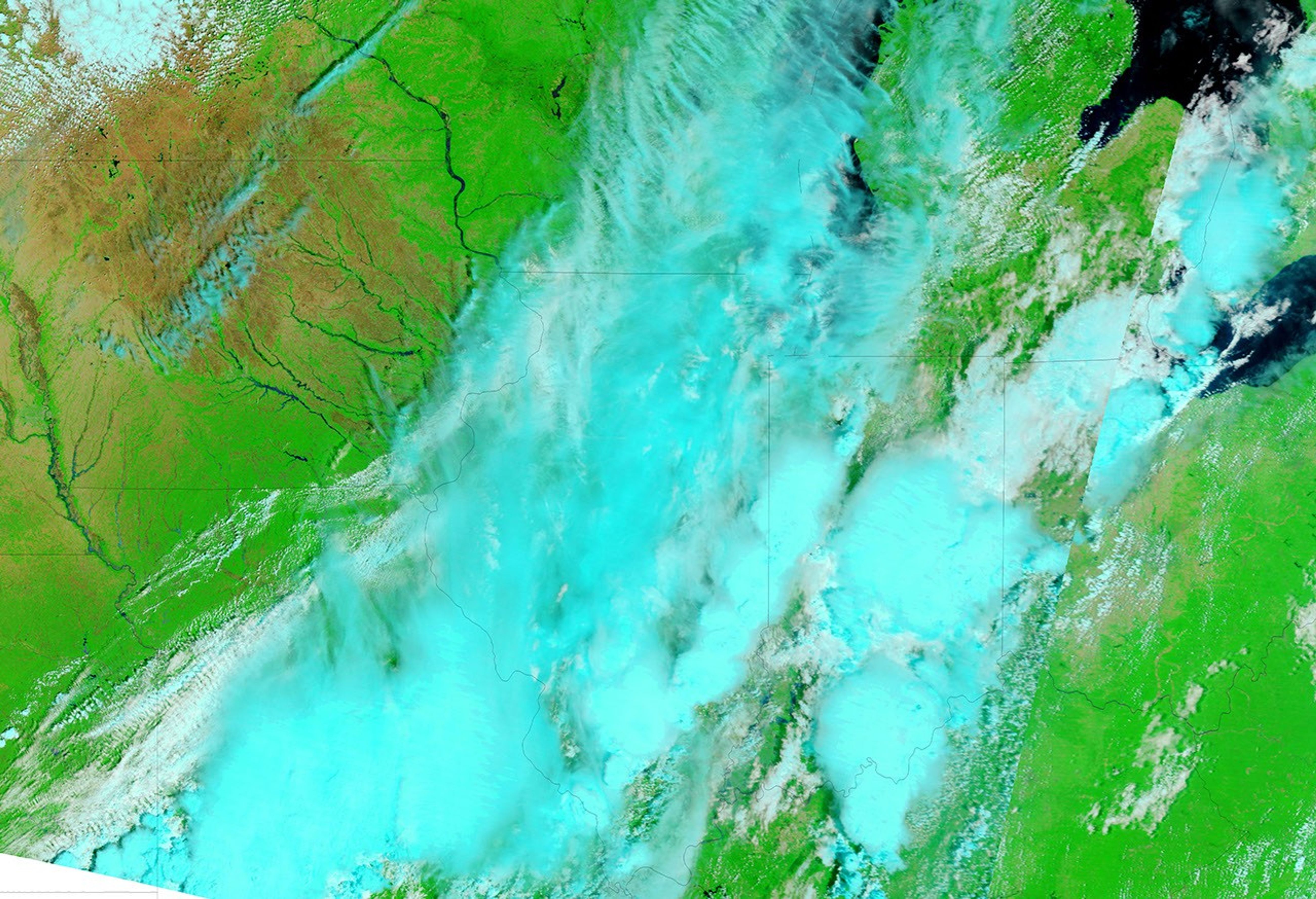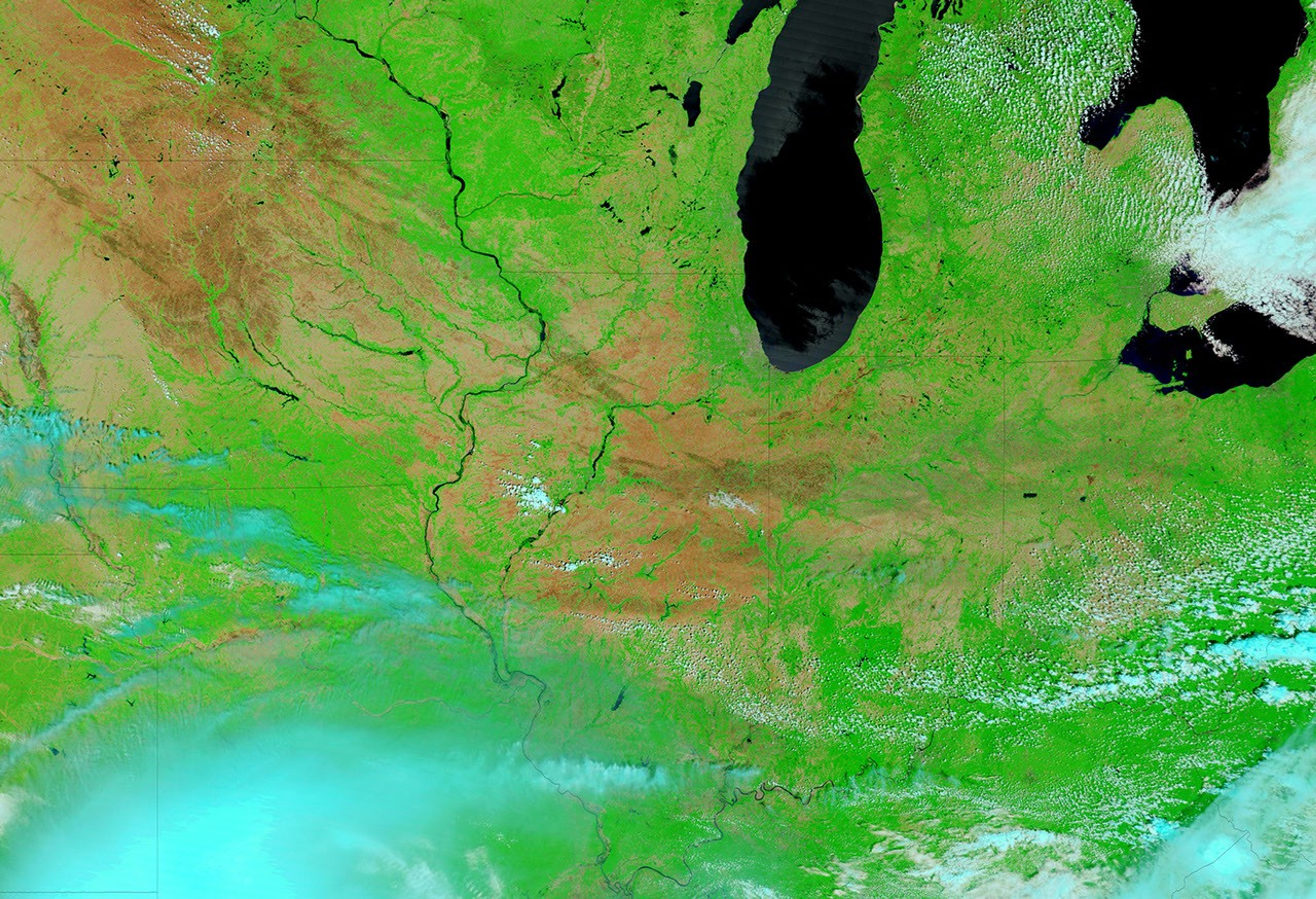

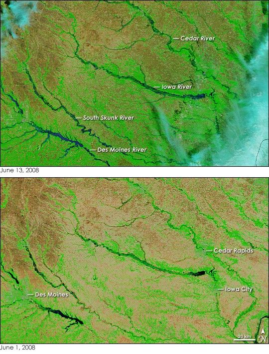
Nearly every river and creek shown in the top false-color image of eastern Iowa was flooded on June 13, 2008. Compared to June 1 (lower image), the river systems look as if they have been outlined in black or dark blue, the color of water in this type of image. Captured by the Moderate Resolution Imaging Spectroradiometer (MODIS) on NASA’s Terra satellite, the images combine light normally visible to the human eye with infrared light to increase the contrast between land and water, which is often mud-colored. Bare or lightly vegetated land is tan. Land that has been burned, most likely in agricultural fires, is red-brown, and plant-covered land is bright green. Cities, the most obvious of which is Des Moines, are gray. Clouds are pale blue and white.
Many of the rivers shown in this image were at or above record levels. The Cedar River crested at 31.12 feet on June 13, nineteen feet above flood stage and eleven feet above the previous highest historical crest, recorded on June 1, 1851, said the National Weather Service. To the south, water levels on the Iowa River near Iowa City were at a historical high of 30.41 feet and rising on June 13, and gauges on the Des Moines River in Des Moines were above or near the river’s historical crest, reached in 1993, said the National Weather Service. The floods forced thousands of evacuations in Iowa, mostly in Cedar Rapids, where more than 400 city blocks were under water, reported the Associated Press on June 13.
References & Resources
- References
- Lorentzen, A. (2008, June 13). Upper Midwest flooding forces evacuations. Associated Press. Accessed June 13, 2008.
- National Weather Service. (2008, June 13) Advanced Hydrologic Prediction Service. National Oceanic and Atmospheric Administration. Accessed June 13, 2008.
NASA images courtesy the MODIS Rapid Response Team at NASA GSFC. Caption by Holli Riebeek.