Suggested Searches

1 min read

Earth from Space

Instruments:
Collections:
Topics:
 

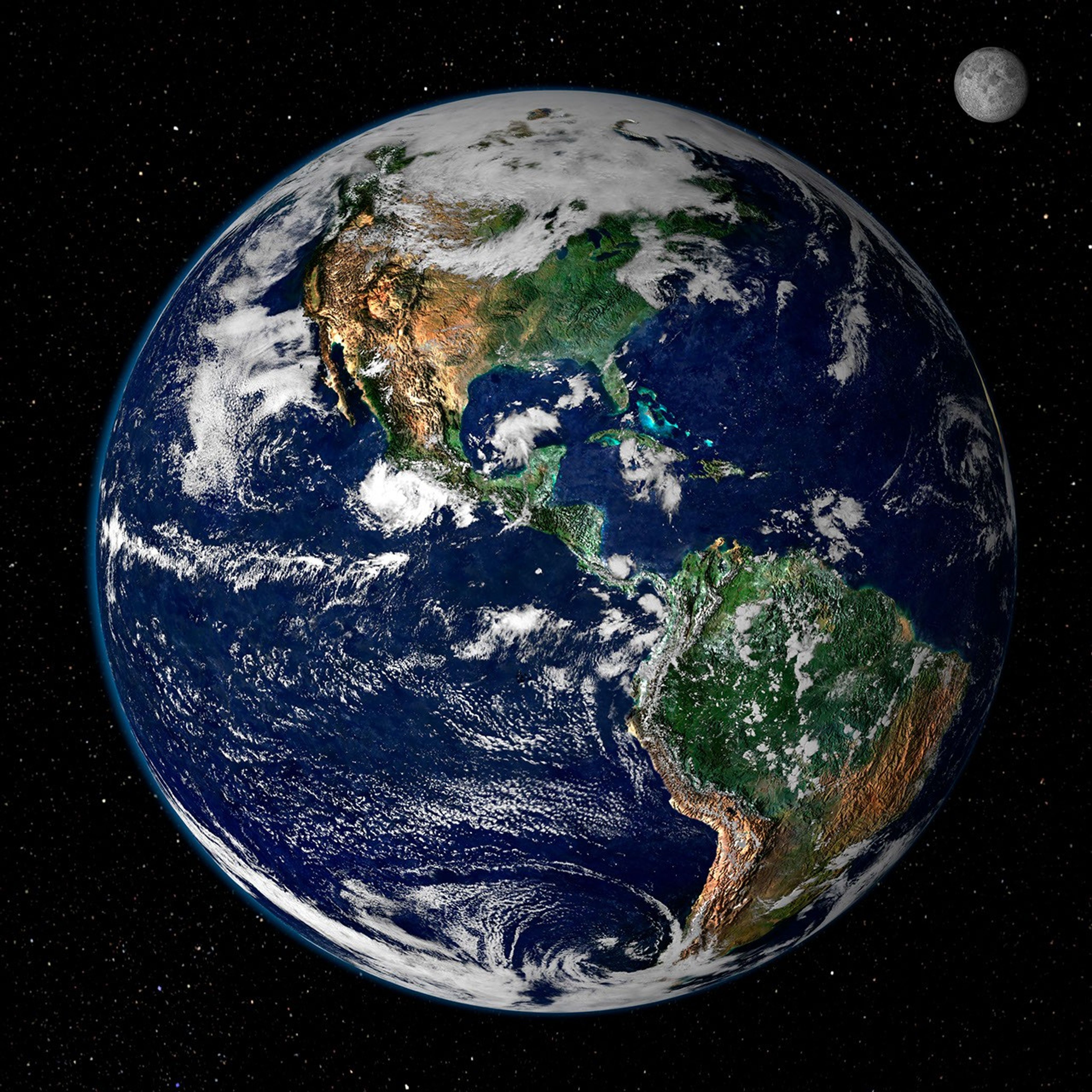
This true-color image shows North and South America as they would appearfrom space 35,000 km (22,000 miles) above the Earth. The imageis a combination of data from two satellites. The ModerateResolution Imaging Spectroradiometer (MODIS) instrument aboardNASA’s Terrasatellite collected the land surface data over 16 days, while NOAA’sGeostationary Operational Environmental Satellite (GOES) produced a snapshotof the Earth’s clouds.

References & Resources

Image created by Reto Stöckli, Nazmi El Saleous, and Marit Jentoft-Nilsen, NASA GSFC

You may also be interested in:

Stay up-to-date with the latest content from NASA as we explore the universe and discover more about our home planet.

Advanced U.S.-India Radar Mission Lifts Off
3 min read

The NISAR satellite will detect the movement of land and ice surfaces with centimeter precision, aiding in a range of…

Article
A Northwest Night Awash in Light
3 min read

The glow of city lights, the aurora, and a rising Moon illuminate the night along the northwest coast of North…

Article
Five Minutes in Orbit
3 min read

An astronaut captured a moonrise—and much more—in a series of photos taken from the International Space Station.

Article