

August 21, 2016
Flooding on the Ganges River
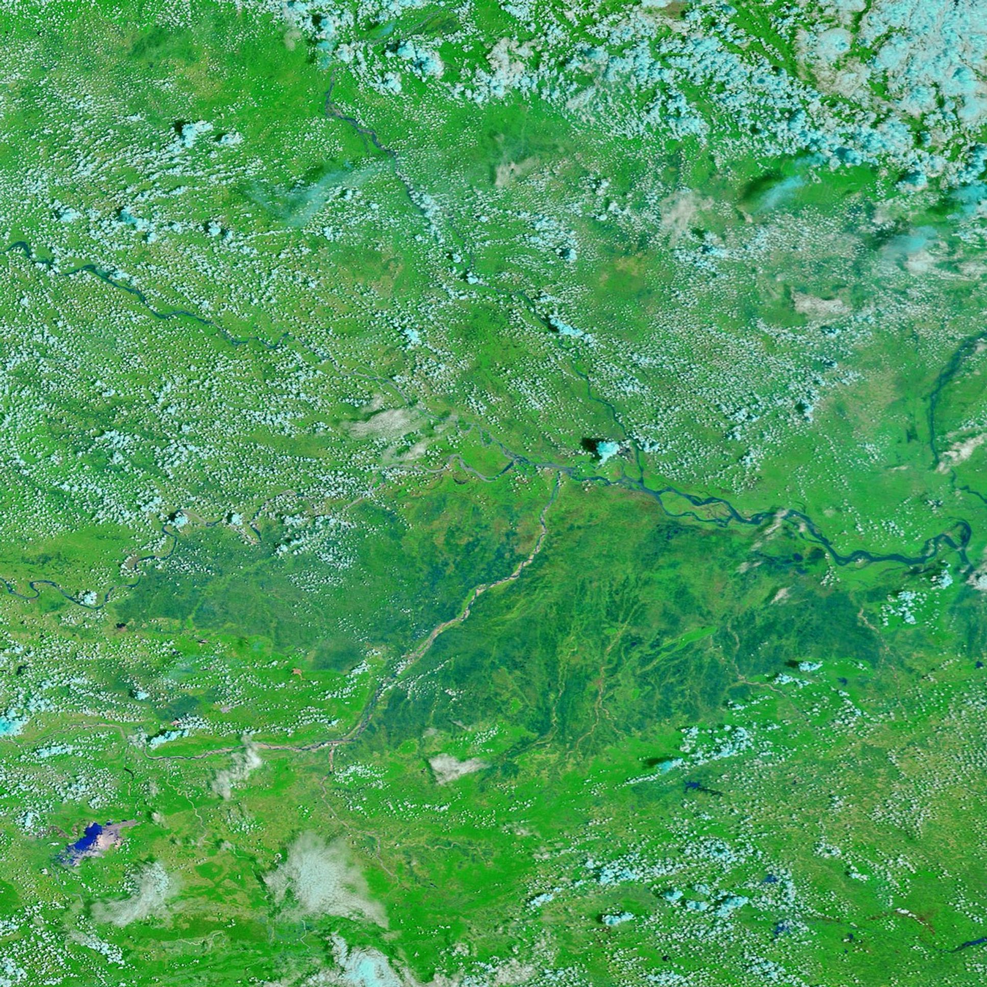
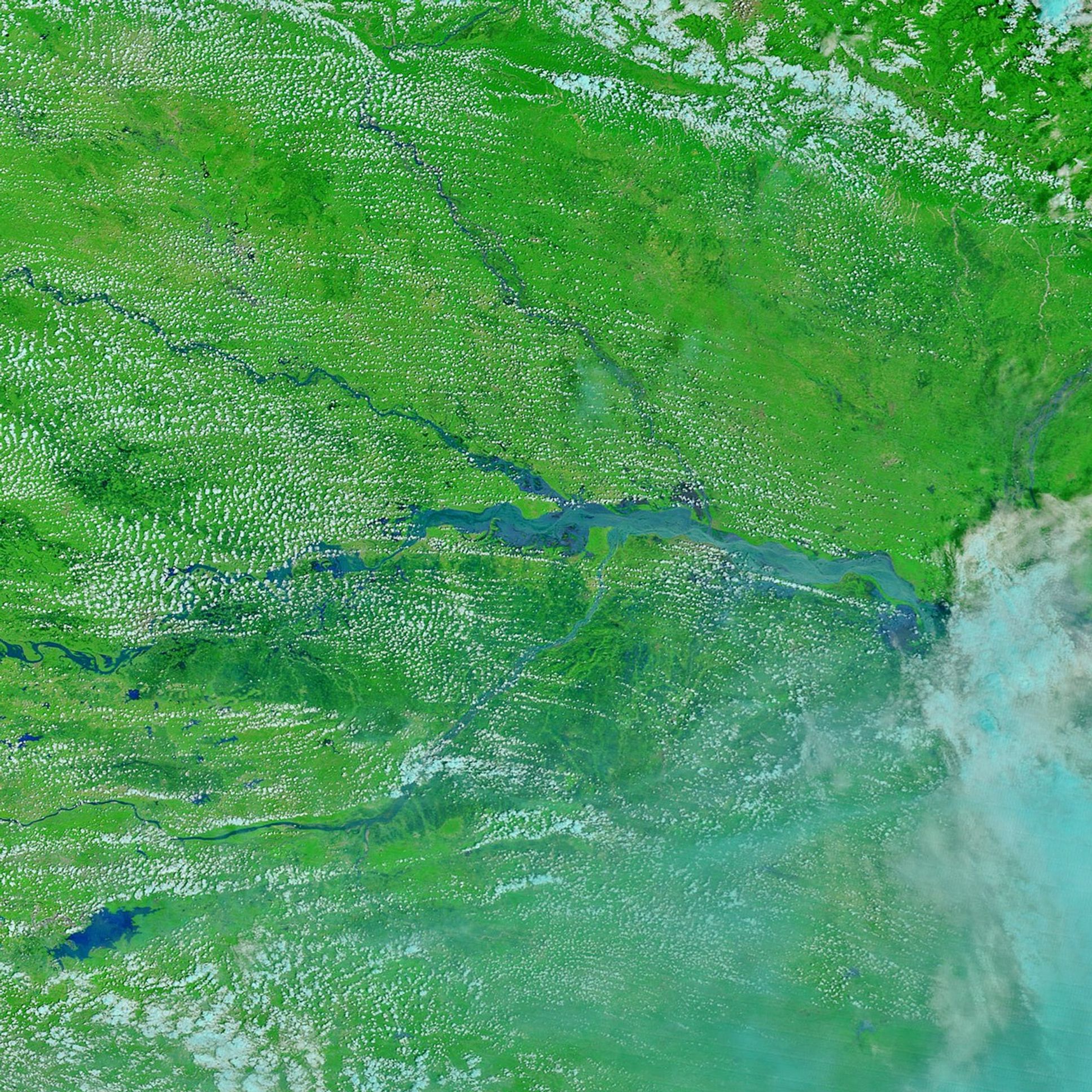
In August 2016, heavy monsoon rains pushed the Ganges and other rivers in eastern and central India above their banks.
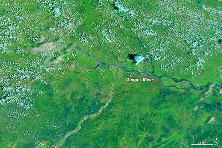
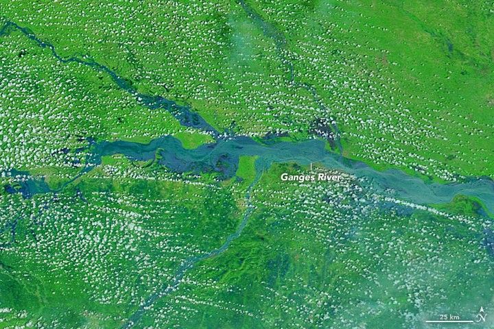
The Moderate Resolution Imaging Spectroradiometer (MODIS) on NASA’s Terra satellite captured these false-color images of a stretch of the Ganges River near Patna on August 10, 2015 (top), and August 21, 2016 (bottom). These images use a combination of infrared and visible light to increase contrast between water and land. Water is blue. Vegetation is green. Notice that the water is a slightly lighter shade of blue in the lower image due to all the suspended sediment in the water.
At least 300 people have died in eastern and central India and more than six million others have been affected by the flooding, according to news reports.
References & Resources
- Floodlist (2016, August 22) Floods in 5 States Leave At Least 35 Dead and Thousands Displaced. Accessed August 23, 2016.
- The Weather Channel (2016, August 22) Dozens Dead, 600,000 Evacuated as Monsoon Rains Flood India. Accessed August 23, 2016.
- Reuters (2016, August 23) Over 300 dead in India as floods force villagers into relief camps. Accessed August 23, 2016.
NASA Earth Observatory images by Joshua Stevens, using Terra MODIS data from the Land Atmosphere Near real-time Capability for EOS (LANCE). Caption by Adam Voiland.