


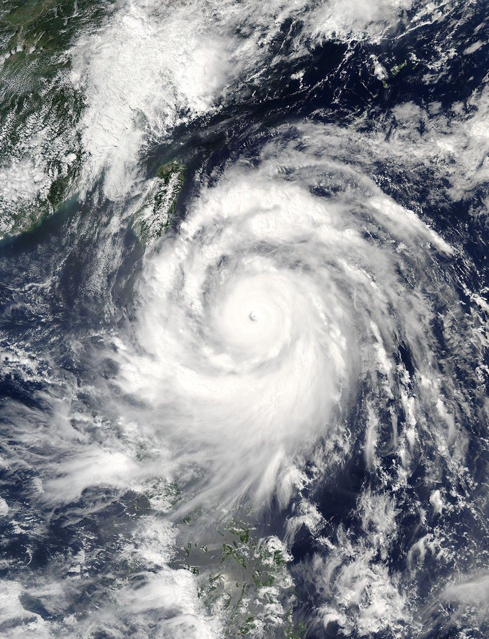
Super Typhoon Meranti neared Taiwan on September 13, 2016. The Moderate Resolution Imaging Spectroradiometer (MODIS) on NASA’s Aqua satellite acquired this natural-color image the same day. At the time, Meranti was a category 5 storm with wind speeds of roughly 160 knots (184mph).
Forecasters expect the storm to skirt the southern tip of Taiwan in the morning hours of September 14. The U.S. Navy’s Joint Typhoon Warning Center (JTWC) predicts maximum open-ocean waves of 48 feet and sustained winds of 150 knots (173 miles per hour), with gusts up to 180 knots (207 mph) as Mernati passes Taiwan. While the eye of the storm won’t hit Taiwan directly, the island will take the brunt of the right side of the storm.
Meranti is expected to lose some momentum by the time it makes landfall in China’s Guangdong province on September 15, with predicted winds of 80 knots (92 mph) and gusts up to 100 knots (115 mph).
The Taiwanese government announced that schools and offices in several municipalities in the south would be closed on Wednesday, according to The Weather Channel. The storm has already caused flight and train delays in the region.
References & Resources
NASA image by Jeff Schmaltz, LANCE/EOSDIS Rapid Response. Caption by Pola Lem.


