


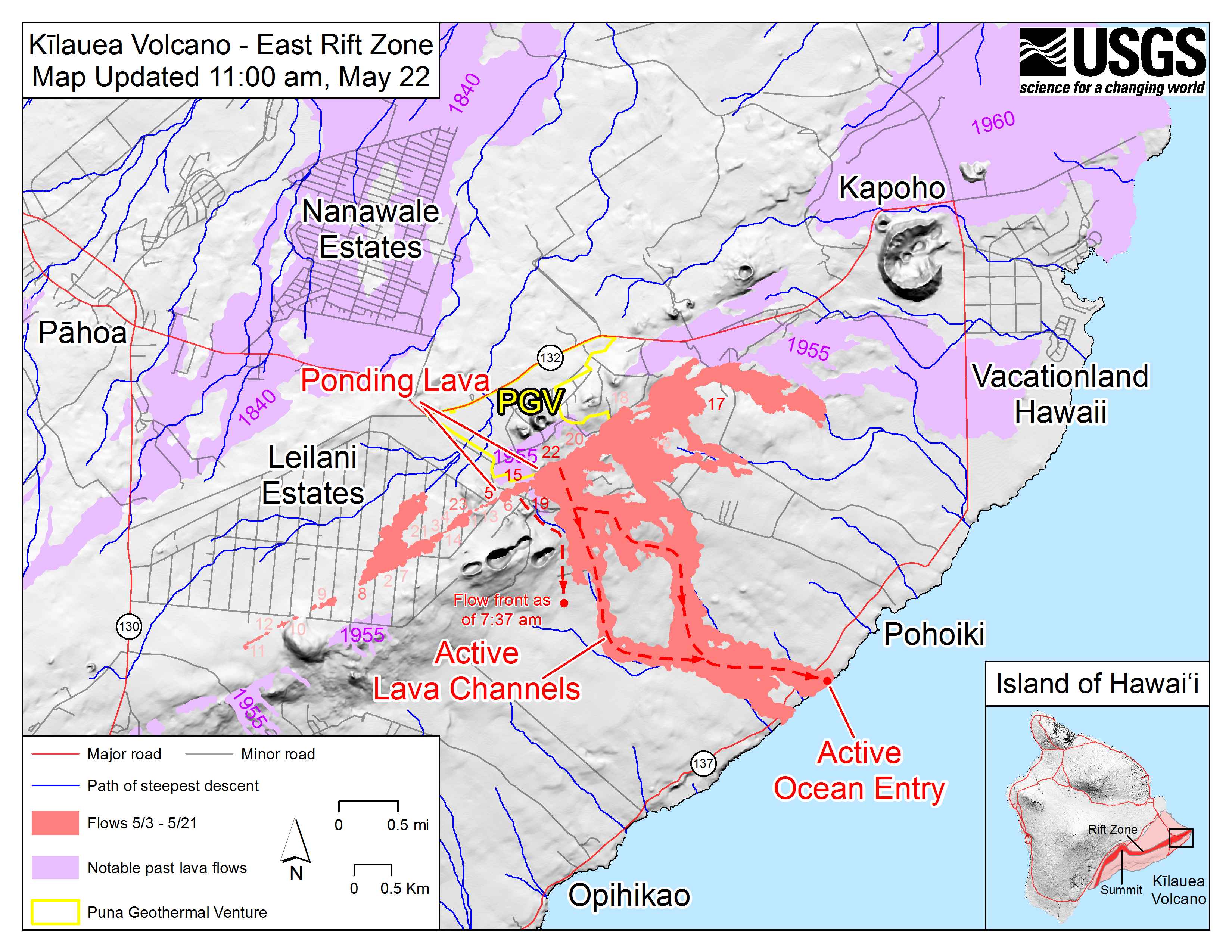
Though Kilauea has been erupting continuously from the Pu’u O’o vent since 1983, the eruption took a dangerous turn on May 3, 2018, when new fissures opened in the residential neighborhood of Leilani Estates. Three weeks later, some fissures have become less active but several others have emerged along the Lower East Rift Zone, including a few just northeast of Leilani Estates.
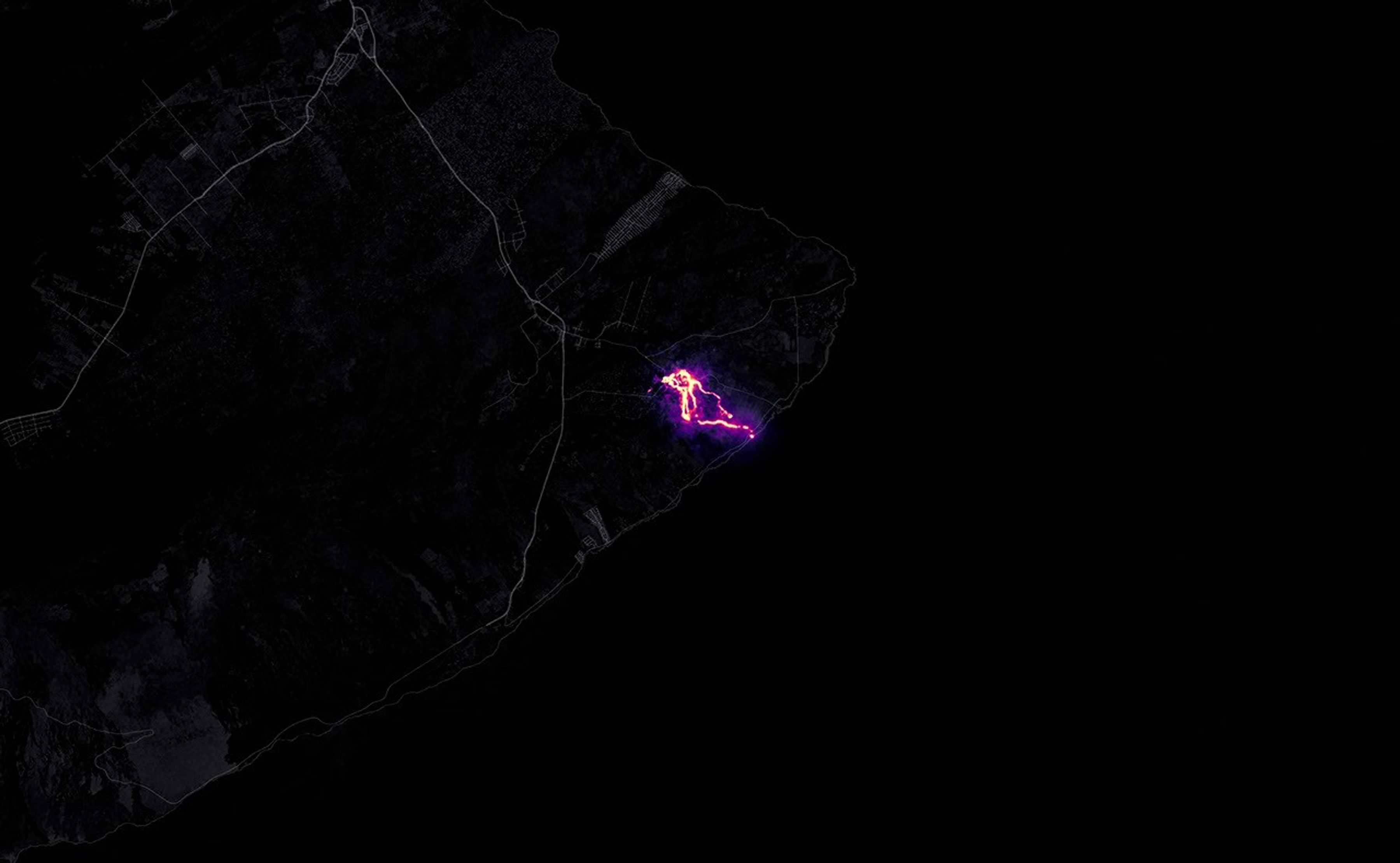
As of May 25, 2018, geologists with the U.S. Geological Survey were tracking 23 fissures. One of the most active is fissure 22, which has shed enough lava to create a channel that extends all the way to Hawaii’s southeastern coast. That lava is entering the ocean near MacKenzie State Park. Though it is routine for lava from Kilauea to reach the ocean, this is a new entry point.
The Operational Land Imager (OLI) on Landsat 8 acquired the data for this false-color view of the lava flow as it appeared on the night of May 23, 2018. The image is based on OLI’s observations of shortwave infrared and green light (bands 6-5-3). It was cloudy when the data was acquired, but a small break in the clouds made it possible to image the lava flows. The purple areas surrounding the flows are clouds lit from below. The animation also makes use of a daytime-image from OLI, with information about the location of roads and coastlines.
Geologists with the Hawaiian Volcano Observatoryare monitoring the fissure eruptions closely. While seismometers and other ground-based instruments can track the underground movement of magma to some degree, it is not possible to predict with a high degree of accuracy how long a particular fissure will remain active or how much lava it will produce.
In the coming weeks, magma may continue to emerge from new fissures or slip back and forth between existing fissures. “Or the eruption could concentrate on some central vent,” explained Patrick Whelley, a planetary geologist working at NASA Goddard Space Flight Center. “It’s uncertain if this is a new phase for Kilauea or if this is just a short-lived escalation, and the activity will go back to Pu’u O’o in a month or so.”
The U.S. Geological Survey and Hawaii County Civil Defense are the best sources of information about the most recent activity at Kilauea.
References & Resources
- Global Volcanism Program (2018) Kilauea. Accessed May 24, 2018.
- In the Company of Volcanoes (2018, February 21) Communicating volcanoes: resources for media. Accessed May 24, 2018.
- Hawaii County Civil Defense (2018) Kilauea Eruption Information Resources. Accessed May 24, 2018.
- NASA Earth Science Disasters Program (2018) Kilauea, Hawaii Eruption 2018. Accessed May 24, 2018.
- United States Geological Survey Kilauea. Accessed May 24, 2018.
NASA Earth Observatory image by Joshua Stevens, using Landsat data from the U.S. Geological Survey . Story by Adam Voiland.


