January 9, 2017
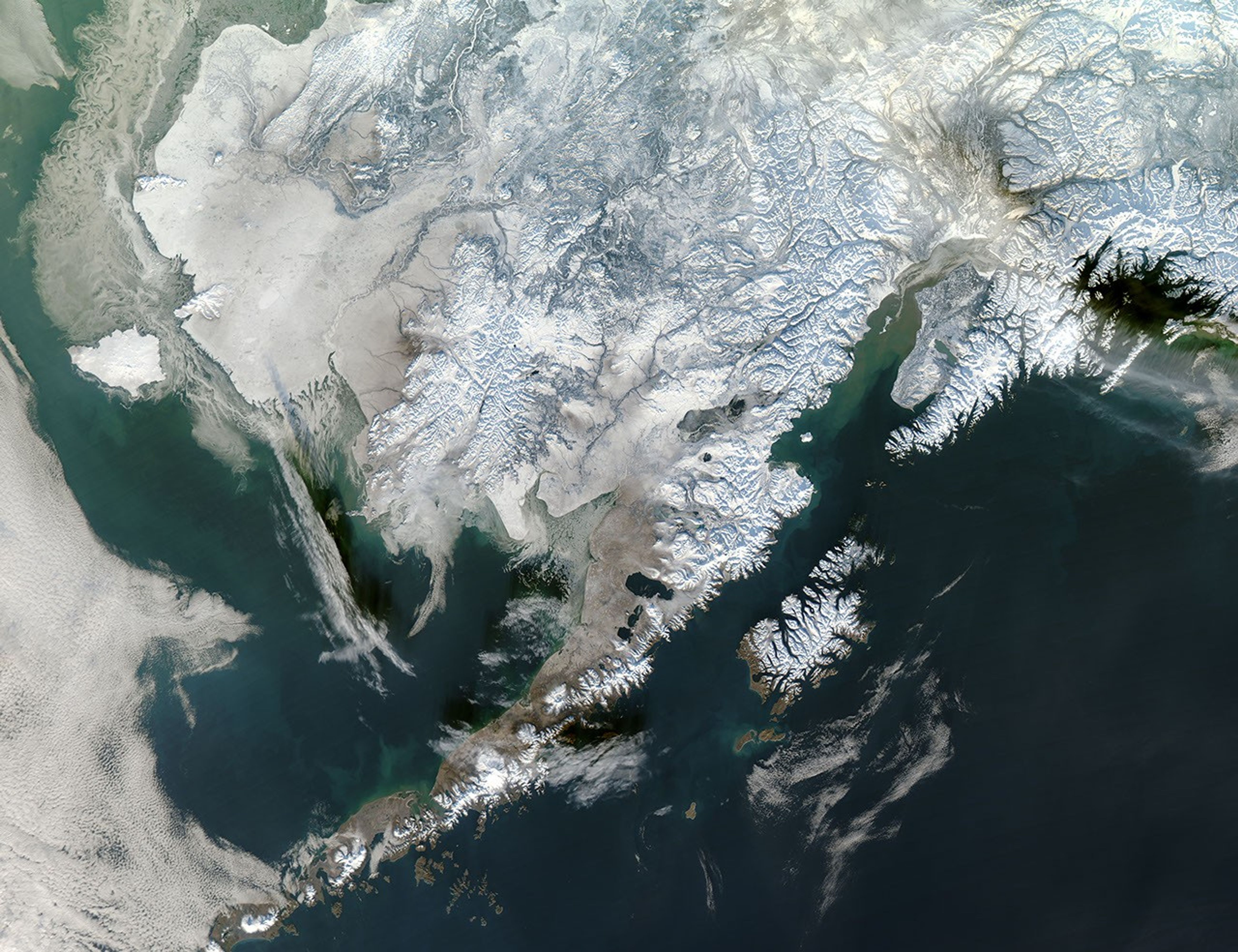
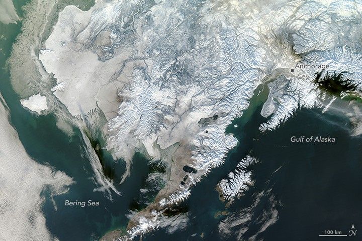
In early January 2017, snow blanketed much of the United States. The northernmost U.S. state was no exception. On January 9, 2017, the Moderate Resolution Imaging Spectroradiometer (MODIS) on NASA’s Aqua satellite captured this image of the winter snowscape in southwestern Alaska.
Ground-based stations in the mountainous area southeast of Anchorage recorded snow depths that day up to almost 20 inches (50 centimeters). Some areas across the state saw just a few inches while others, like the Weary Lake site, reported much more snow. Browse the snow depth map for details about a specific site.
References & Resources
- National Weather Service (2017, January) Alaska Region HQ. Accessed January 10, 2017.
- USDA Natural Resources Conservation Service (2017, January 9) Snow Telemetry (SNOTEL) and Snow Course Data and Products. Accessed January 10, 2017.
NASA image by Jeff Schmaltz, LANCE/EOSDIS Rapid Response . Caption by Kathryn Hansen.