


![Request for Information – Potential [Placeholder for Prize]](https://assets.science.nasa.gov/dynamicimage/assets/science/psd/solar/2023/09/s/solarsystem_0.jpg?w=1024)


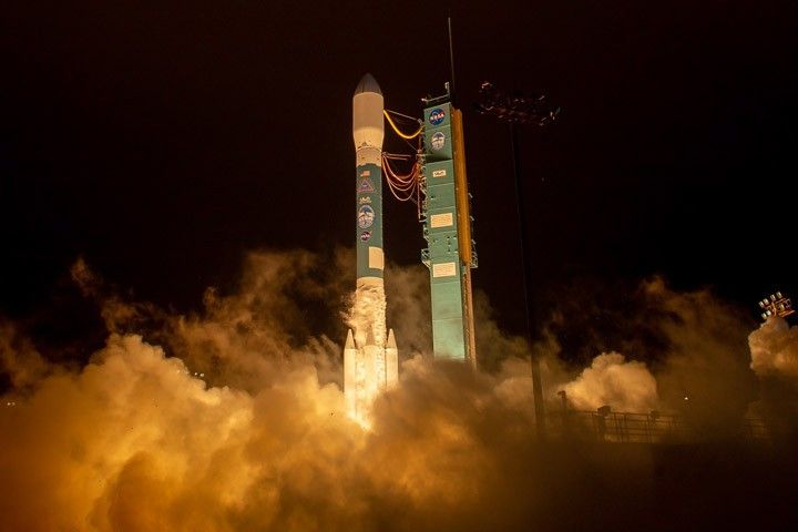
NASA’s Ice, Cloud and land Elevation Satellite-2 (ICESat-2) successfully launched from California, embarking on its mission to measure the ice of Earth’s frozen reaches with unprecedented accuracy. This photograph was taken during launch, which occurred just after 6 a.m. Pacific Daylight Time on September 15, 2018.
ICESat-2 lifted off from Space Launch Complex-2 at Vandenberg Air Force Base on United Launch Alliance’s final Delta II rocket. Ground stations in Svalbard, Norway, acquired signals from the spacecraft about 75 minutes after launch. It is performing as expected and orbiting the globe, from pole to pole, at 17,069 miles per hour from an average altitude of 290 miles.
“With this mission we continue humankind’s exploration of the remote polar regions of our planet and advance our understanding of how ongoing changes of Earth’s ice cover at the poles and elsewhere will affect lives around the world, now and in the future,” said Thomas Zurbuchen, associate administrator of NASA’s Science Mission Directorate.
ICESat-2 carries a single instrument, the Advanced Topographic Laser Altimeter System (ATLAS). ATLAS will be activated approximately two weeks after the mission operations team completes initial testing of the spacecraft. Then ICESat-2 will begin work on its science objective, gathering enough data to estimate the annual height change of the Greenland and Antarctic ice sheets to within four millimeters—the width of a pencil.
“While the launch today was incredibly exciting, for us scientists the most anticipated part of the mission starts when we switch on the laser and get our first data,” said Thorsten Markus, ICESat-2 project scientist at NASA’s Goddard Space Flight Center. “We are really looking forward to making those data available to the science community as quickly as possible so we can begin to explore what ICESat-2 can tell us about our complex home planet.”
The high-resolution data will document changes in the Earth’s polar ice caps, improve forecasts of sea level rise bolstered by ice sheet melt in Greenland and Antarctica, and help scientists understand the mechanisms that are decreasing floating ice and assess how that sea ice loss affects the ocean and atmosphere.
Read the full story here.
References & Resources
- Flickr (2018, September 15) NASA HQ Photo. Accessed September 15, 2018.
- NASA Release (2018, September 15) NASA, ULA Launch Mission to Track Earth's Changing Ice. Accessed September 15, 2018.
Photo by Bill Ingalls/NASA. Story adapted from NASA news releases.


