![Request for Information – Potential [Placeholder for Prize]](https://assets.science.nasa.gov/dynamicimage/assets/science/psd/solar/2023/09/s/solarsystem_0.jpg?w=1024)


As of early August, the Oklahoma panhandle was experiencing its driest year (previous 365 days) since 1921, according to records kept by the Oklahoma Climatological Survey. Through July, year-to-date precipitation in Boise City, in the heart of Cimarron County, was only about 4.8 inches, barely half of average and drier than some years in the 1930s, the height of the Dust Bowl.
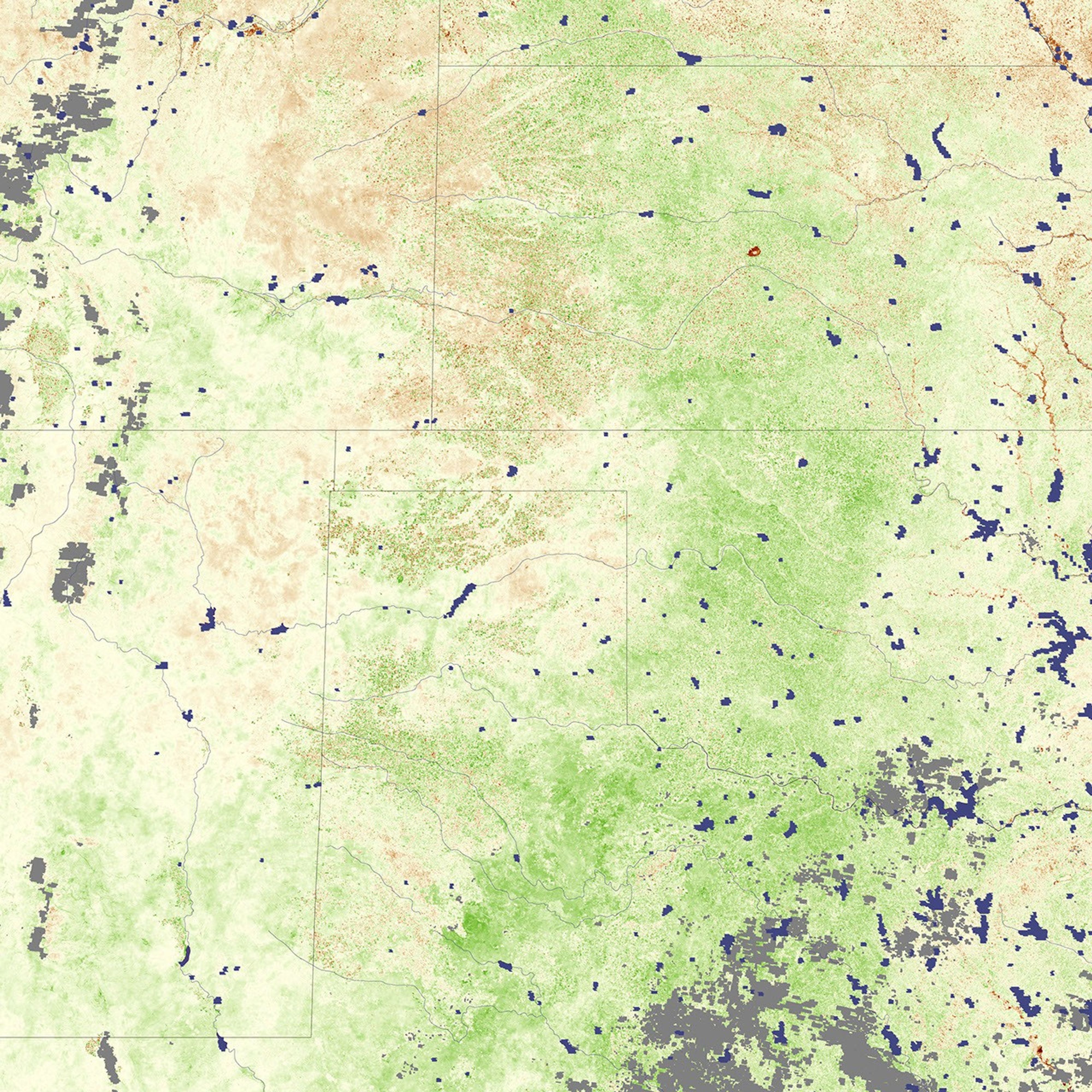
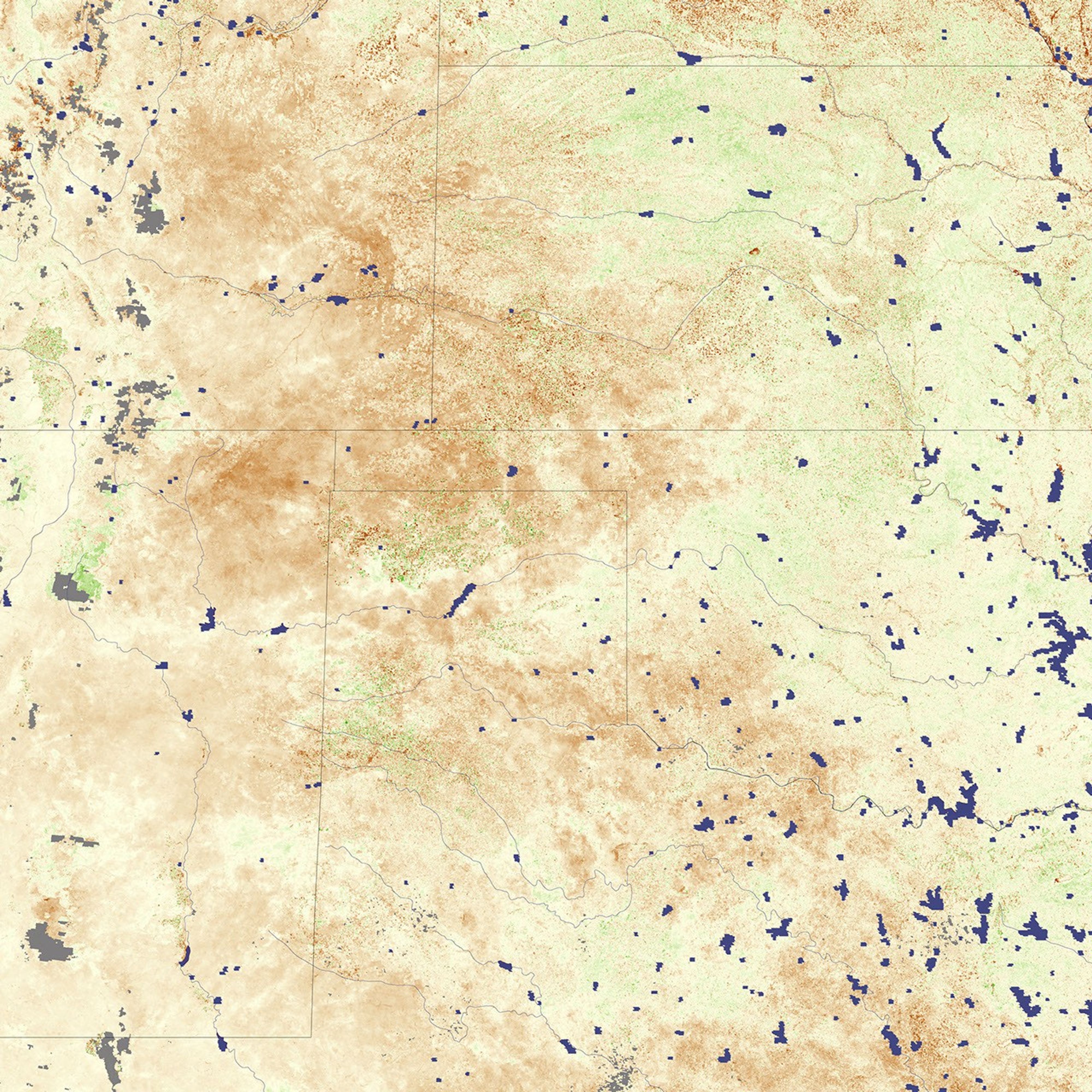
The toll of the drought on crops and pasture is evident in satellite-based vegetation images spanning the past year. On NASA’s Terra satellite, the Moderate Resolution Imaging Spectroradiometer (MODIS) collects observations of visible and infrared light that scientists use to create a scale, or index, of vegetation conditions. These maps show how vegetation conditions compared to average during 16-day periods in July 2007 and June/July 2008. Green indicates more vegetation than the 2000-2006 average, brown is less vegetation than normal, and beige indicates that vegetation conditions were average.
In late July 2007 (top image), conditions in the Panhandle appeared near or only a little below normal compared to average. By mid-autumn, however, during the beginning of the growing season for the winter wheat crop, conditions started to deteriorate. By July 2008 (bottom image), vegetation was below average across most of the region. Grazing land, such as areas in the northwest corner of the Panhandle, declined more than many fields, some of which benefit from irrigation.
For additional vegetation images showing the development of the drought over the course of the past year, as well as details and photos of the impacts of this exceptional dry spell, read the Earth Observatory Feature story Devastating Drought Settles on the High Plains.
References & Resources
NASA images by Jesse Allen and Robert Simmon, based on MODIS data from the Global Agricultural Monitoring Project. Caption by Rebecca Lindsey.