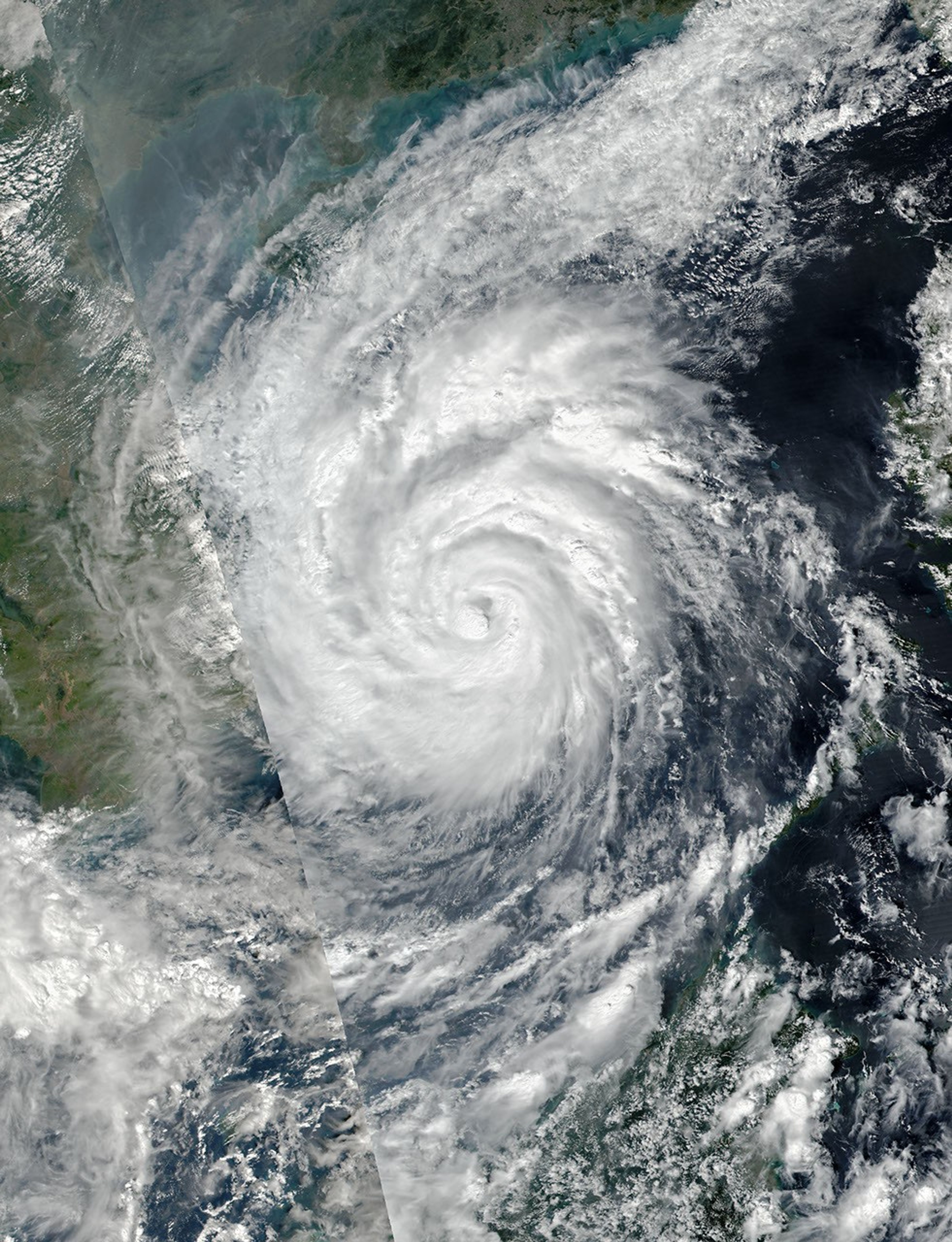

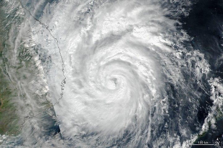
Vietnam is bracing for the strongest typhoon to make landfall in the nation in at least sixteen years. Typhoon Damrey was expected to move ashore in central and southern Vietnam early on November 4, 2017.
The Visible Infrared Imaging Radiometer Suite (VIIRS) on the Suomi NPP satellite acquired this natural-color image of Damrey in the early afternoon of November 3, 2017. (Note that the line across the far left side of the image is a swath edge; pixels to the left of that line were acquired on the next north-south satellite pass, about 100 minutes after those acquired the right.)
Around the time that the image was acquired, Damrey’s maximum sustained winds were estimated to be 75 knots (90 miles or 140 kilometers per hour), according to the U.S. Joint Typhoon Warning Center (JTWC). Forecasters predicted that Damrey’s winds would strengthen slightly to category 2 storm strength, then weaken from interaction with land. They also warned of heavy rain (150 to 300 millimeters, or 6 to 12 inches in many areas) and the potential for flooding and mudslides.
This is the second Typhoon Damrey to hit Vietnam. A storm with the same name struck the nation in September 2005.
References & Resources
- AccuWeather (2017) Damrey: Strongest typhoon in 16 to strike southern Vietnam with flooding, damaging winds. Accessed November 3, 2017.
- NASA (2017) Hurricanes and Tropical Storms. Accessed November 3, 2017.
- Vietnam.net/VNS (2017, November 3) Storm Damrey strengthens to level 15. Accessed November 3, 2017.
- Vietnam.net/DTINews (2017, November 3) Flights cancelled ahead of Storm Damrey. Accessed November 3, 2017.
NASA image by Jeff Schmaltz, LANCE/EOSDIS Rapid Response. Story by Mike Carlowicz.