August 22, 2015
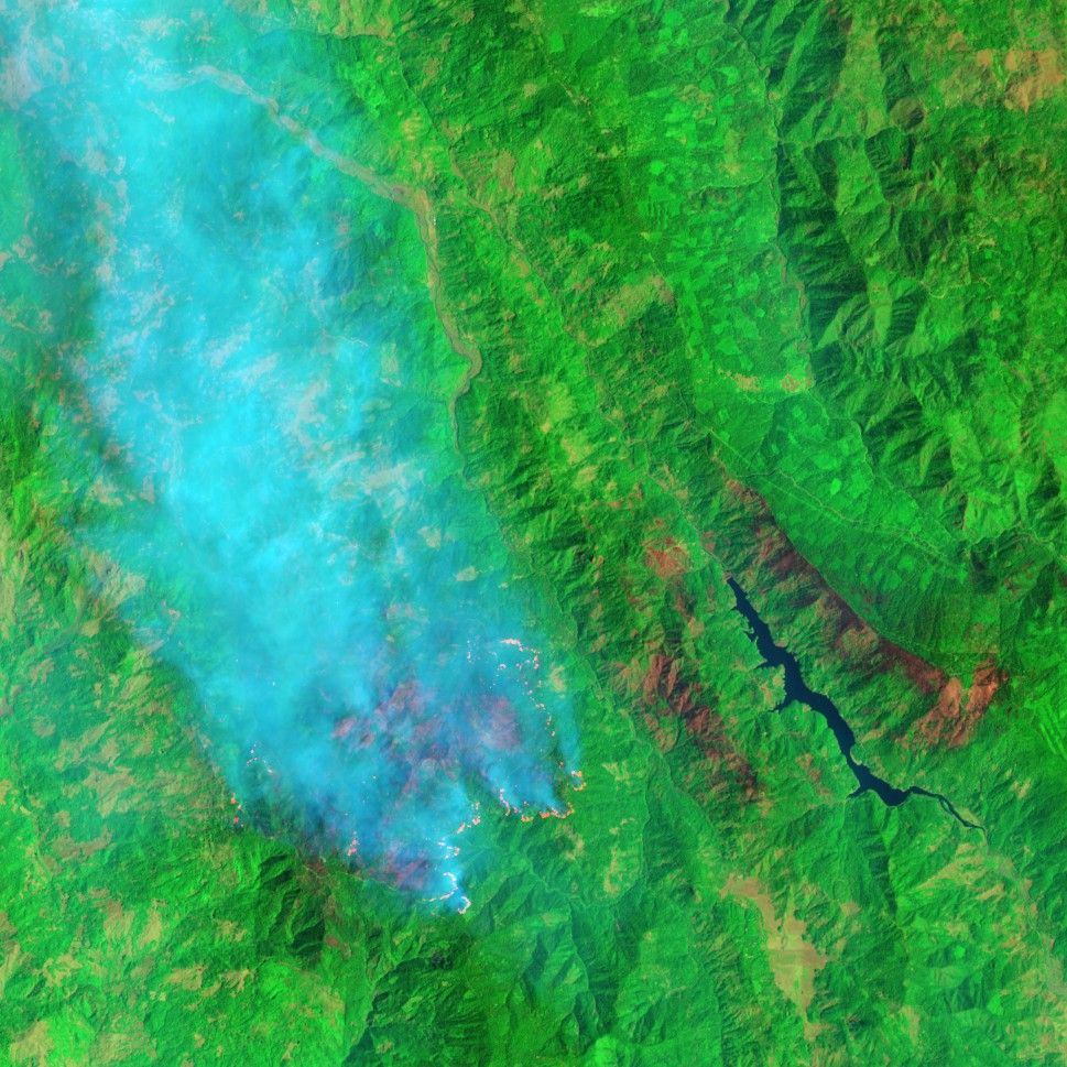
In late July 2015, lightning ignited the Mad River Complex fires in northwest California’s Six Rivers National Forest. The Advanced Land Imager (ALI) on the Earth Observing-1 (EO-1) satellite captured this false-color image of the area almost one month later on August 22, 2015. Hot areas of active fires glow bright orange-red; relatively cooler areas of recently burned land are dark red.
When this image was acquired, InciWeb reported that the burned area spanned about 51 square miles (132 square kilometers), and the fire was 65 percent contained. Full containment was expected by early September.
References & Resources
- Inciweb (2015, August 22) Mad River Complex. Accessed August 26, 2015.
- Inciweb (2015, August 26) Mad River Complex. Accessed August 26, 2015.
NASA Earth Observatory image by Jesse Allen, using EO-1 ALI data provided courtesy of the NASA EO-1 team. Caption by Kathryn Hansen.