


September 1, 2015
Alaska Charred
Wildfires have consumed more than 5.2 million acres (2.1 million hectares) in Alaska this year—an area nearly the size of New Jersey. That makes 2015 the second most severe wildfire season Alaska has experienced since 1950. The worst year on record—2004—saw 6.5 million acres burn, according to statistics cited by the state’s Department of Natural Resources Division of Forestry and the University of Alaska Fairbanks. During an average year, about 800,000 acres burn.
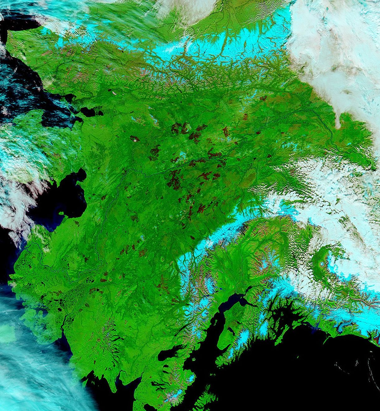
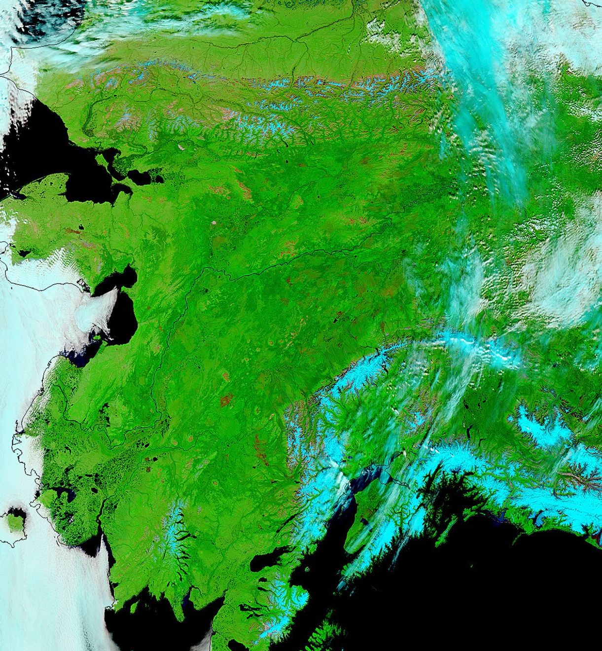
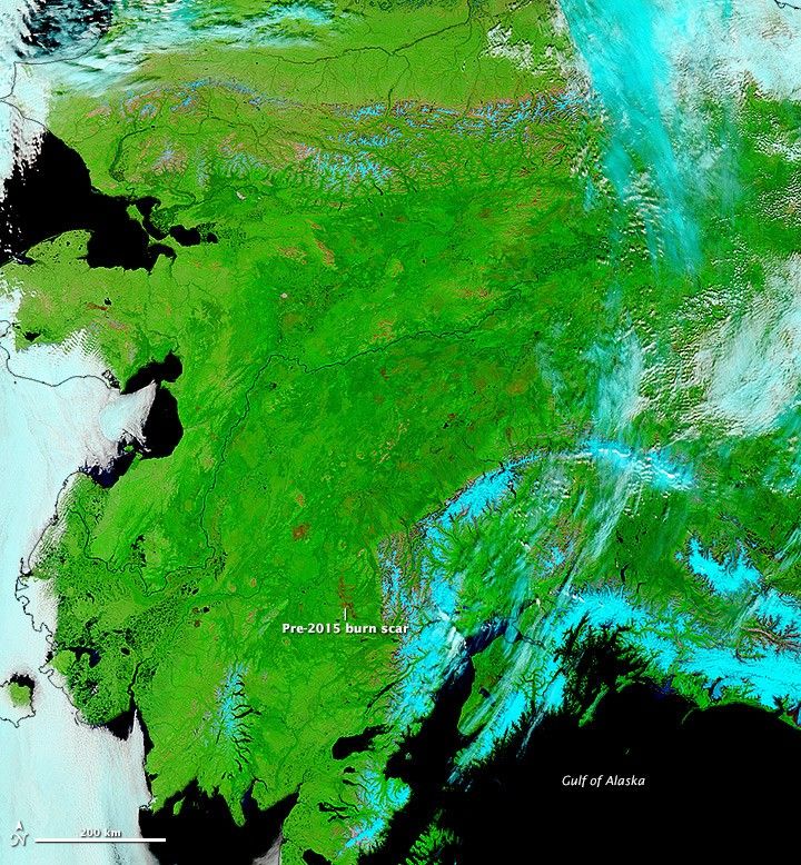
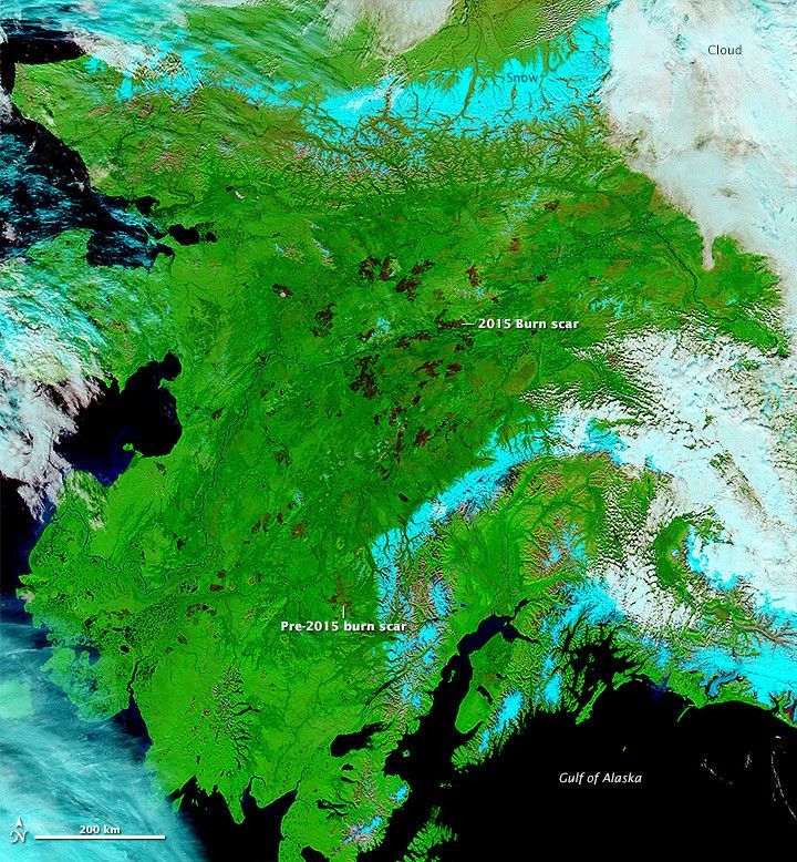
The Moderate Resolution Imaging Spectroradiometer (MODIS) on NASA’s Terra and Aqua satellites captured these false-color images of Alaska’s forests on June 14, 2015, before fire season intensified, and September 1, 2015, after major fires had been controlled. The images include a combination of infrared and visible light to increase the contrast between burned land and vegetated or bare land. Note that most all of the readily visible burn scars were created this summer, though a few were already present at the outset.
Most of the large fires occurred in the boreal forests of Alaska’s interior as well as in the southwestern part of the state. With few people and limited infrastructure at risk, authorities allowed many fires to burn unchecked. Through a combination of unusually warm temperatures, dry conditions, and severely reduced snowpack, many of the fires became quite large. An early start to the lightning season exacerbated the size of several of the fires by giving them a few weeks longer than usual to burn. Of the 768 fires tracked by authorities, 348 were triggered by human activity and 417 were triggered by lightning. However, the vast majority of the acres burned—more than 99 percent—was caused by lightning-triggered fires.
Satellites are particularly useful for monitoring and assessing the environmental impact of forest fires in remote forests. For instance, a team of scientists from the University of California, Irvine, and Woods Hole Research Center recently published an analysis of carbon emissions for boreal fires in Alaska that was based on burned area maps from MODIS (similar to the images above). The researchers concluded that mean emissions for 2001 to 2012 was 15 teragrams of carbon per year.
“We don’t have all the data in yet that we would need to make a proper estimate for 2015, but a quick back-of-the-envelope calculation is that we are probably looking at emissions somewhere between 37 and 55 teragrams. That would be a bit less than the largest fire year—2004—and about the same as 2005, another large fire year,” said Sander Veraverbeke, an Earth scientist at the University of California, Irvine.
References & Resources
- Alaska Interagency Coordination Center (2015, September 3) Alaska Interagency Coordination Center Situation Report. Accessed September 3, 2015.
- Alaska Department of Natural Resources (2006, March) Fire Statistics. Accessed September 3, 2015.
- University of Alaska (2006, March) Wildland fire in Alaska: A History of Organized Fire Suppression and Management in the Last Frontier. Accessed September 3, 2015.
- Veraverbeke, S. et al, (2015, June 10) Daily burned area and carbon emissions from boreal fires in Alaska. Biogeosciences, 12, 3759-3601.
- Sedano, F. & Randerson, J. (2014, July 18) Multi-scale influence of vapor pressure deficit on fire ignition and spread in boreal forest ecosystems. Biogeosciences, 11, 3739-3755.
NASA image by Jeff Schmaltz, LANCE/EOSDIS Rapid Response. Caption by Adam Voiland.