![Request for Information – Potential [Placeholder for Prize]](https://assets.science.nasa.gov/dynamicimage/assets/science/psd/solar/2023/09/s/solarsystem_0.jpg?w=1024)


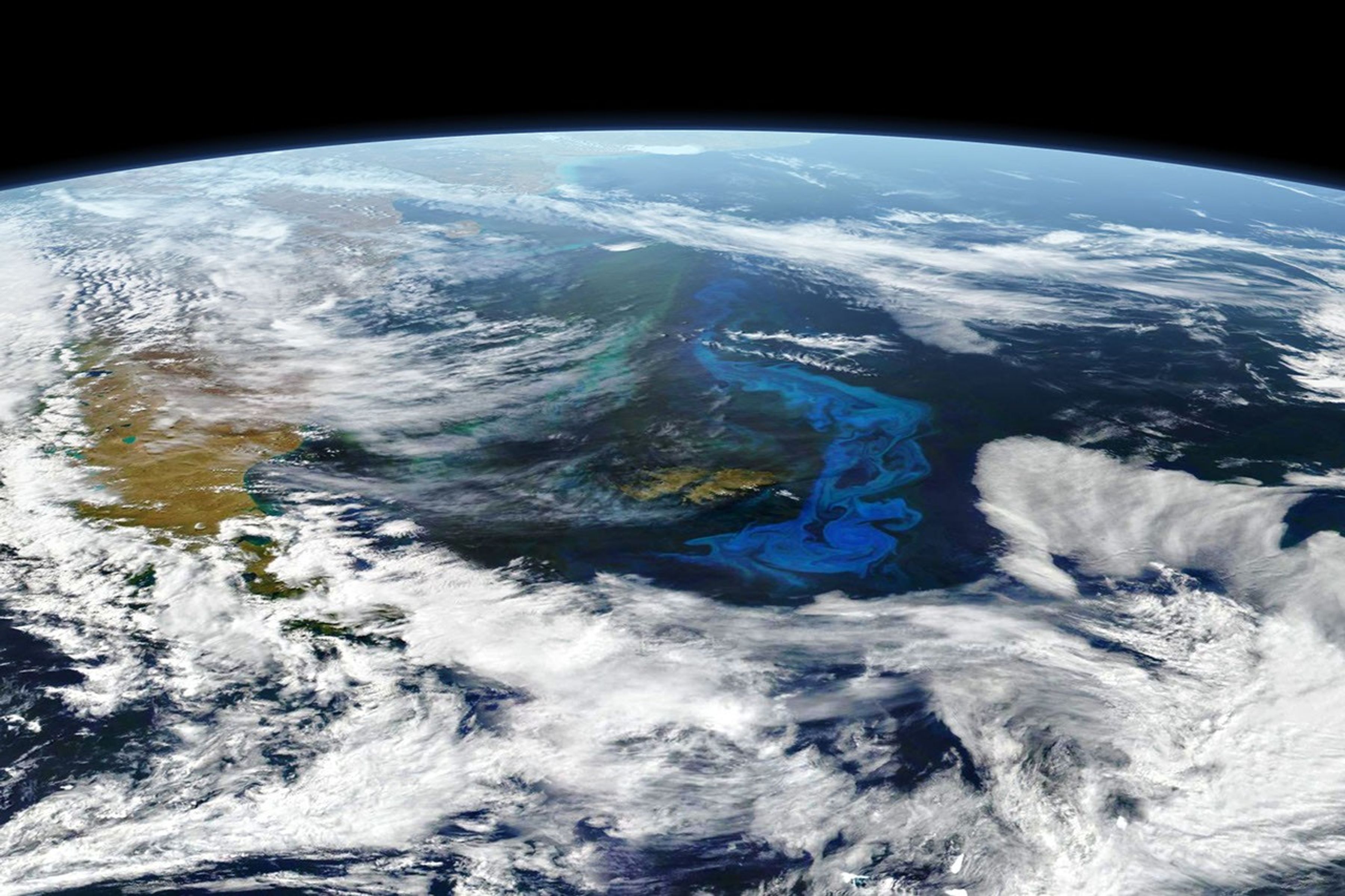
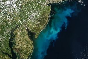
On December 28, 2017, the Visible Infrared Imaging Radiometer Suite (VIIRS) on the Suomi NPP satellite (top) and the Moderate Resolution Imaging Spectroradiometer (MODIS) on the Aqua satellite (second) acquiredthe data for these natural-color images. Swirls of milky blue and green reveal the presence of massive numbers of phytoplankton in the South Atlantic Ocean near the Falkland Islands. The dense blooms stretched hundreds of kilometers. The puffs of white in each image are thin clouds.
Phytoplankton are microscopic, plant-like marine organisms that use chlorophyll to harness sunlight for energy in much the same way that land-based plants do. When conditions are right, these tiny floating organisms can multiply exponentially and spread across hundreds of square kilometers of the ocean surface.
Phytoplankton form the center of the marine food web, serving as the primary food source for zooplankton, shellfish, fish, and larger marine creatures that consume them both. They are also critical to the global carbon cycle, as they absorb carbon dioxide from the atmosphere and turn it into carbohydrates. When the phytoplankton (or the animals that eat them) die, some of their remains sink to the ocean floor, transporting carbon to the bottom of the ocean. Finally, phytoplankton are key producers of the oxygen that makes the planet livable for humans and other creatures.
Bloom conditions are often just right near the east coast of South America and the Falklands in southern spring and winter. The waters are fueled by abundant nutrients carried on the Malvinas Current. Spun off of the Circumpolar Current of the Southern Ocean, the Malvinas flows north and east along the coast. The waters are enriched by iron and other nutrients from Antarctica and Patagonia, and they are made even richer by the interaction of ocean currents along the shelfbreak front, where the continental shelf slopes down to the deep ocean abyssal plain.
References & Resources
- NASA Earth Observatory (2013, October 22) Something Fishy in the Atlantic Night.
- NASA Earth Observatory (2010, July 13) What are Phytoplankton?
NASA Earth Observatory image by Joshua Stevens, using VIIRS data from the Suomi National Polar-orbiting Partnership and MODIS data from LANCE/EOSDIS Rapid Response . Story by Mike Carlowicz.