
New Space Views of Southeast Asian Floods Aid United Nations DisasterRelief Effort
Emergency food supplies being rushed to victims of the currentflooding in Southeast Asia are being planned with the help of a new typeof image from NASA's Terra spacecraft and a unique global floodmonitoring system funded by NASA.
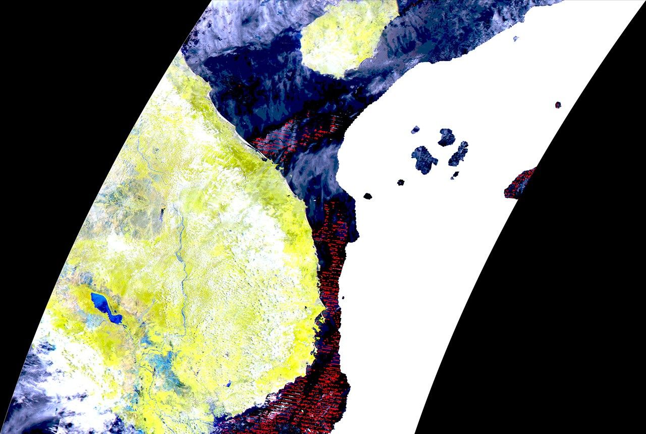
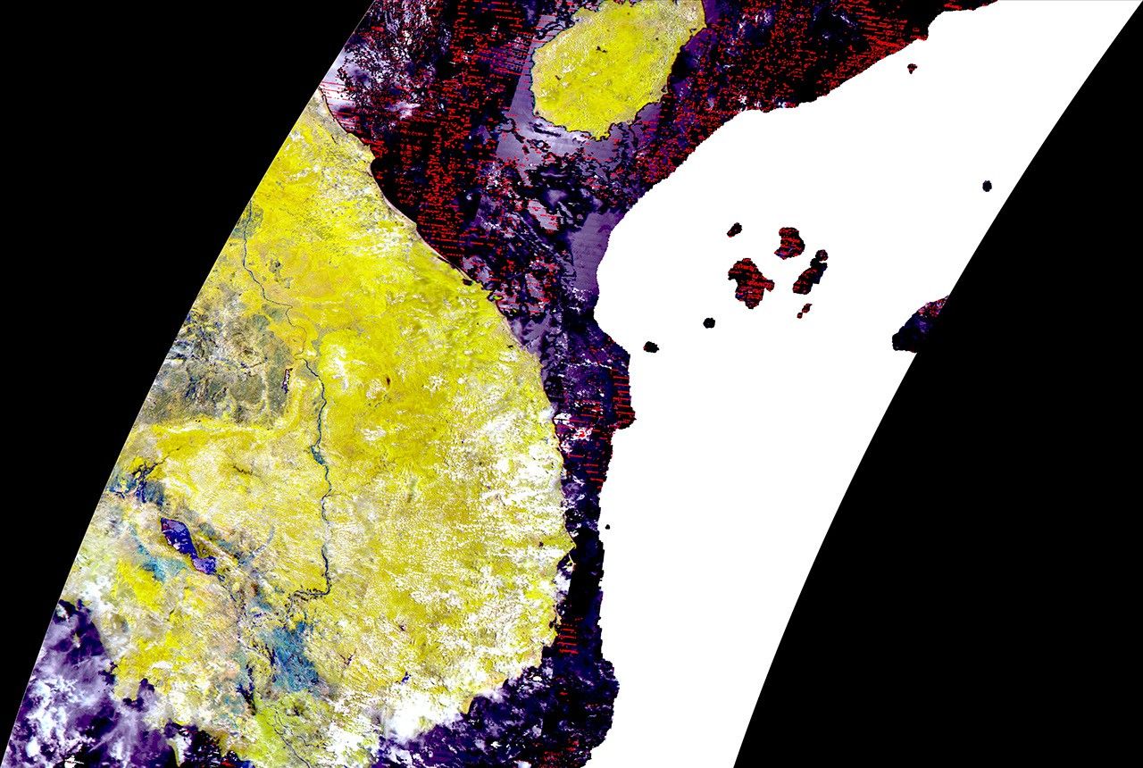
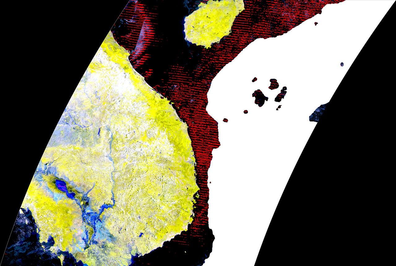
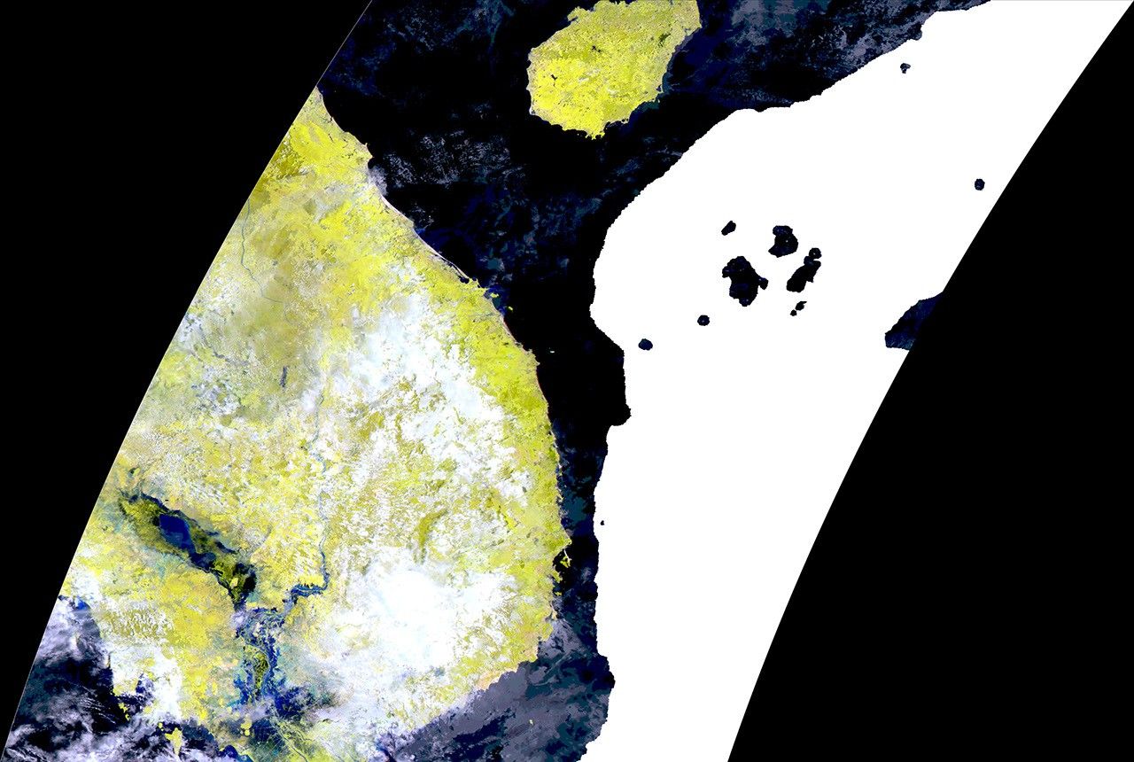
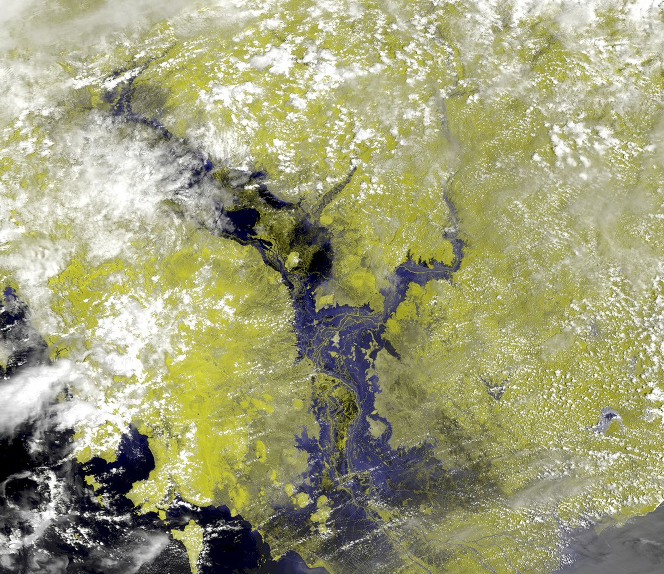
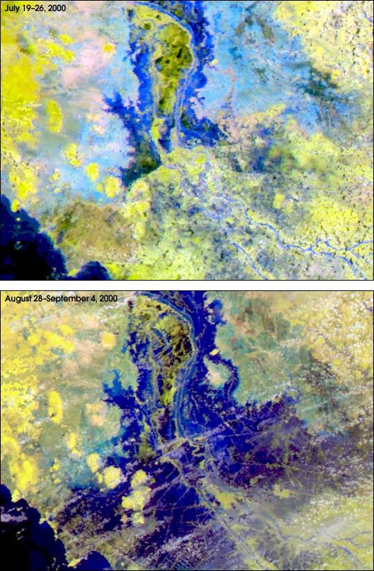
With new composite surface images from Terra released last month,Robert Brakenridge of Dartmouth College (Hanover, N.H.) produced mapsshowing the precise locations of flooded areas along the Mekong River.Hundreds of thousands of people have been displaced in the region by theworst flooding since 1961. These maps are being used by United NationsWorld Food Program staff to pinpoint the worst-hit areas.
"We get a dramatic increase in our mapping accuracy with the new8-day composite images from the Moderate Resolution Imaging Spectroradiometer(MODIS) instrument onboard Terra," saysBrakenridge. This new data product was released to the scientificcommunity in August by the EROS Data Center in Sioux Falls, SouthDakota, which is part of NASA's Earth Observing System Data andInformation System. Images were available from early June at the onsetof the Southeast Asia floods.
The frequent heavy cloud cover over Southeast Asia makes it difficultto regularly see the surface and flooded areas, says Brakenridge. Toovercome this problem, eight MODIS images from consecutive days areblended together to produce one image that combines all the cloud-freeviews of the surface. This new image product provides a look at how muchfloods rise or fall nearly every week.
Observations of floods in a region over successive years helpdisaster relief agencies like the United Nations unequivocally identifythe largest flood events and allocate limited aid resources accordingly.
"The MODIS maps are proving really useful to us," said MahadevanRamachandran, the United Nations World Food Program regionalvulnerability analysis and mapping officer in Phnom Penh, Cambodia. "Inareas like Cambodia and Laos where there are weak data collectionsystems on the ground, the MODIS data will be our first-hand informationto identify the areas we need to visit and assess for ourselves."
For more information, see the Dartmouth Flood Observatory, and NASA's Earth Observing System program
References & Resources
Images courtesy Robert Brakenridge