![Request for Information – Potential [Placeholder for Prize]](https://assets.science.nasa.gov/dynamicimage/assets/science/psd/solar/2023/09/s/solarsystem_0.jpg?w=1024)


| Information courtesy of the Earth Sciences and Image Analysis Laboratory, Johnson Space Center. July 9, 2002 |
Although most of NASA’s Earth Science activities are conducted using free-flying satellite sensors, spacecraft with humans on board also make important contributions to our understanding of the Earth. Astronaut photography of Earth from the first space flights in the 1960s formed the foundation for the remote sensing technologies that followed (Lowman 1999). As the number of sensors and satellites in orbit has increased, the baseline activity by astronauts has also continued. Human Spaceflight now includes missions on the Space Shuttle Orbiters and the International Space Station. The types of missions include specific sensors that are flown to collect data for a short period of time, and ongoing efforts by the astronauts to photograph the Earth below them as they orbit the planet.
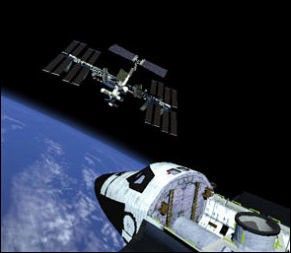
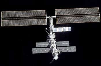
International Space Station
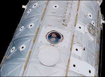
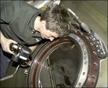
The NASA tradition of Earth observation from human-tended spacecraft continues on the International Space Station (ISS) with new opportunities for high-quality spatial and spectral resolution. Part of the station, the U.S. Laboratory Destiny, has a special Earth observing window with a clear diameter of 50.8 cm. The window is constructed of fused silica polished to telescope-quality optical characteristics. The reflective coating on the window absorbs UV radiation, but transmittance rises rapidly after 304 nm to > 90 percent in the visible and into the near infrared. Transmittance begins to tail off after 800 nm, but is nearly 50 percent to 1,500 nm. It is effectively zero at approximately 2,600 nm (see window transmittance graph).
Photographic cameras including film cameras, digital still cameras, and IMAX have all used the lab window for Earth imaging. This window permits the use of remote sensing instruments inside of the spacecraft without the need for space hardening, allows for instrument configuration changes while on orbit, and the return of instruments to the ground for servicing or calibration. Such instruments will be mounted in the Window Observational Research Facility (WORF) which provides a place for sensor mounting as well as vibration isolation, power and data transfer capabilities in the window. The WORF is scheduled for installation in the window in 2003. Several remote sensing instruments are being considered for deployment in the window; remote sensing instruments can also be mounted on external Station platforms.


Mission Facts
The International Space Station began construction in November 1998, and Earth Science activities began with the arrival of the first crew members in October 2000. At approximately 200 nautical miles (400 km) in altitude, the orbital inclination of the Station is 51.6 degrees and covers over 75 percent of Earth’s surface, containing 95 percent of human-inhabited areas. Orbits take approximately 91 to 93 minutes with a repeat about every 3 days and a 63-day lighting cycle.
- Orbital characteristics of the ISS
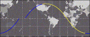
- Current position of the ISS in orbit
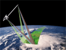
- Window Observational Research Facility (WORF)
Earth Science Projects on the Station
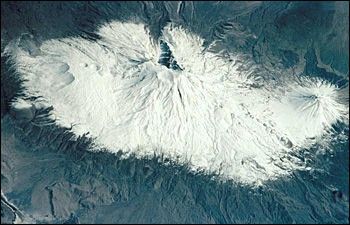
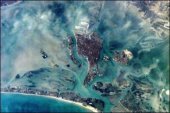
Crew Earth Observations (CEO) is the project guiding astronaut handheld photography from the ISS. Crew Earth Observations focuses on some of the most dramatic examples of change on the Earth’s surface. An interdisciplinary group of scientists selected some of the most dynamic regions of the Earth as their initial target sites (PDF format) that could be observed under the tight time constraints of the early phases of Space Station construction. These sites include major deltas in south and east Asia, coral reefs, major cities, smog over industrial regions, areas that typically experience floods or droughts triggered by El Niño cycles, alpine glaciers, tectonic structures, and features on Earth, such as impact craters, that are analogs to structures on other planets.
Earth Knowledge Acquired by Middle school students (EarthKAM) is a project where middle school students control a digital camera mounted in the window of the ISS. It began in 1994 as a pilot program on the Space Shuttle (then known as “Kidsat”) and is now a long-term program on the Space Station. Students request that specific images of Earth be taken from orbit and the images are then incorporated into their classroom curricula. These photos are used to study the planet from a variety of disciplines, geography to environmental studies to visual arts. The images will soon be included in the larger Gateway to Astronaut Photography of Earth, to extend their availability to the public and scientific community.
Stratospheric Aerosol and Gas Experiment (SAGE III) is the first U.S. Earth observing project planned for external mounting. The SAGE III instrument characterizes the vertical distribution of aerosols and ozone from the upper troposphere through the stratosphere. In addition, SAGE III also provides unique measurements of temperature in the stratosphere and mesosphere and profiles of trace gases such as water vapor and nitrogen dioxide that play significant roles in atmospheric radiative and chemical processes. It is scheduled to go into orbit in 2004.
Space Shuttle
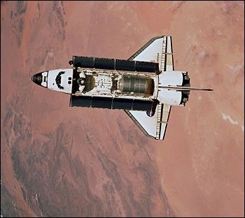
Mission Facts
The Space Shuttle forms a unique platform for Earth Science experiments because equipment can be used for a short period of time (5 to 15 days) and then returned to Earth. First launched in April 1981, the Shuttle program has launched over 100 missions using 5 Orbiter vehicles. The altitude for each mission is different, ranging from 222 to 611 km. Most recent missions have focused on Space Station construction, and have had altitudes of approximately 400 km. The orbital inclination (the highest latitude reached on each orbit) also has varied from 28 to 62 degrees. Most missions have had inclinations of 28.5, 39, 51.6 (Space Station inclination), or 57 degrees.
Current position of the Space Shuttle in orbit (when in orbit)
Recent Earth Science Projects on Shuttle
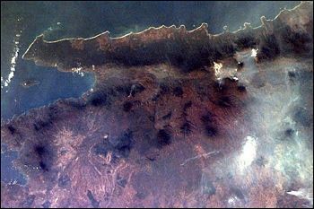
Space Shuttle Earth Observation Photography Throughout the Space Shuttle era, astronauts in orbit have photographed the Earth through the spacecraft windows.
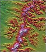
Shuttle Radar Topography Mission (SRTM) was a mission to map the topography (elevation data) of the world with unprecedented resolution. It flew on the Space Shuttle Endeavor in February 2000. During the 10 days of operation, it collected data on as much of the surface of the Earth as possible (between 60 degrees north latitude and 54 degrees south latitude). A systematic global data set will be completed by the end of 2002.
Spaceborne Imaging Radar-C/X-band Synthetic Aperture Radar (SIR-C/X-SAR) was the precursor to SRTM, and flew twice on the Space Shuttle in 1994. SIR-C/X-SAR featured multiparameter radar imaging (3 bands, programmable polarization modes). Two earlier missions SIR-A (1983) and SIR-B (1984) demonstrated the radar capabilities for various scientific applications. These missions focused on a limited number of “supersite” targets for repeated viewing and illustrated the potential of radar mapping.
Astronaut Photography
Background
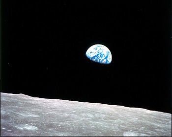
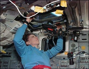
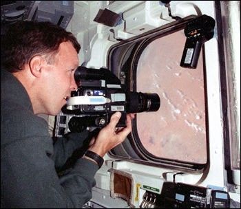
Astronauts have used hand-held cameras to photograph the Earth for more than 30 years, beginning with the Mercury missions in the early 1960s. Crew members on NASA missions have taken nearly 400,000 photographs with Hasselblad, Linhof, Rolleiflex, and Nikon hand-held cameras.
Astronauts are trained in scientific observation of ecological, geological, geographic, oceanographic, environmental, and meteorological phenomena. They are also instructed in the use of photographic equipment and techniques. Preflight training helps the astronauts make informed decisions on which areas and phenomena to photograph. Specific areas of scientific interest are selected before each flight by a group of scientists. The astronauts receive intensive training, in-flight aids, and messages from the ground to help them locate these sites that are of scientific interest.
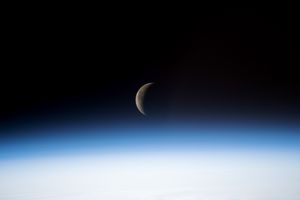
An astronaut trained in the Earth sciences can rapidly identify and photograph interesting and unexpected phenomena, interpret what has been observed, and modify planned activities as needed. Near real-time information exchange between the crew and scientists expedites the recording of dynamic events of geological, oceanographic, environmental, and meteorological importance. Critical environmental monitoring sites are photographed repeatedly over time; some have photographic records dating back to the Gemini and Skylab missions. Earth limb pictures taken at sunrise and sunset document changes in the Earth’s atmospheric layers. Photographs of hurricanes, thunderstorms, squall lines, island cloud wakes, and the jet stream supplement weather satellite images by offering high-resolution stereoscopic coverage of such phenomena.
Astronaut photography provides several unique contributions to the range of Earth Science information available from NASA (Lulla et al. 1996). First, the images are readily accessible to the public — they are non-proprietary, can distributed in digital form on the Internet (at the Gateway to Astronaut Photography of Earth), and are in a real-color photographic form that is easily interpretable by non-scientists. Second, the unique aspects of handheld data make it possible to view the Earth in ways that are not common from other sensors. In addition to images looking directly down at the ground, astronauts can look obliquely at haze in the atmosphere, or use sunglint to view water boundaries and wave features. Third, because the photographs are in the public domain, they provide a low-cost alternative data source for cases where other satellite imagery cannot be acquired or is not sufficient. Such cases often include studies in developing countries, in areas that have not usually been targets for major satellites, needing supplemental low-cloud data, requiring a time series, or requiring a large number of images.
Photographic Characteristics
Variability is both a key feature and a data extraction challenge for astronaut photography of Earth. Because astronauts use a variety of lenses and look angles, different cameras and films, and take their images from different altitudes, there is not a single spatial resolution for the imagery. Most nadir-viewing (directly down at the Earth) images have spatial resolution of 20 to 60 m. However, recently higher magnifications have been used successfully with spatial resolutions less than 6 m. At the Gateway to Astronaut Photography of Earth, NASA provides interactive tools that can be used to estimate spatial resolution for a specific image (Robinson et al, in press).
Summary
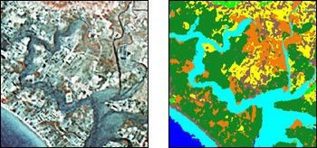
Astronaut orbital photography fills a niche between aerial photography and imagery from unmanned satellite scanners and complements these two familiar formats with additional information. The ability of the trained astronaut to rapidly identify and photograph interesting phenomena on the Earth makes the Shuttle photographs unique. Near-real-time information exchange with the crew facilitates the recording of current events of geological, oceanographic, environmental, and meteorological importance. Near-vertical or low-oblique angle photographs can be digitized at high resolution and used as three-band (RGB) remote sensing images in the same way a scientist would use data from Landsat, SPOT, or Terra satellites (Webb et al. 2000). These digital images can be classified to determine land use, land cover, or change over time.
Links
- More information on astronaut photography
- Scientific publications using astronaut photography
References
- Lowman, P. D., Jr., 1999, Landsat and Apollo: the forgotten legacy. Photogrammetric Engineering & Remote Sensing, 65, 1143-1147.
- Lulla, K., Evans, C., Amsbury, D., Wilkinson, J., Willis, K., Caruana, J., O'Neill, C., Runco, S., McLaughlin, D., Gaunce, M., McKay, M.F., and Trenchard, M., 1996, The NASA Space Shuttle Earth Observations Photography Database: an underutilized resource for global environmental geosciences. Environmental Geosciences, 3, 40-44.
- Robinson, J. A., D. A. Liddle, C. A. Evans, and D. L. Amsbury, In press, Astronaut-acquired orbital photographs as digital data for remote sensing: spatial resolution. International Journal of Remote Sensing.
- Webb, E. L., Ma. A. Evangelista, and J. A. Robinson, 2000, Digital land use classification using Space Shuttle-acquired orbital photographs: a quantitative comparison with Landsat TM imagery of a coastal environment, Chanthaburi, Thailand. Photogrammetric Engineering & Remote Sensing 66,1439-1449.
NASA Earth Observatory story by Johnson Space Flight Center.