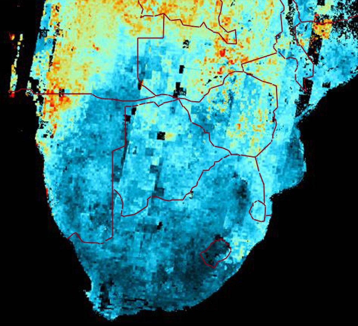
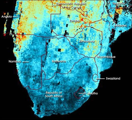
This map shows the abundance of airborne particulates, or aerosols,over Southern Africa during the period August 14–September 29, 2000.Low particle concentrations are shown in shades of blue, and highconcentrations in shades of red. The results were generated from Multi-angleImaging Spectroradiometer (MISR)imagery acquired over this time period, and processed using MISR’sautomated software system. The approach for deriving aerosol amountmakes use of the variation of scene brightness and contrast as afunction of observation angle. Black areas over the land area correspondto places where a result was not obtained, for example, due to thepresence of clouds.
Extensive burning of grass and shrubland for land management andagriculture comprises a principal source of these aerosols. Vegetationavailability increases northward, hence the greater abundance of hazeand smoke in Angola and southern Zaire. The lower aerosol abundancearound Lesotho and southeastern South Africa is consistent with thehigher terrain elevations near the Drakensberg Mountains.
References & Resources
Image courtesy NASA/GSFC/JPL, MISR Team.