


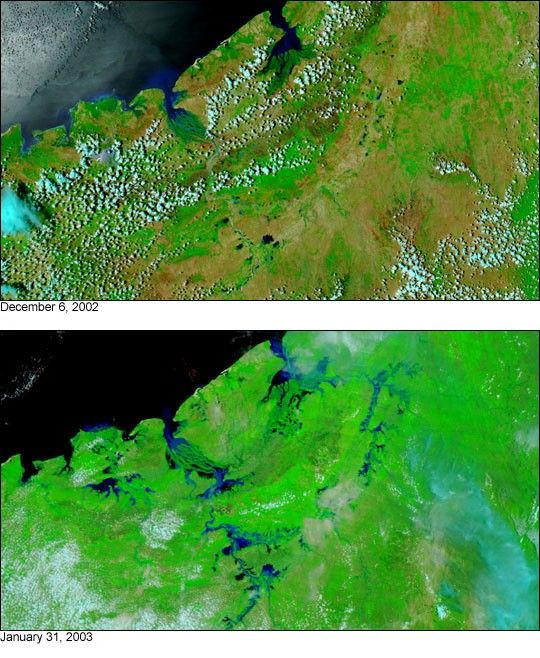
January 31, 2003
In January, two weeks of heavy rain inundated Madagascar just before the island was struck by Cyclone Fari. The above image taken on January 31, 2003, by the Moderate Resolution Imaging Spectroradiometer (MODIS) instrument aboard NASA’s Terra satellite displays flooding in northwest Madagascar. Prior to being hit by the cyclone, floods throughout the country killed 13 people and forced several thousand from their homes.
Normally, the rivers and lakes in northwest Madagascar are much less swollen (top image, acquired on December 6, 2002). In these false-color images, water is solid blue and black, land is green and brown, and clouds are light blue and white.
References & Resources
Image courtesy Jacques Descloitres, MODIS Land Rapid Response Team at NASA GSFC.


