August 14-18, 2020
\n", "credits": "", "title": "Untitled"}, "image2": {"contentType": "image", "id": 1056018, "url": "https://assets.science.nasa.gov/dynamicimage/assets/science/esd/eo/images/imagerecords/147000/147139/nocalfires_virs_2020231.jpg", "zoom": 20, "focalPoint": {"x": ".50", "y": ".50"}, "fit": "contain", "alt": "", "caption": "2020-08-18 00:00:00
\n", "credits": "", "title": "Untitled"}, "fileList": []} /-->

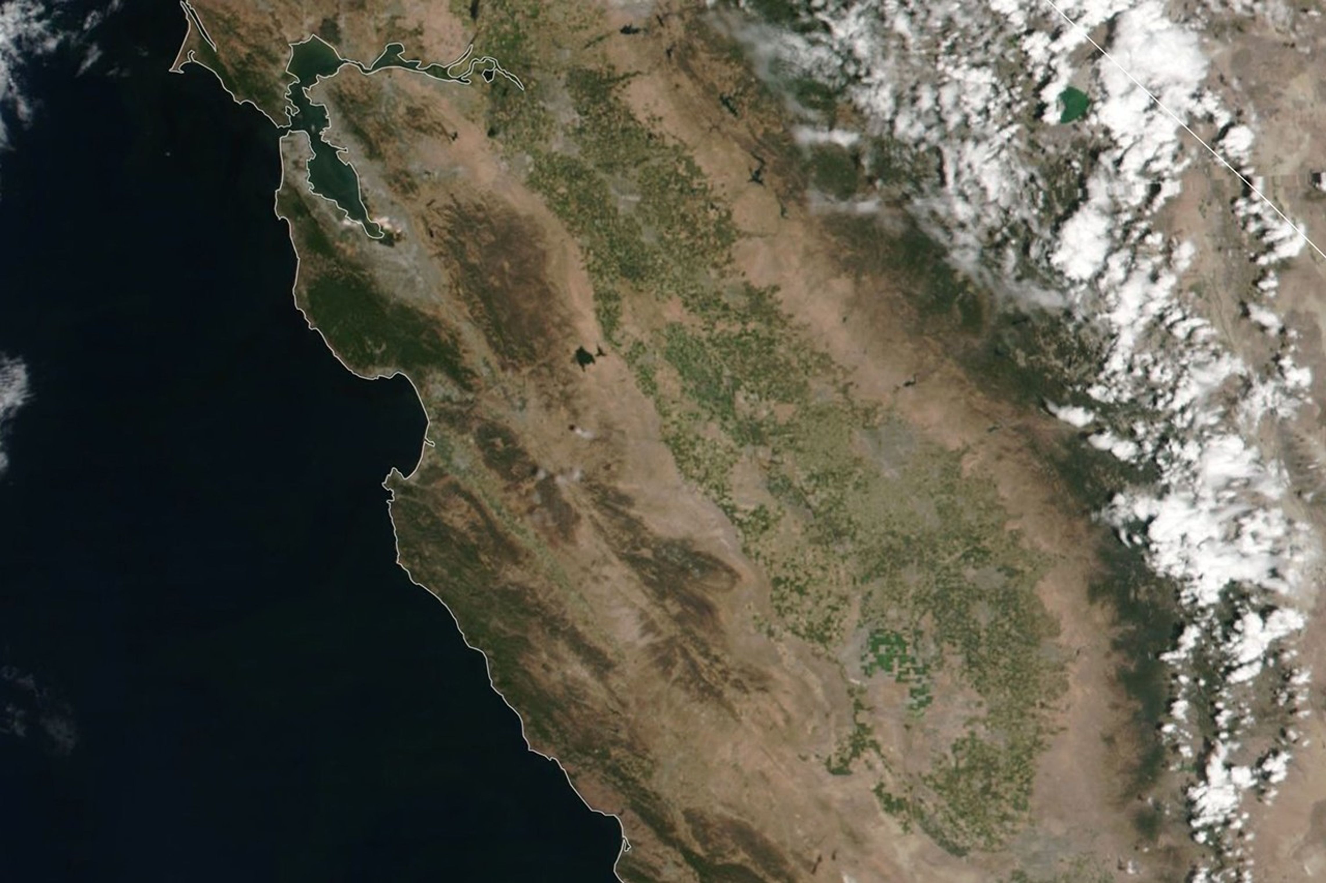
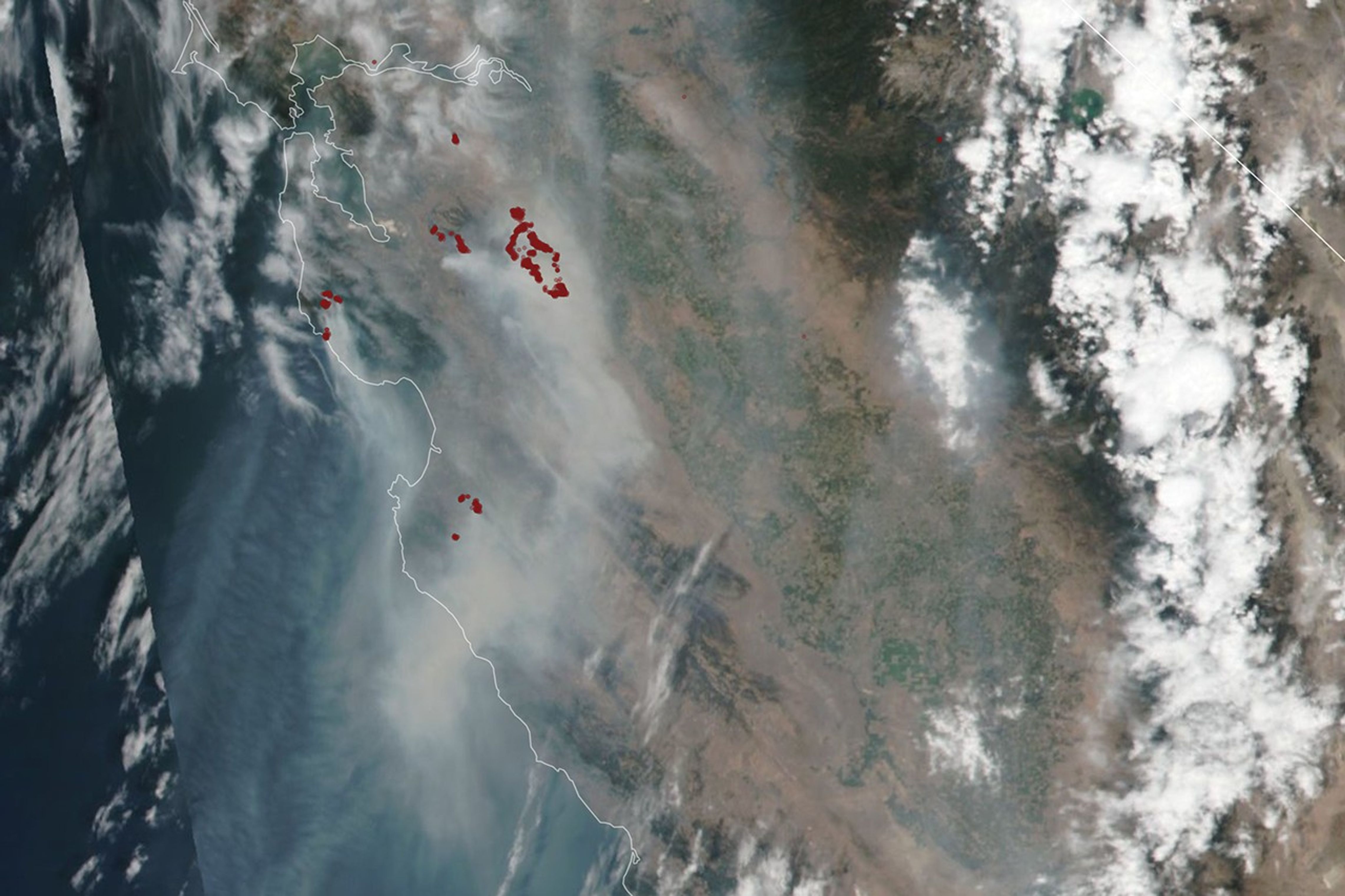
On August 18, 2020, several fires exploded across northern California and scorched thousands of acres.
The Visible Infrared Imaging Radiometer Suite (VIIRS) on the NOAA-NASA Suomi NPP satellite captured a natural-color image (right) showing wildfire smoke blanketing the region. The red dots depict a “fire detection,” a pixel in which the sensor and a computer algorithm indicated there was active fire. (The seam running diagonally through the August 18 image shows where two adjacent VIIRS swaths were stitched together to make one image.) The image on the left shows clear skies on August 14, before the fires had started.
Many of the fires were sparked by intense lightning storms and moved rapidly due to an intense heatwave and sustained high winds. On August 18, the governor declared a statewide emergency. Thousands of people have evacuated some towns surrounding the San Francisco Bay Area as well as areas in and surrounding Santa Clara county.
References & Resources
- Los Angeles Times (2020, August 14) California heat wave may rival deadly July 2006 event, forecasters say. Accessed August 19, 2020.
- Los Angeles Times (2020, August 19) Fires explode across Bay Area, burning homes and sparking mass evacuations. Accessed August 19, 2020.
- The Mercury News (2020, August 18) Bay Area fires: Lightning-sparked blazes continue to burn uncontrolled in Santa Clara, Contra Costa, Napa counties. Accessed August 19, 2020.
- NBC Bay Area (2020, August 19) SCU Complex: 20 Fires in 5 Counties Prompt Evacuation Orders. Accessed August 19, 2020.
- Office of Governor Gavin Newsom (2020, August 18) Governor Newsom Declares Statewide Emergency Due to Fires, Extreme Weather Conditions. Accessed August 19, 2020.
NASA Earth Observatory images by Lauren Dauphin, using VIIRS data from NASA EOSDIS/LANCE and GIBS/Worldview and the Suomi National Polar-orbiting Partnership . Text by Kasha Patel.