


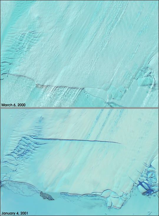
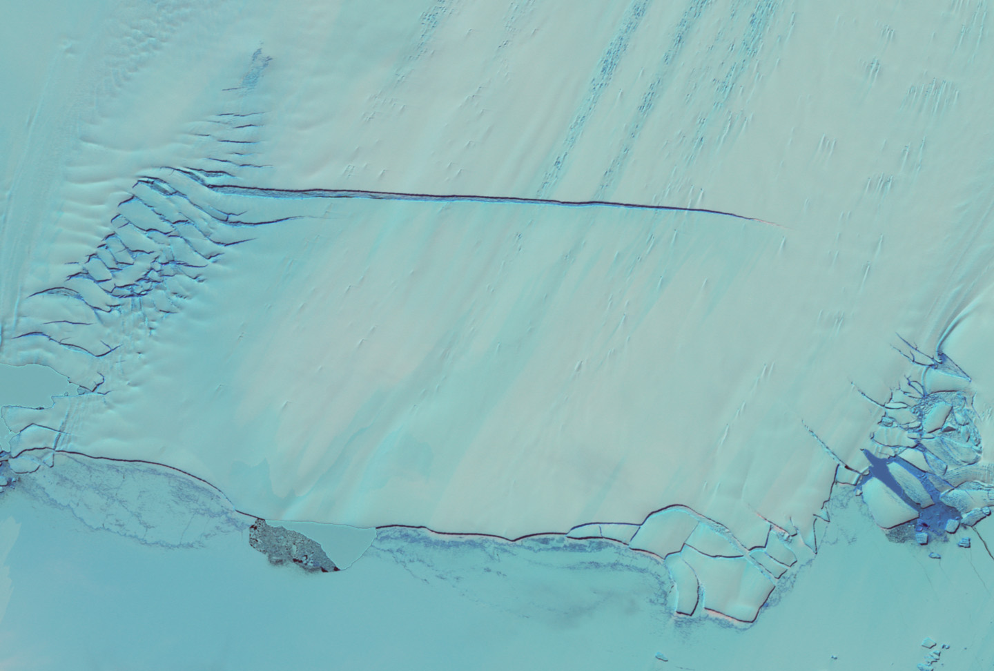
There is a new crack in Antarctica's icy armor. The earliest stages ofthe formation of a massive iceberg was captured by NASA's Landsat 7satellite on January 4, 2001. As is evident in this pair of Landsat 7images, there was no crack in the March 2000 scene, but by January thecrack had grown to more than 25 km (15) miles long, stretching more thantwo-thirds of the way across the Pine Island Glacier.
According to NASA Glaciologist Robert Bindschadler, most of this crackformed very rapidly, in less than five weeks. Currently, the crack isgrowing much more slowly, at about 13 meters (40 feet) a day.Bindschadler's prediction is that the crack will result in the calvingof a major iceberg in probably less than 18 months.
Landsat 7, a cooperative mission between NASA and the United StatesGeological Survey, Reston, Virginia, completed its second annualcontinent-wide mapping of Antarctica last month. With its capability tosee features as small as 15 meters (50 feet) across, Landsat 7 providesthe most detailed observations available of the remote continent, manyparts of which have never been mapped at this resolution before. Landsat7 passes over the continent 16 times a day in its nearly pole-to-poleorbit, taking an average of 300 images each week during the Antarcticsummer (November to February) when the surface is best illuminated withsunlight.
For more details, images, and animations, read NASA Image Reveals Giant Chip off the Antarctic Ice Block
References & Resources
Image courtesy NASA GSFC Scientific Visualization Studio, based on data from the Landsat 7 science team.
None


