




























March 18, 2004
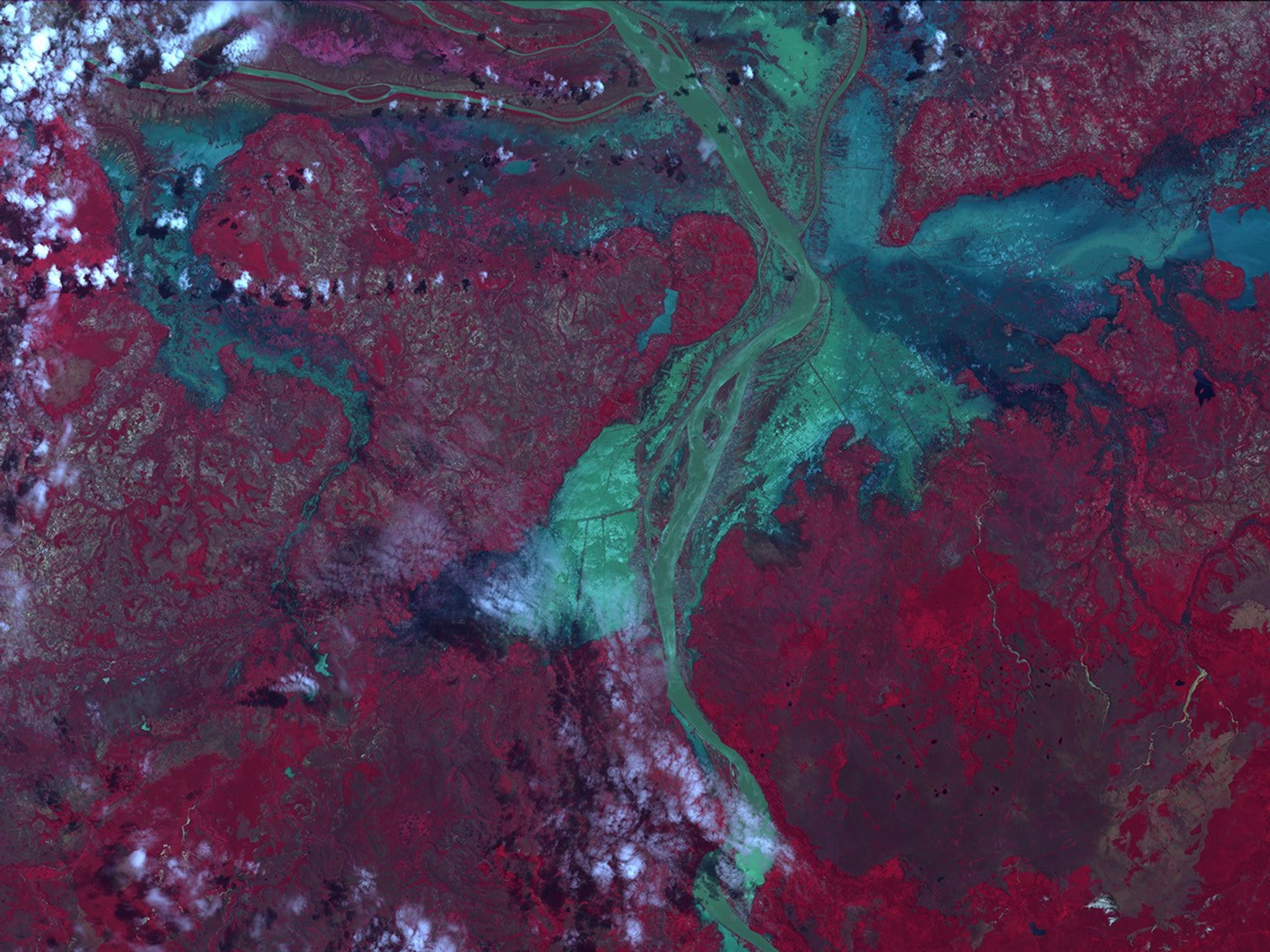
Large pools of water surround the lower reaches of the Betsiboka River in northeastern Madagascar. Flooding has been a problem since Tropical Cyclone Gafilo blew across the island on March 7 and 8, and then returned on March 10. The Advanced Spaceborne Thermal Emission and Reflection Radiometer (ASTER) on the Terra satellite captured this image on March 18, 2004. Here, vegetation is red, water is green and blue, and clouds are white. As of March 18, 113 people were reported dead, many of whom drowned in the floods.
References & Resources
Image courtesy Jesse Allen based on expedited ASTER data provided the NASA/GSFC/MITI/ERSDAC/JAROS, and U.S./Japan ASTER Science Team