


Before scientists apply new spacecraft measurements to global climatechange research, they must carefully test their understanding of thedata under controlled conditions. During April 2001, a team of 200investigators from 11 countries participated in the AerosolCharacterization Experiment (ACE) field campaign in Asia, deployinginstruments aboard several ships, aircraft, and island stations in thewaters surrounding Japan and Korea. They characterized meteorologicalconditions, measured the atmospheric energy balance, and directlysampled airborne dust and pollution particles while the Multi-angle Imaging SpectroRadiometer (MISR)and other satellite instruments flew overhead.
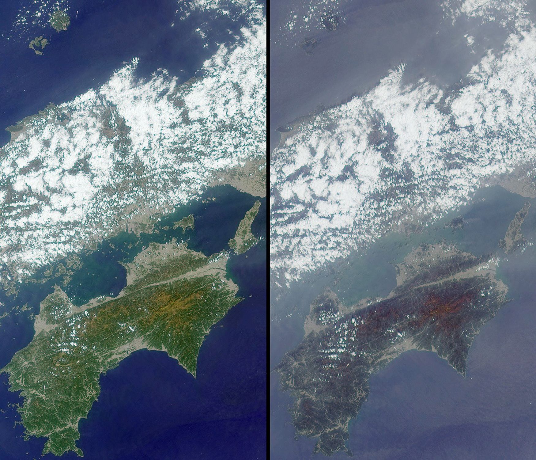
These MISR images, centered just north of Shikoku Island in southwestJapan, were acquired on April 13, 2001. They aretwo of nine simultaneous views obtained at different angles by theinstrument, at 26 degrees aft of vertical (left) and 60 degrees forwardof vertical (right). The entire west end of Honshu Island, which crossesthe upper half of the images, is covered with broken clouds. Away fromthe clouds, the atmosphere looks hazier in the steeper MISR view; suchdifferences reveal information about particles in the atmosphere.
As these images were taken, the U.S. National Oceanographic andAtmospheric Administration (NOAA) Research Vessel Ron Brown and theNational Science Foundation (NSF)/National Center for AtmosphericResearch (NCAR) C-130 aircraft probed the environment near Oki island,in the upper left part of the images. At the same time, the Center forInterdisciplinary Remotely Piloted Aircraft Studies (CIRPAS) Twin Otteraircraft made atmospheric chemistry and heat-balance measurements in thebottom-center region of the images.
For more about ACE-Asia, seehttp://saga.pmel.noaa.gov/aceasia/
References & Resources
Image courtesy NASA/GSFC/LaRC/JPL, MISR Team.