Suggested Searches

1 min read

Typhoon Nanmadol

Instruments:
2004-12-02 00:00:00
December 2, 2004

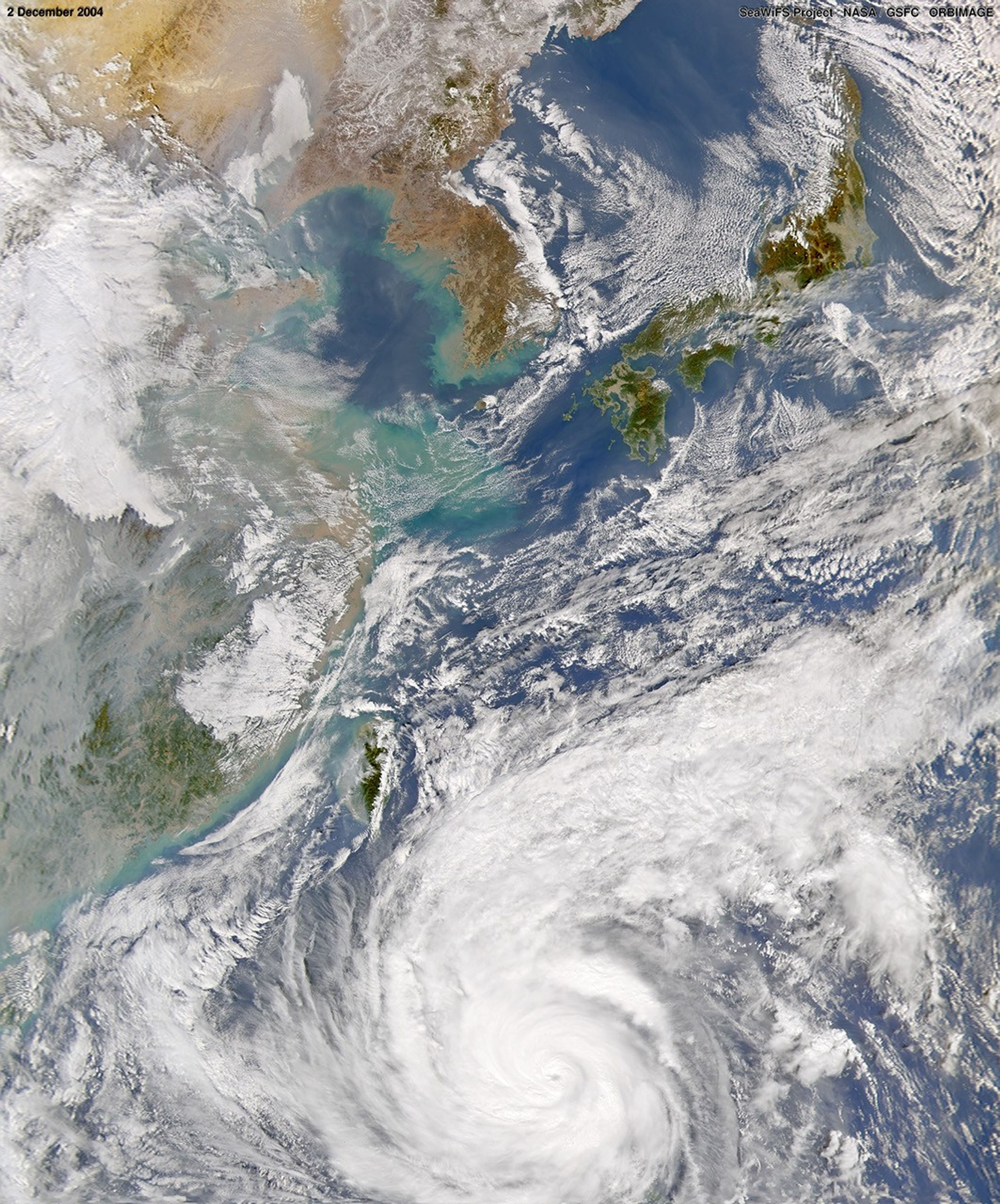
The SeaWiFS sensor onboard the OrbView-2 satellite captured this visible image of Typhoon Nanmadol on December 2, 2004, at 4:15 UTC. At the time this image was taken Nanmadol was located approximately 590 miles east-southeast of Naga City and was moving towards the west-northwest at 27 mph. This make Nanmadol the fastest moving typhoon of the 2004 season. Maximum sustained winds were near 121 mph with higher gusts to 150 mph.

References & Resources

Provided by the SeaWiFS Project, NASA/Goddard Space Flight Center, and ORBIMAGE.

You may also be interested in:

Stay up-to-date with the latest content from NASA as we explore the universe and discover more about our home planet.

Ragasa Steers Toward China
3 min read

The super typhoon headed for Guangdong province after lashing Taiwan and northern Luzon in the Philippines.

Article
Typhoon Kajiki Lashes Southeast Asia
2 min read

Late summer in the Northwest Pacific Ocean often sees an increase in storminess, which in August 2025 included a typhoon…

Article
A Glimpse of History in Benin City
3 min read

The ancient walls, ramparts, and ditches that wind through this Nigerian city are the longest known earthworks of the pre-mechanical…

Article