


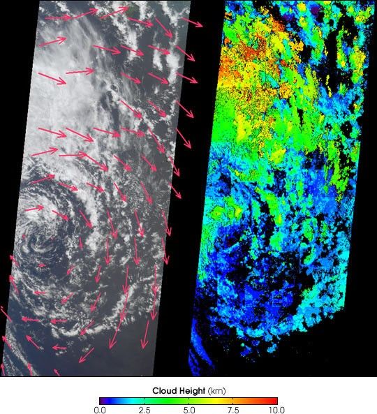
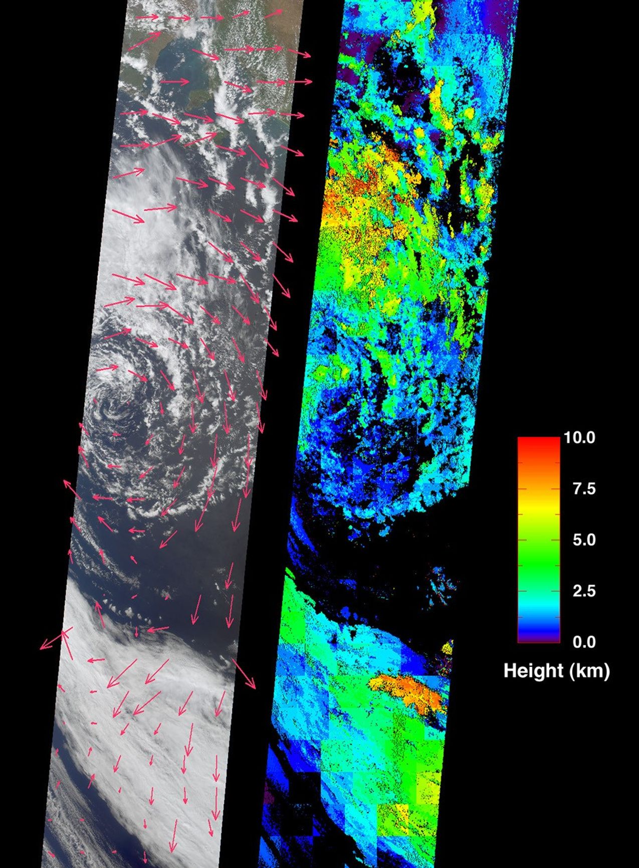
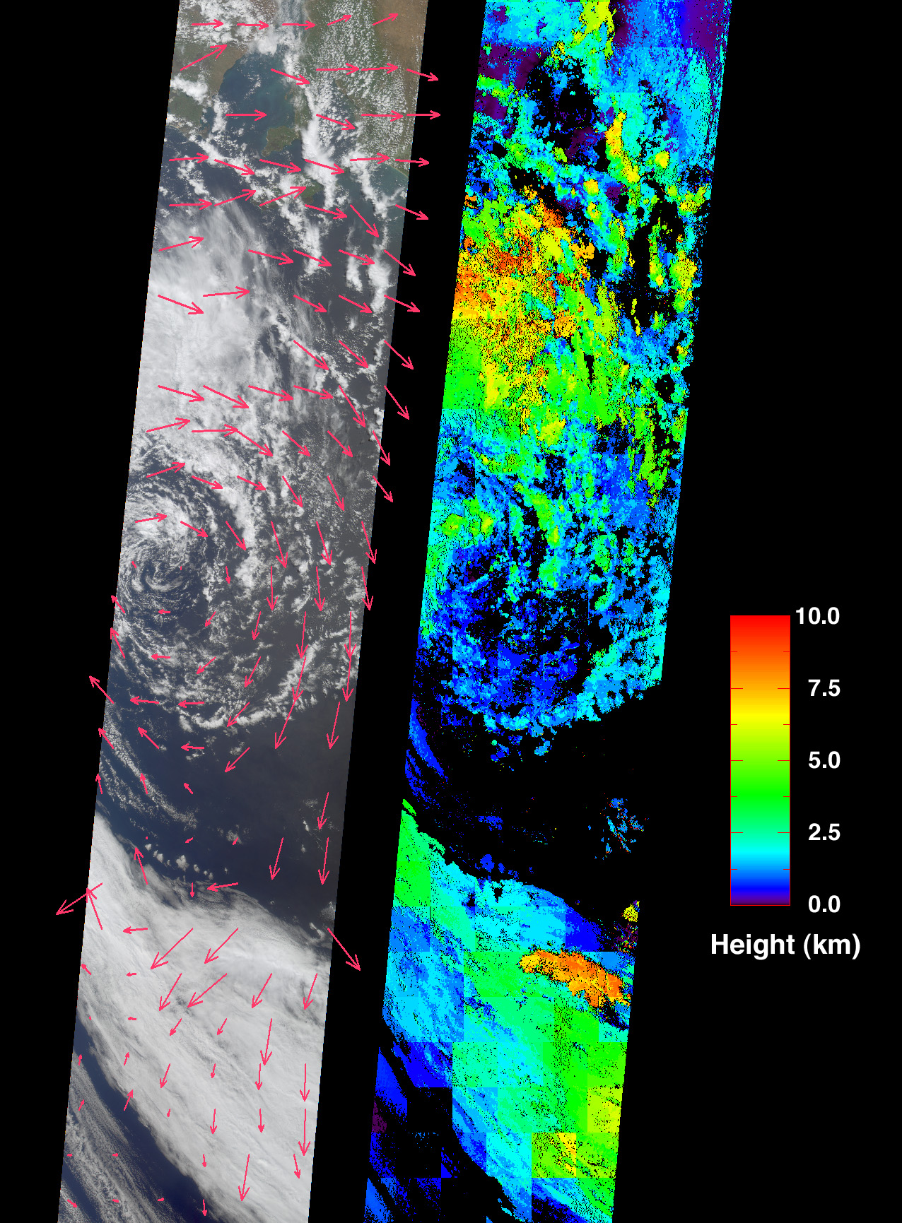
These images from the Multi-angle Imaging SpectroRadiometer (MISR) portray anoccluded extratropical cyclone situated in the Southern Ocean, about 650kilometers south of the Eyre Peninsula, South Australia.
The left-handimage, a true-color view from MISR’s nadir (vertical-viewing) camera, shows clouds just south of the Yorke Peninsula and the Murray-Darlingriver basin in Australia.Retrieved cloud-tracked wind velocities are indicated by thesuperimposed arrows. The image on the right displays cloud-top heights.Areas where cloud heights could not be retrieved are shown in black.Both the wind vectors and the cloud heights were derived using data frommultiple MISR cameras within automated computer processing algorithms.The stereoscopic algorithms used to generate these results are stillbeing refined, and future versions of these products may show modestchanges.
Extratropical cyclones are the dominant weather system atmidlatitudes, and the term is used generically for regional low-pressuresystems in the mid- to high-latitudes. In the southern hemisphere,cyclonic rotation is clockwise. These storms obtain their energy fromtemperature differences between air masses on either side of warm andcold fronts, and their characteristic pattern is of warm and cold frontsradiating out from a migrating low pressure center which forms, deepens,and dissipates as the fronts fold and collapse on each other. The centerof this cyclone has started to decay, with the band of cloud to thesouth most likely representing the main front that was originallyconnected with the cyclonic circulation.
These views were acquired on October 11, 2001, and the large viewrepresents an area of about 380 kilometers x 1900 kilometers.
References & Resources
Image courtesy NASA/GSFC/LaRC/JPL, MISR Team.


