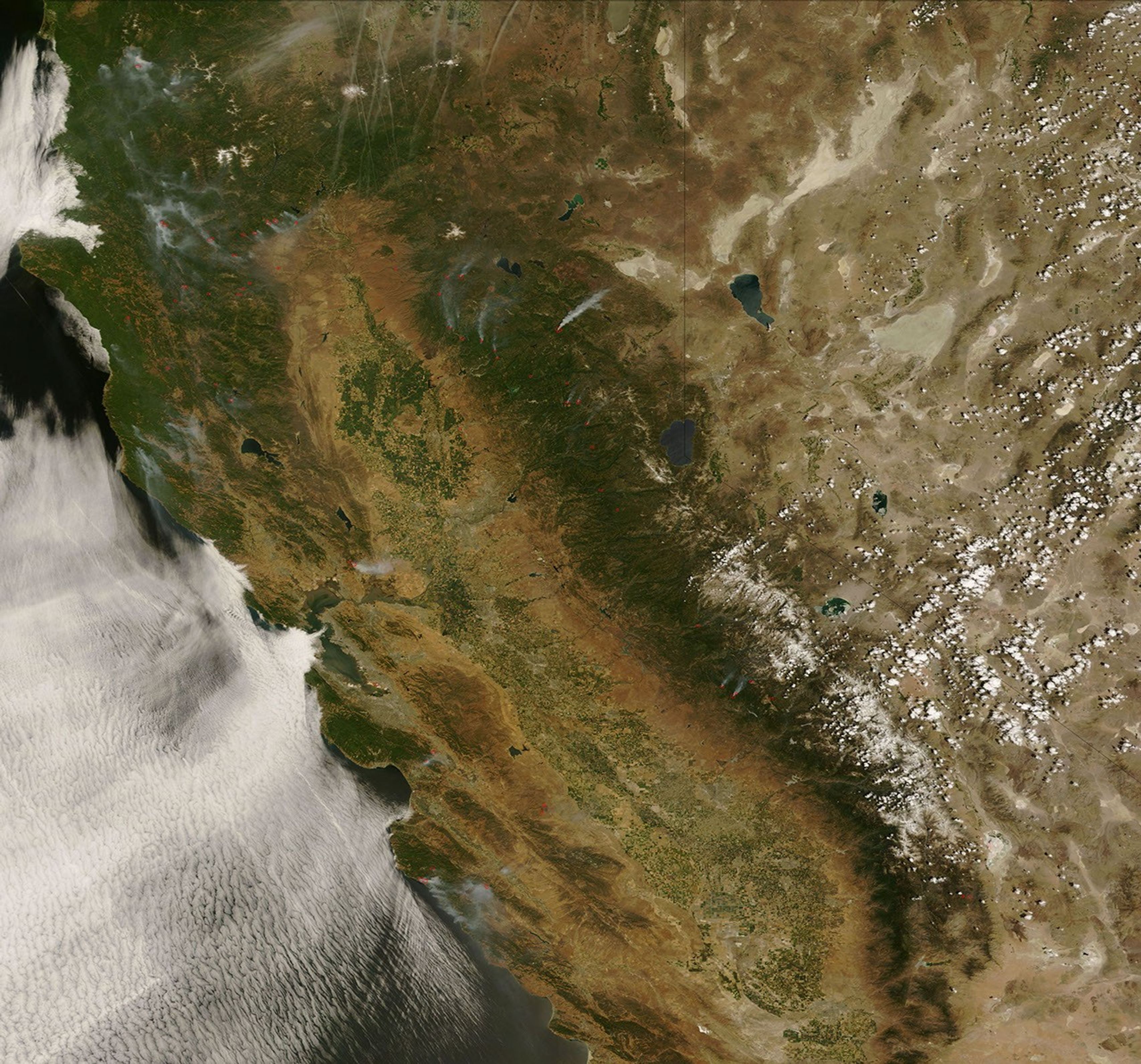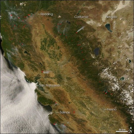
A heat wave and windy weather plagued firefighters in California in mid-June 2008 as they worked to contain hundreds of fires across the state. Many of the fires were triggered by lightning on Friday, June 20. This natural-color image from the Moderate Resolution Imaging Spectroradiometer (MODIS) on NASA’s Terra satellite on Sunday, June 22, shows places where the sensor detected actively burning fires (red outlines). Fires appear most numerous in Northern California.
The high-resolution image provided above is at MODIS’ maximum spatial resolution (level of detail) of 250 meters per pixel. The MODIS Rapid Response Team provides twice-daily images of
and
in additional resolutions and formats, including an infrared-enhanced version that highlights burned ground.
References & Resources
NASA image courtesy the MODIS Rapid Response Team. Caption by Rebecca Lindsey.