


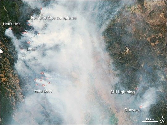
Smoke engulfed the northern Sacramento Valley in California on July 22, 2008, when the Moderate Resolution Imaging Spectroradiometer (MODIS) on NASA’s Aqua satellite passed over head and captured this natural-color image. Places where MODIS detected actively burning fires are outlined in red.
The state has been plagued with a record-breaking number of fires for this time of year following a spate of “dry” thunderstorms that brought thousands of lightning strikes during the third week of June. Evacuations were in effect on July 23 for areas near the Hell’s Half and the Iron and Alps Complex Fires. According to the daily report from the National Interagency Fire Center, hundreds of thousands of acres were affected by fires in California. The large version of this image shows the 138,000-acre Basin Complex Fire near Big Sur.
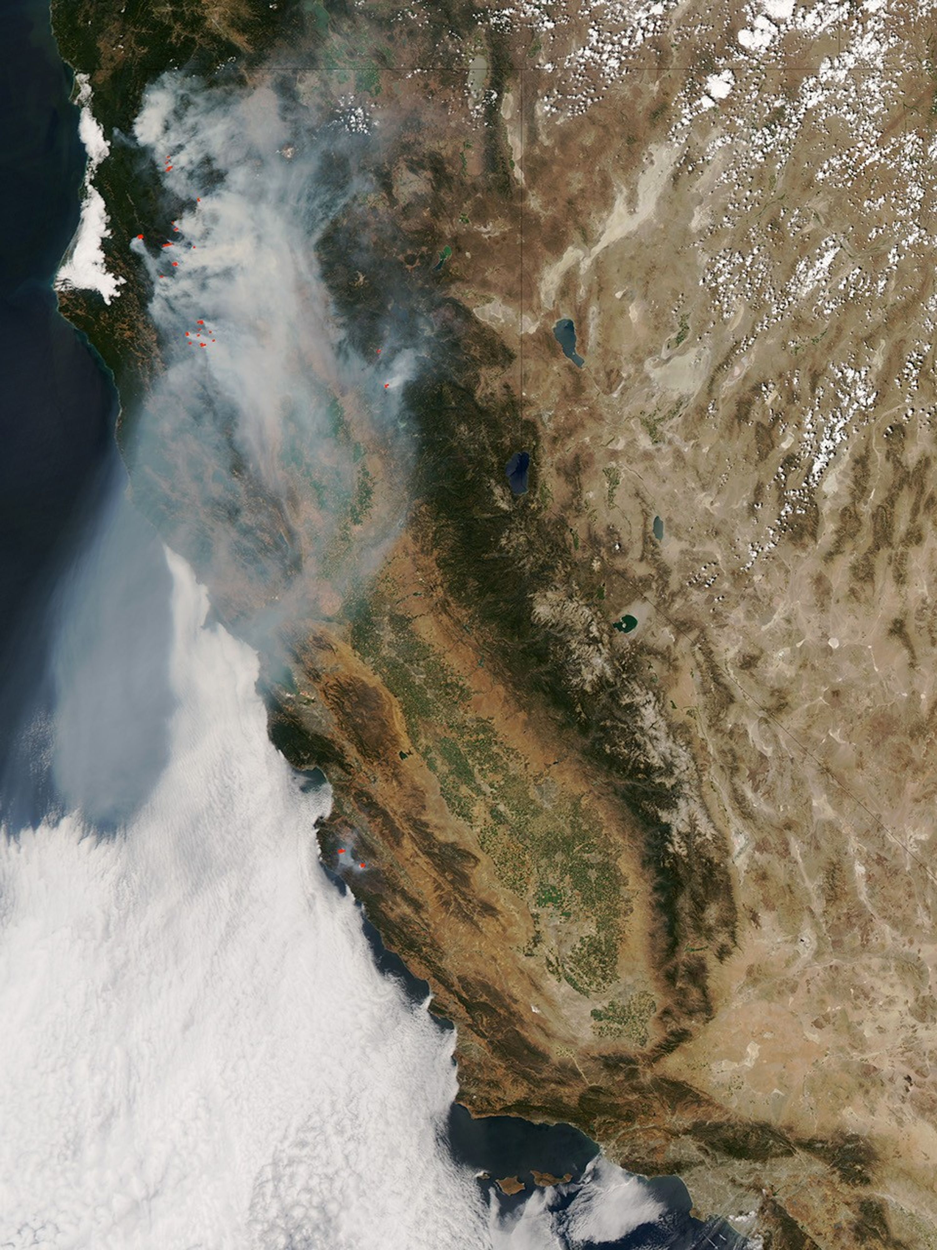
The high-resolution image provided above is at MODIS’ maximum spatial resolution (level of detail) of 250 meters per pixel. The MODIS Rapid Response Team provides this image in additional resolutions.
References & Resources
NASA image courtesy Jeff Schmaltz, MODIS Rapid Response Team, NASA-GSFC. Caption by Rebecca Lindsey.


