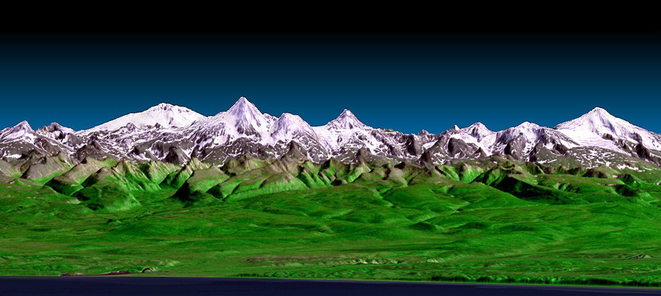
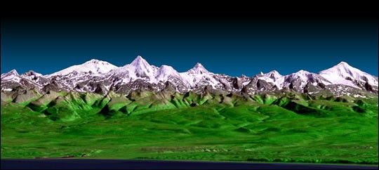
This perspective view shows the western side of the volcanicallyactive Kamchatka Peninsula in eastern Russia. The image was generatedusing the first data collected during the Shuttle Radar TopographyMission (SRTM). In the foreground is the Sea of Okhotsk. Inland from thecoast, vegetated floodplains and low relief hills rise toward snow-capped peaks. The topographic effects on snow and vegetationdistribution are very clear in this near-horizontal view. Forming theskyline is the Sredinnyy Khrebet, the volcanic mountain range that makesup the spine of the peninsula. High resolution SRTM topographic datawill be used by geologists to study how volcanoes form, and to understandthe hazards posed by future eruptions.
This image was generated using topographic data from SRTM and anenhanced true-color image from the Landsat 7 satellite. This imagecontains about 2,400 meters (7,880 feet) of total relief. Thetopographic expression was enhanced by adding artificial shading ascalculated from the SRTM elevation model. The Landsat data was providedby the United States Geological Survey’s Earth Resources ObservationsSystems (EROS) Data Center, Sioux Falls, South Dakota.
Size: 33.3 km (20.6 miles) wide x 136 km (84 miles) coast to skyline
Location: 58.3 deg. North lat., 160 deg. East long.
Orientation: Easterly view, 2 degrees down from horizontal
Original Data Resolution: 30 meters (99 feet)
Vertical Exaggeration: 3 times
Date Acquired: February 12, 2000 (SRTM) August 1, 1999 (Landsat)
Image: NASA/JPL/NIMA
References & Resources
Image Courtesy SRTM, NASA/JPL/NIMA