


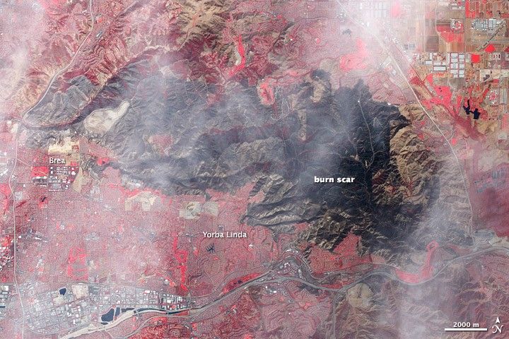
Several days after it started, the Freeway Fire left a sprawling burn scar on the California landscape. The Advanced Spaceborne Thermal Emission and Reflection Radiometer (ASTER) on NASA’s Terra satellite captured this image on November 22, 2008. In this false-color image, red indicates vegetation, tan indicates bare ground, gray-blue indicates buildings and paved surfaces, and dark blue indicates water. The Freeway Fire burn scar, stretching across the middle of the image, is a charcoal color. Along its southwestern margin, the burn scar intrudes into the curving suburban streets of Yorba Linda and Brea.
References & Resources
NASA image created by Robert Simmon, using data provided courtesy of NASA/GSFC/METI/ERSDAC/JAROS, and U.S./Japan ASTER Science Team. Caption by Michon Scott.


