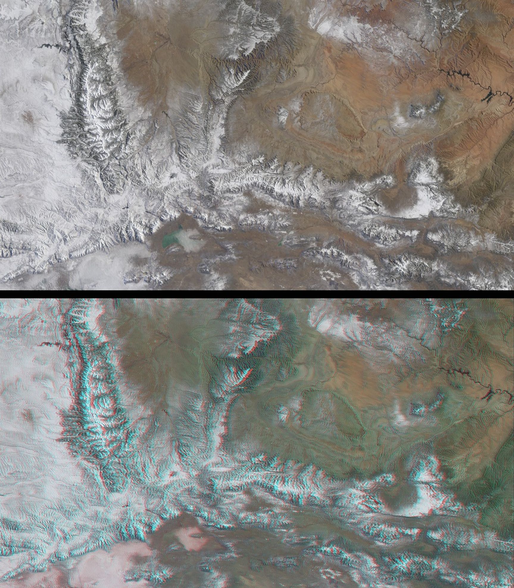
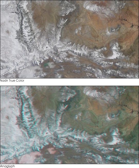
The peaks of the Wasatch and Uinta Ranges provide spectacularbackdrops for the 2002 Winter Olympics, to be held in Salt Lake City,Utah. The mountains surrounding Salt Lake City are renowned for the dry,powdery snow that results from the arid climate and location at thewestern edge of the Rocky Mountains and eastern rim of the Great Basin.
This early-winter image pair was acquired by the Multi-angle ImagingSpectroRadiometer (MISR) on December 31, 2000. The topimage is a natural-color view from MISR’s nadir (downward-looking)camera, and the bottom image is a stereo anaglyph created using red-banddata from MISR’s 46-degree forward-looking camera, and green andblue-band data from the nadir camera. In order to facilitate stereoviewing, the images have been oriented with north at the left and westat the bottom. To observe the 3-D effect of the stereo anaglyph,red/blue glasses should be used with the red filter placed over yourleft eye. Information on ordering glasses can be found athttp://photojournal.jpl.nasa.gov/Help/VendorList.html#Glasses.
The canyons and peaks of the Uinta and Wasatch Mountains areparticularly striking in the stereo view. The Uinta Mountains containthe highest peaks in Utah and are notable as the most prominenteast-west trending range in the contiguous United States. The upper leftcorner of the image contains a portion of Wyoming, and part of theColorado River can be seen near the right-hand edge. Each imagerepresents an area of approximately 270 kilometers x 475 kilometers.
References & Resources
Image courtesy NASA/GSFC/LaRC/JPL, MISR Team.