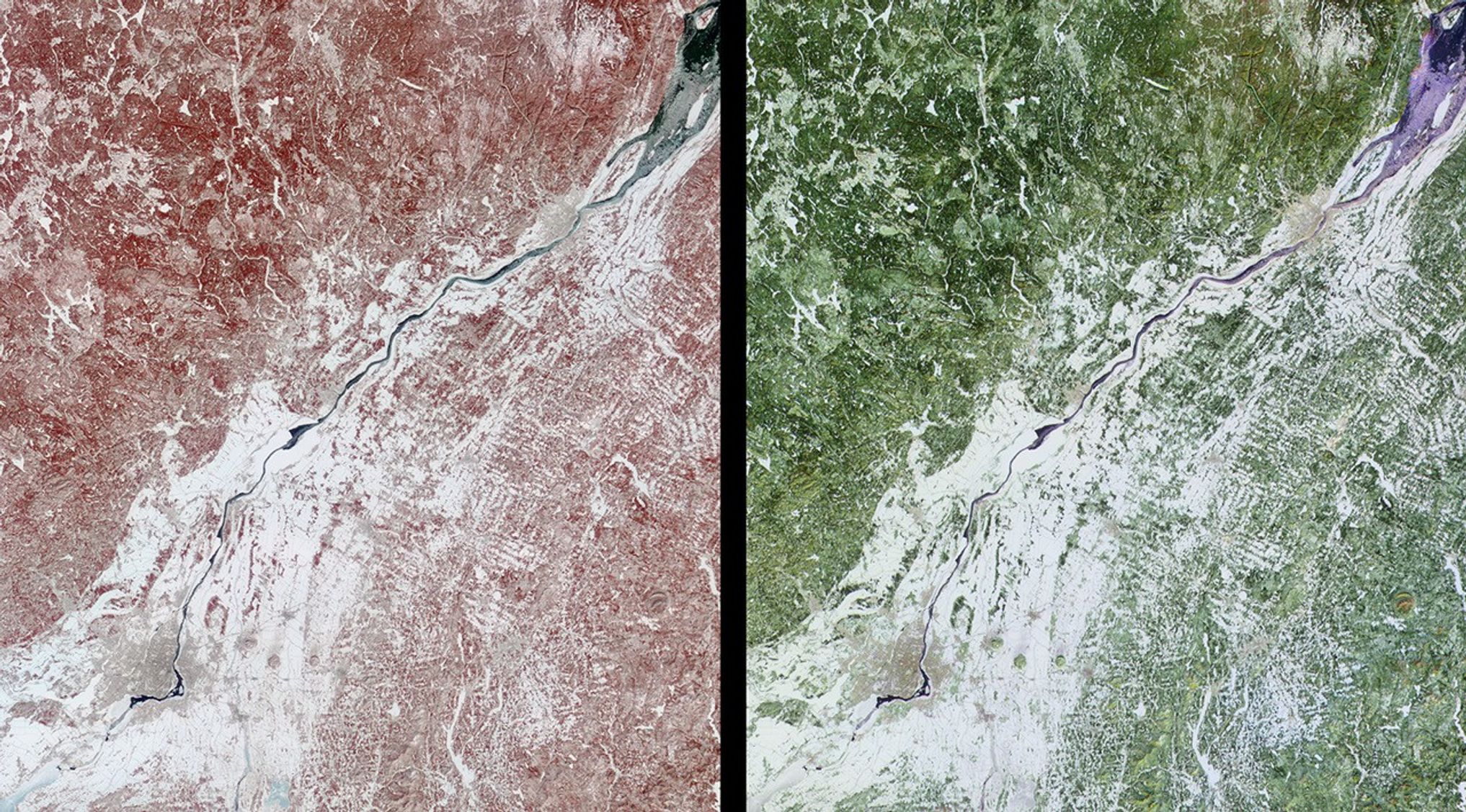
These images of Canada’s Québec province were acquired by the Multi-angleImaging SpectroRadiometer on March 4, 2001. The region’s forests are a mixtureof coniferous and hardwood trees, and “sugar-shack” festivities are held at thistime of year to celebrate the beginning of maple syrup production. The largeriver visible in the images is the northeast-flowing St. Lawrence. The city ofMontréal is located near the lower left corner, and Québec City, at the upperright, is near the mouth of the partially ice-covered St. Lawrence Seaway.
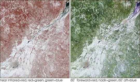
Both spectral and angular information are retrieved for every scene observed byMISR. The left-hand image was acquired by the instrument’s vertical-viewing(nadir) camera, and is a false-color spectral composite from the near-infrared,red, and blue bands. The right-hand image is a false-color angular compositeusing red band data from the 60-degree backward-viewing, nadir, and 60-degreeforward-viewing cameras. In each case, the individual channels of data aredisplayed as red, green, and blue, respectively.
Much of the ground remains covered or partially covered with snow. Vegetationappears red in the left-hand image because of its high near-infrared brightness.In the multi-angle composite, vegetated areas appear in shades of green becausethey are brighter at nadir, possibly as a result of an underlying blanket ofsnow which is more visible from this direction. Enhanced forward scatter fromthe smooth water surface results in bluer hues, whereas urban areas looksomewhat orange, possibly due to the effect of vertical structures whichpreferentially backscatter sunlight.
The data cover an area measuring 275 kilometers x 310 kilometers.
References & Resources
Image courtesy NASA/GSFC/LaRC/JPL, MISR Team.