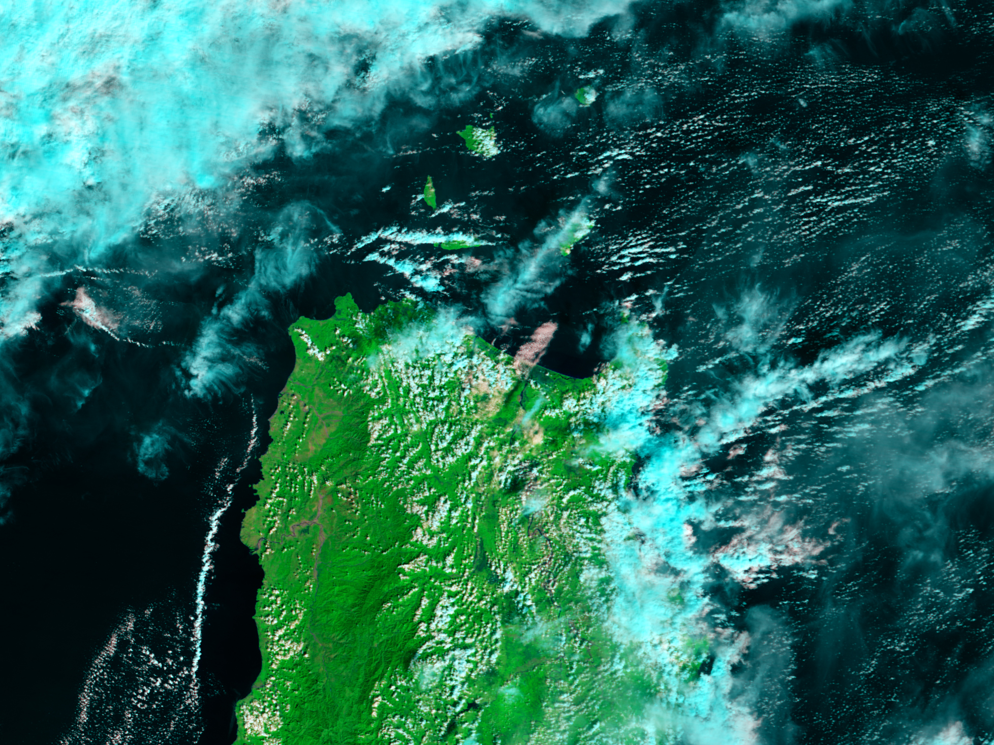











January 28, 2006
- January 28, 2006 (3.1 MB; Aqua MODIS)
- January 22, 2006 (2.9 MB; Terra MODIS)
Tropical Depression Agaton swamped the northern Philippines with heavy rains on January 26, 2006, leaving towns in the northern portions of the island of Luzon flooded. The Cagayan River was still swollen when the Moderate Resolution Imaging Spectroradiometer (MODIS) on NASA’s Aqua satellite captured the top image on January 28, 2006. The mud-laden flood water in the Cagayan River valley is dark blue. Blue smudges near the northern coast suggest flooding there as well. The ever-present clouds in this tropical region are light blue and white. Vegetation is bright green and bare earth is tan.
References & Resources
NASA image created by Jesse Allen, Earth Observatory, using data provided courtesy of the MODIS Rapid Response team.