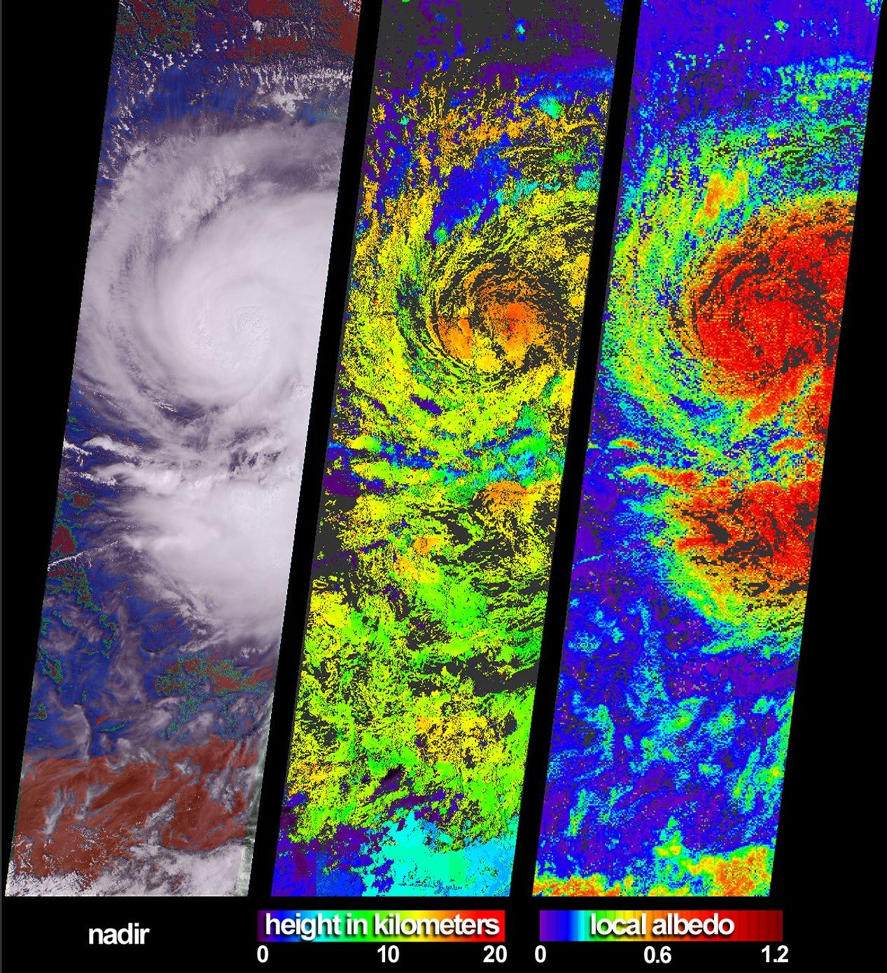
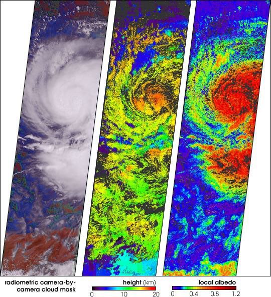
These views of Hurricane Isidore were acquired by the Multi-angleImaging SpectroRadiometer (MISR) on September 20, 2002. After bringinglarge-scale flooding to western Cuba, Isidore was upgraded (on September21) from a tropical storm to a category 3 hurricane. Sweeping westwardto Mexico’s Yucatan Peninsula, the hurricane caused major destructionand left hundreds of thousands of people homeless. Although weakenedafter passing over the Yucatan landmass, Isidore regained strength as itmoved northward over the Gulf of Mexico.
At left is a colorful visualization of cloud extent that superimposesMISR’s radiometric camera-by-camera cloud mask (RCCM) over natural-colorradiance imagery, both derived from data acquired with the instrument’svertical-viewing (nadir) camera. Using brightness and statisticalmetrics, the RCCM is one of several techniques MISR uses to determinewhether an area is clear or cloudy. In this rendition, the RCCM has beencolor-coded, and purple = cloudy with high confidence, blue = cloudywith low confidence, green = clear with low confidence, and red = clearwith high confidence.
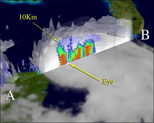
In addition to providing information on meteorological events, MISR’sdata products are designed to help improve our understanding of theinfluences of clouds on climate. Cloud heights and albedos are among thevariables that govern these influences. (Albedo is the amount ofsunlight reflected back to space divided by the amount of incidentsunlight.) The center panel is the cloud-top height field retrievedusing automated stereoscopic processing of data from multiple MISRcameras. Areas where heights could not be retrieved are shown in darkgray. In some areas, such as the southern portion of the image, thestereo retrieval was able to detect thin, high clouds that were notpicked up by the RCCM’s nadir view. Retrieved local albedo values forIsidore are shown at right. Generation of the albedo product isdependent upon observed cloud radiances as a function of viewing angleas well as the height field. Note that over the short distances (2.2kilometers) that the local albedo product is generated, values can begreater than 1.0 due to contributions from cloud sides. Areas wherealbedo could not be retrieved are shown in dark gray.
The Multi-angle Imaging SpectroRadiometer observes the daylit Earthcontinuously from the north to the south pole, and views almost theentire globe every 9 days between 82 degrees north and 82 degreessouth latitude. The data are collected in swaths during the daylitperiod of each orbit. The MISR Browse Image Viewer provides access tolow-resolution true-color versions of these images. These dataproducts were generated from a portion of the imagery acquired duringTerra orbit 14669. The panels cover an area of about 380 kilometers x704 kilometers, and utilize data from blocks 70 to 79 within WorldReference System-2 path 17.
View abrowse image of the entire swath from which this image wasextracted.
References & Resources
Image courtesy NASA/GSFC/LaRC/JPL, MISR Team.