As of 11:00 p.m. Manila time (15:00 UTC) on October 21, 2009, Typhoon Lupit was 390 nautical miles (720 kilometers) northeast of Manila, and was expected to travel in the general direction of the Philippine island of Luzon, according to the U.S. Navy’s Joint Typhoon Warning Center. At that time, Lupit had maximum sustained winds of 80 knots (150 kilometers) with gusts up to 100 knots (185 kilometers per hour).
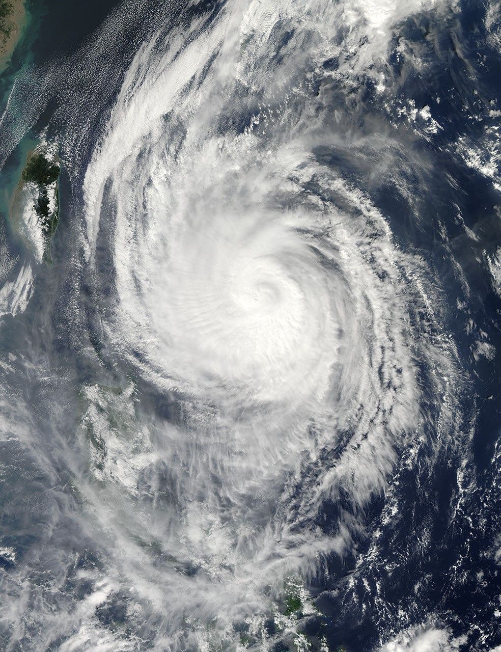
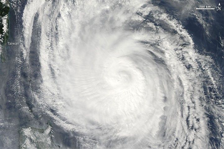
The Moderate Resolution Imaging Spectroradiometer (MODIS) on NASA’s Aqua satellite captured this true-color image of Typhoon Lupit at 1:05 p.m. Manila Time (05:05 UTC) on October 21, 2009. The storm spans several hundred kilometers, and rages just off the northeastern coast of Luzon. The east coast of Taiwan appears along the left edge of the image.
According to tracking information from Unisys Weather, Lupit was a Category 1 typhoon as of 06:00 UTC on October 21, less than one hour after this image was acquired.
References & Resources
- Joint Typhoon Warning Center. (2009, October 21). Typhoon 22W (Lupit) Warning #31. Accessed October 21, 2009.
- Unisys Weather. (2009, October 21). Super Typhoon Lupit. Accessed October 21, 2009.
NASA image by Jeff Schmaltz, MODIS Rapid Response Team. Caption by Michon Scott.