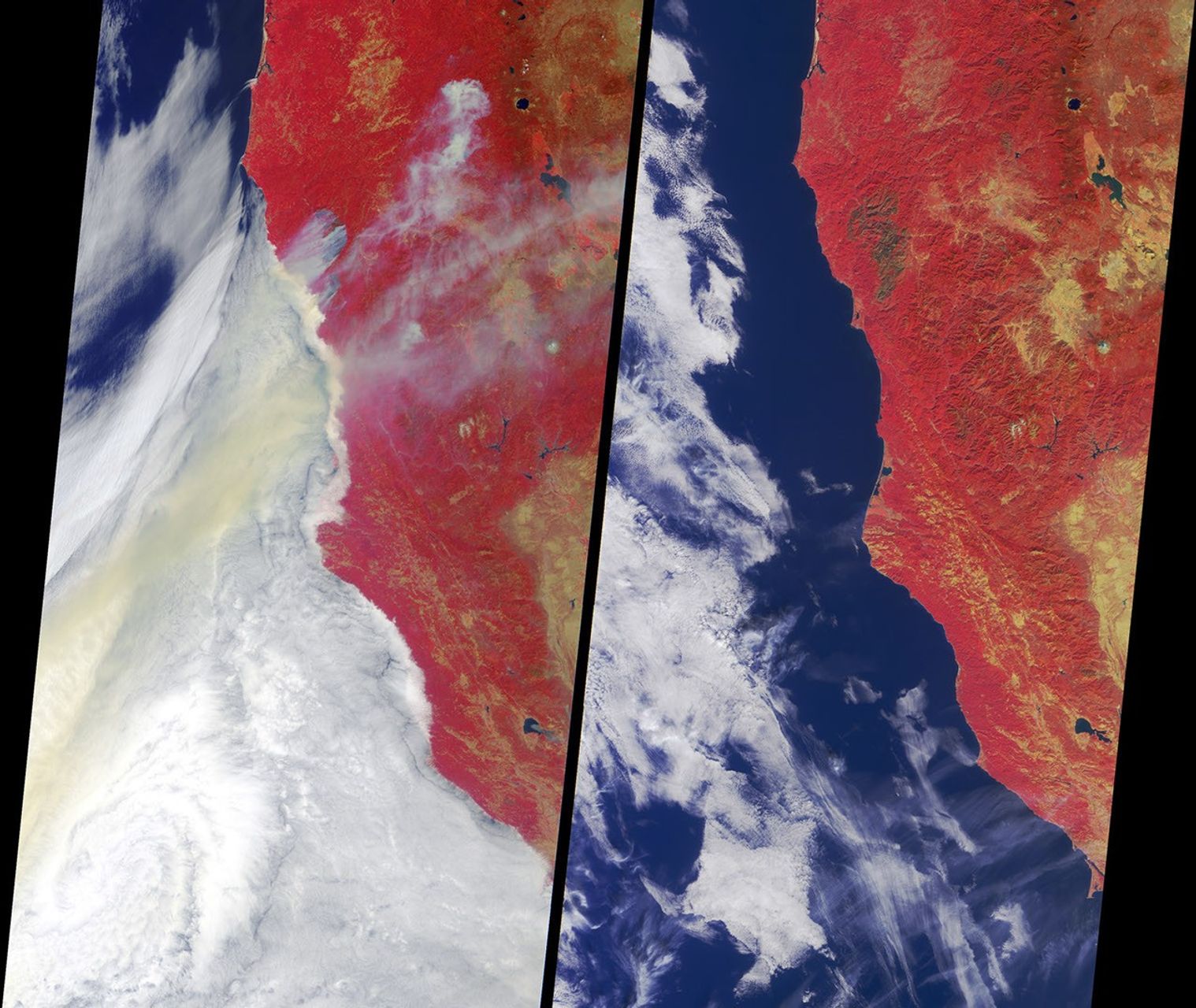

Ignited by lightning strikes during a record-breaking heat wave, the BiscuitFire became Oregon's largest wildfire of the past century. Between mid July andearly September 2002, it consumed almost 500,000 acres in southern Oregon andnorthern California. This image pair from the Multi-angle ImagingSpectroRadiometer (MISR) portrays the fire underway and the burn scars on thelandscape after the event. Vegetated regions appear red in these false-colorviews, which were acquired by MISR's vertical-viewing (nadir) camera. Data fromthe near-infrared, red and blue bands, are displayed as red, green and blue,respectively. This display technique accentuates the contrast between burnt andunburnt areas.
The left-hand panel captures parts of southern Oregon and northwest Californiaas they appeared on July 29. Smoke plumes emanate from several sections of theBiscuit Fire near the Oregon-California border. Numerous other fires were alsoburning across Oregon, sending large amounts of smoke seaward over a clouddeck in the Pacific Ocean.
The right-hand panel portrays the same geographic area on October 29, aboutseven weeks after the fire had been fully contained. A large, dark-colored burnscar at the site of the Biscuit Fire indicates the area consumed, which includedalmost the entire Kalmiopsis Wilderness Area and parts of the Siskiyou and SixRivers National Forests. The fight to suppress the Biscuit Fire was the most expensive fire fighting effort in Oregon's history, with more than 6,000 personnel assisting the battle to suppress the fire and protect thousands of threatened homes.
The Multi-angle Imaging SpectroRadiometer observes the daylit Earth continuouslyand every 9 days views the entire globe between 82 degrees north and 82 degreessouth latitude. These data products were generated from a portion of the imageryacquired during Terra orbits 13899 and 15297. The panels cover an area of 380kilometers x 704 kilometers, and utilize data from blocks 56 to 60 within WorldReference System-2 path 46.
References & Resources
Image NASA/GSFC/LaRC/JPL, MISR Team. Text acknowledgment: Clare Averill (Acro Service Corporation/Jet Propulsion Laboratory).