


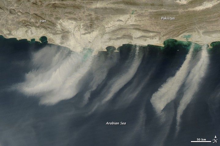
The shift from summer heat to winter’s chill in the mountains of southwest Asia leads to regular dust storms over the Arabian Sea. The Moderate Resolution Imaging Spectroradiometer (MODIS) on NASA’s Aqua satellite acquired this photo-like image on November 9, 2009. It is remarkably similar to images captured in late October and November in 2008, 2007, 2006, and previous years. In 2009, as in other years, distinct plumes of dust blow from the desert between the Makran Mountains and the Arabian Sea.
Wind and weather patterns in southwestern Pakistan and southeastern Iran are largely driven by the summer and winter monsoons. In the winter, the cloudless, dry air over southwest Asia cools. The cool, dense air sinks. Air over the Arabian Sea, meanwhile, is warm. The warm air rises, and the cool air from the continent rushes in to take its place. The movement of air from the land to the Arabian Sea creates strong winds that generate the dust storms seen every year.
The large image is the highest resolution version of this image. The image is also available in additional resolutions from the MODIS Rapid Response Team.
References & Resources
- Lindsey, R. (2006, February 1). Winds Connect Snow to Sea. NASA Earth Observatory. Accessed November 9, 2009.
NASA images courtesy Jeff Schmaltz, MODIS Rapid Response Team at NASA GSFC. Caption by Holli Riebeek.


