


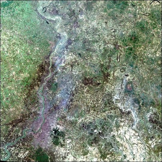

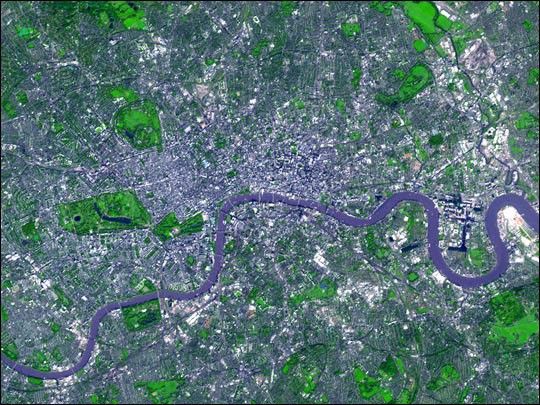
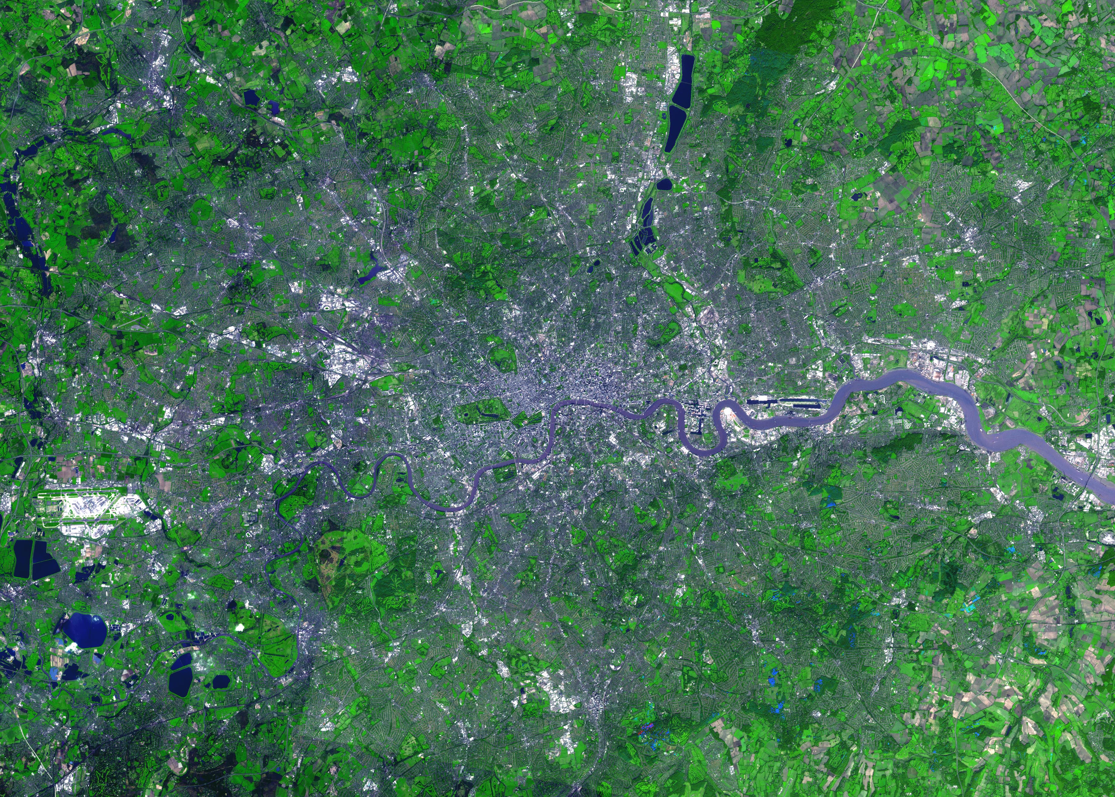
For almost 2,000 years, the River Thames has served as the life force ofLondon, capital of the United Kingdom and one of the world’s most famouscities. In AD 43 the Romans established the trading settlement ofLondinium at a favorable crossing point on the river. The Romansremained until the 5th century, when the city came under Saxon control.The early 17th century saw enormous growth, but the deadly plague of1664 and 1665 ravaged the population, and in the following year theGreat Fire, which burned for four days, destroyed most of the city. Apublic transportation system and other city services in the early 19thcentury eased many of the increasing urban problems of the burgeoningcapital of the wealthy British empire. After coping with the devastatingeffects of bombing during World War II and the gradual dismantling ofthe empire, London today thrives as a vital modern metropolis. London isone of 100 cities being studied using Advanced Spaceborne Thermal Emissionand Reflection Radiometer (ASTER) data to map and monitor urban use patternsand growth.
This image was acquired on October 12, 2001 by the Advanced SpaceborneThermal Emission and Reflection Radiometer (ASTER) on NASA’s Terrasatellite. With its 14 spectral bands from the visible to the thermalinfrared wavelength region, and its high spatial resolution of 15 to 90meters (about 50 to 300 feet), ASTER images Earth to map and monitor thechanging surface of our planet.
Size (full image): 39.5 x 55.3 km (24.5 x 34.3 miles)
Location: 51.5 deg. North lat., 0.1 deg. West long.
Orientation: North at top
Image Data: green, red, and near-infrared
Original Data Resolution: 15 m
Date Acquired: October 12, 2001
References & Resources
Image courtesy NASA/GSFC/MITI/ERSDAC/JAROS, and U.S./Japan ASTER Science Team


