


browse image of orbit 16454 (200 KB JPEG)
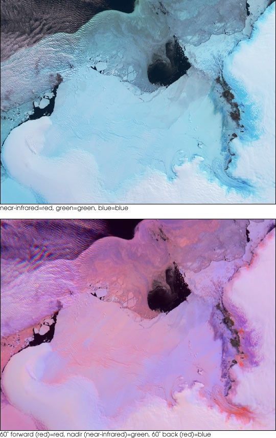
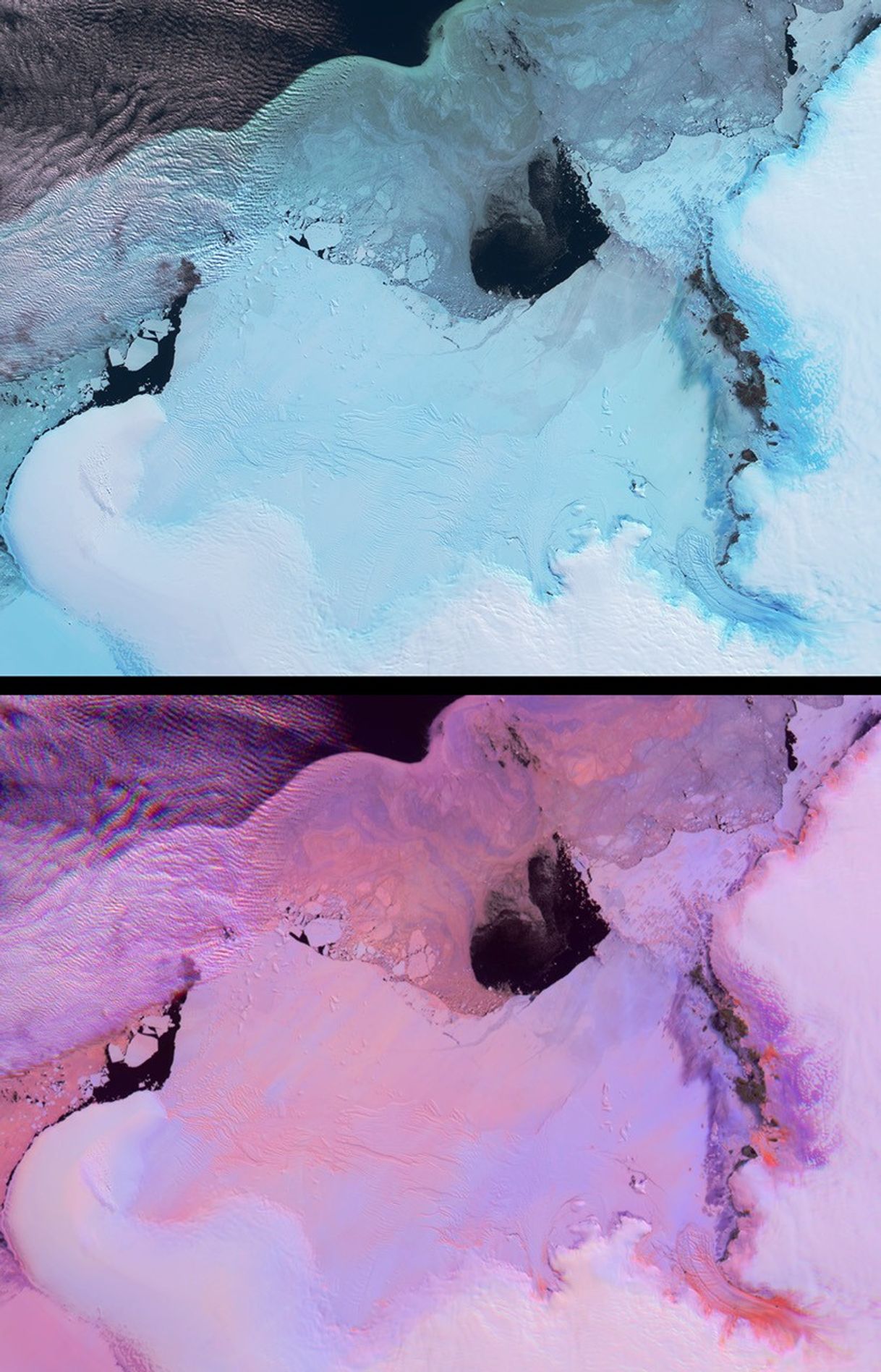
These views from the Multi-angle Imaging SpectroRadiometer (MISR)portray the Lutzow-Holm Bay region of Queen Maud Land, East Antarctica,on September 5, 2002. Although Queen Maud Land remains one of the leaststudied regions of Antarctica, Lutzow-Holm Bay is an exception. Syowa(pronounced ‘Showa’) Station is the Japanese Antarctic ResearchExpedition base situated on Ongul Island, just off the eastern coast ofthe Bay (in the top right-hand portion of these views). Scientists therehave studied changes in the ice sheet and sea level for several decades.Large outlet glaciers, such as the fast-flowing Shirase Glacier in thelower right-hand corner of these images, are the primary drainagesystems for the Antarctic ice sheet.
These two views provide information on both the spectral and angularreflectance properties of the region and can be used to understand thegeophysical environment. The top panel shows the region from MISR’sdownward-looking (nadir) camera and is a false-color view in which thenear-infrared, green and blue spectral bands have been displayed as red,green and blue. Because of the tendency of water to absorb near-infraredwavelengths, some ice types exhibit an especially bright blue hue inthis display.
The lower panel is a multi-angular composite from three MISR cameras inwhich changes in reflection at different view angles, as well as in thenear-infrared spectral region, assist with the identification of roughand smooth ice surfaces. In this display, red band data from MISR’s60-degree forward and backward-viewing cameras are displayed as red andblue, respectively, and near-infrared data from the nadir camera aredisplayed as green. Using this technique, surfaces that predominantlyexhibit backward scattering (generally rough surfaces) appearred/orange, and surfaces that predominantly exhibit forward scattering(generally smooth surfaces) appear in blue hues. Clouds (and othersurfaces that exhibit both forward and backward scattering) appearpurple.
The Multi-angle Imaging SpectroRadiometer observes the daylit Earthcontinuously and every 9 days views the entire globe between 82 degreesnorth and 82 degrees south latitude. The MISR Browse Image Viewer provides access tolow-resolution true-color versions of these images. These data products were generatedfrom a portion of the imagery acquired during Terra orbit 16454. Thepanels cover an area of about 335 kilometers x 257 kilometers.
References & Resources
Image courtesy NASA/GSFC/LaRC/JPL, MISR Team. Text by Clare Averill (Acro Service Corporation/Jet Propulsion Laboratory).


